East London residents can discover safe and green walking routes using free apps like Walkit and TfL’s Citymapper, council interactive maps on borough websites, and established networks such as the Greenway or Lea Valley Walk. These tools highlight quieter paths through parks, away from busy roads, prioritising low-traffic areas and green spaces in Newham, Tower Hamlets, Hackney, Waltham Forest, Redbridge, and Barking & Dagenham. Local councils maintain dedicated sections for active travel, making it straightforward for residents to plan secure, nature-filled strolls.
- Why This Matters to Local Residents
- Step-by-Step Actions to Solve the Problem
- Which Council Service Handles It
- Information or Documents Needed
- Expected Response Time
- What to Do If Follow-Up Is Required
- Rights and Responsibilities Under UK Rules
- Practical Tips to Avoid the Problem in Future
- Exploring Iconic East London Routes
- Integrating Technology for Ease
- Community and Health Benefits
Why This Matters to Local Residents
Walking safely amidst greenery boosts physical health and mental wellbeing for East London families. In bustling boroughs like Hackney and Newham, green routes reduce exposure to traffic fumes and noise, offering peaceful escapes in places like Victoria Park or Epping Forest fringes.
These paths encourage daily exercise, vital for residents managing busy lives amid urban density. Tower Hamlets council and others promote them to foster community connections, with routes linking neighbourhoods to allotments, wetlands, and canals for refreshing outings.
For parents in Waltham Forest or Redbridge, safe green walks mean reliable school runs or playtime without main-road stress. Overall, they enhance quality of life, aligning with East London councils’ focus on healthier streets.

Step-by-Step Actions to Solve the Problem
Start by identifying your starting point using a postcode checker on your local council’s active travel page or apps like Google Maps with “walking” and “avoid highways” filters.
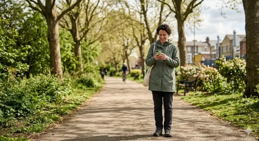
- Enter your postcode into Walkit.com or the TfL Go app, selecting “healthiest route” to prioritise low-pollution, green paths through parks and tree-lined streets.
- Check your East London council’s website—search for “walking routes” or “active travel maps”—to download PDFs or interactive maps tailored to your borough, such as Newham’s Greenway trails.
- Cross-reference with AllTrails or Ramblers’ routes, filtering for “easy” and “pavement” to ensure safety, then test a short segment on foot.
- Join local walking groups via council newsletters for guided green tours, building confidence in lesser-known paths.
Verify routes seasonally, as foliage changes affect visibility. This process takes under 10 minutes and yields reusable plans.
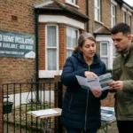
Which Council Service Handles It
East London councils’ Highways and Active Travel teams oversee safe and green walking routes. In Newham council, the Walking and Cycling Officer manages path maintenance and mapping; Tower Hamlets council’s Transport Strategy team publishes green link guides.
Hackney Council’s Streetscene services update low-traffic neighbourhoods, while Waltham Forest, Redbridge, and Barking & Dagenham councils use their Planning and Regeneration departments for green infrastructure like the Lea Valley Walk.
Residents access these via online portals under “Getting Around” or “Environment,” where dedicated pages list verified routes. No specialist department exists beyond these—standard council web tools suffice.
Information or Documents Needed
No formal documents are required to find routes; a postcode and device suffice. Councils like those in East London provide free access without login.
Useful extras include a borough boundary map to confirm your area, Ordnance Survey apps for detailed topography, and weather apps for safe planning. For families, note play areas on routes via council family services pages.
Print or screenshot maps for offline use, ensuring battery life on walks. Personal details stay private—no applications needed.
Expected Response Time
Digital tools deliver instant results: apps generate routes in seconds, council maps load immediately. Physical checks, like walking a path, take 15-30 minutes.
Councils refresh online maps quarterly, with major updates after community feedback cycles (3-6 months). Ramblers and TfL networks remain evergreen, accessible 24/7.
What to Do If Follow-Up Is Required
If a mapped route feels unsafe—due to overgrown paths or new obstacles—report via your council’s online form under “Highways Maintenance.”
Email the Active Travel team with photos, postcode, and description; expect acknowledgment in 5-10 working days. For urgent issues like fallen branches, use out-of-hours reporting on council sites.
Escalate persistent problems to your ward councillor via the democratic services page. Communities often form volunteer upkeep groups for green spaces.
Rights and Responsibilities Under UK Rules
Under the Highways Act 1980, councils must maintain public rights of way, including green pedestrian paths, ensuring safe passage for local residents.
Walkers have a right to use designated routes without obstruction, but must stick to paths, yield to cyclists, and clean up litter per Clean Neighbourhoods Act. Councils fulfil duties via annual inspections.
Residents share responsibility: report hazards promptly and avoid unofficial shortcuts. Equality Act 2010 mandates accessible routes, so flag barriers affecting mobility.
Practical Tips to Avoid the Problem in Future
Build a personal route library by favouriting app paths weekly, noting seasonal notes like wet marshes in Barking & Dagenham.
Combine with public transport: alight early on TfL buses for green detours. Join East London walking challenges from Ramblers for motivation and local insights.
Wear hi-vis in low light, share locations via apps, and rotate routes to discover hidden gems like Coppermill Fields. Councils reward repeat users with newsletters on new links.
Exploring Iconic East London Routes
The Greenway in Newham offers elevated, traffic-free views over parks and the Thames, ideal for all ages. Lea Valley Walk spans Hackney to Waltham Forest, weaving through marshes and mills.
Tower Hamlets’ Regent’s Canal path connects to Victoria Park, while Redbridge taps Epping Forest edges for woodland strolls. Barking & Dagenham’s Thames Chase paths blend history and nature.
Green Link network links Waltham Forest’s Epping to Hackney’s green corridors, promoted by local councils for safer travel. These evergreen options suit daily use.

Integrating Technology for Ease
Apps like Citymapper’s “Go” mode filter for green, safe walks, integrating real-time bus links. WalkEast.org highlights East London specifics, from Mile End to Thames Path.
Council GIS maps overlay air quality data, helping Newham or Tower Hamlets residents dodge pollution hotspots. Offline downloads ensure reliability.
Community and Health Benefits
Regular green walks cut stress, with studies showing side-street routes halve pollution intake. East London councils champion this via Healthy Streets initiatives.
Groups like Living Streets host free events, fostering neighbourly bonds. Families in these boroughs gain fitness without gym fees.
What free tools can I use to find safe and eco-friendly walking routes near me?
Use free route planners like Google Maps, Citymapper, or Komoot to filter walking routes, choose quieter streets, green spaces, and well-lit paths, and check live conditions in your area.