


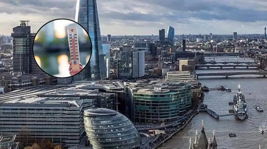
Key Points
- Yellow heat-health alerts are due to run from 9am on Saturday until 9pm on Tuesday.
- The alerts cover most of England, including London, the South East, East of England, East Midlands, West Midlands, South West, and Yorkshire and the Humber.
- The North East and North West are not included in the latest alert area, according to reports.
- The Met Office expects temperatures to rise steadily over the weekend and into next week.
- Temperatures could reach 30C on Saturday, rise into the low 30s in southern England on Sunday and reach between 32C and 34C on Wednesday.
- Parts of East Anglia and south-east England could reach 36C on Thursday.
- The developing spell of hot weather could become the UK’s fifth heatwave of the year.
- The alerts warn that high temperatures could affect public wellbeing, health services and social care, particularly for vulnerable people.
East Anglia (Eat London Times) August 8, 2026— that temperatures are expected to rise through the weekend as heatwave conditions return to the UK, with parts of East Anglia and south-east England potentially reaching 36C by Thursday. New yellow heat-health alerts are in force from 9am on Saturday until 9pm on Tuesday, warning that the hot weather could affect the wellbeing of the population.
- Key Points
- Why are new heat-health alerts being issued?
- How hot could it become across the UK?
- Which areas are covered by the alerts?
- Could this become the fifth heatwave of 2026?
- What weather can be expected in Scotland and Northern Ireland?
- What could the heat mean for public services?
- What is the wider concern linked to the hot weather?
- What is the background to this development?
- How could the development affect residents?
The latest warning covers much of England as forecasters prepare for another significant rise in temperatures. The UK Health Security Agency has issued yellow alerts for the East Midlands, West Midlands, South East, South West, East of England, Yorkshire and the Humber, and London. Reports indicate that the North East and North West are outside the latest alert area.
The developing weather pattern is expected to produce a north-south split across the UK. While England and Wales are forecast to remain largely dry, sunny and increasingly warm, Scotland and Northern Ireland could see spells of heavy rain during the weekend.
Why are new heat-health alerts being issued?
The yellow alerts have been introduced because temperatures are expected to reach levels that could affect people’s health and place additional pressure on health and social care services. A yellow heat-health alert is particularly relevant to vulnerable people, including older residents, people with existing health conditions and individuals receiving care.
The alert does not mean that every person will experience serious health effects. Instead, it signals that hot weather may create risks for some groups and could require action from health and social care organisations. The Met Office explains that yellow alerts can be issued when heat is unlikely to affect most people but may cause difficulties for those who are less able to cope with high temperatures.
The current alerts are scheduled to remain in place for four days, beginning at 9am on Saturday and ending at 9pm on Tuesday. However, the period of highest temperatures is currently expected later in the week, with the heat forecast to strengthen after Tuesday.
The UKHSA may update the alert position as confidence in the forecast changes and as the expected temperature pattern becomes clearer.
A previous BBC weather report said the agency was expected to provide further updates as the heatwave intensified.
How hot could it become across the UK?
Forecast temperatures are expected to increase in stages rather than arrive at their highest level immediately. The Met Office expects highs of about 30C on Saturday, followed by temperatures rising into the low 30s in southern and south-east England on Sunday.
Some parts of England and Wales could again reach 30C on Tuesday. The forecast then indicates a further increase, with temperatures of between 32C and 34C possible on Wednesday in parts of central and southern England and south-east Wales.
East Anglia and south-east England are expected to experience the highest temperatures. Parts of those regions could reach 36C on Thursday, although the precise areas affected will depend on the final track and strength of the high-pressure system.
The forecast would make the approaching spell one of the warmest periods of the summer so far, although it is not expected to exceed the year’s highest temperature at this stage.
The Independent reported that 38C was recorded at Lingwood in Norfolk on June 28, which remains the highest temperature recorded in the UK during the year so far.
The difference between daytime and overnight temperatures could also become important as the hot spell develops. While the available forecasts focus mainly on daytime highs, prolonged heat can become more difficult for some people when buildings do not cool sufficiently overnight.
The alert system is designed to help health and social care services prepare for these wider effects rather than focus only on the highest afternoon temperature.
Which areas are covered by the alerts?
The yellow heat-health alerts cover several regions across England. They include London, the South East, the East of England, the East Midlands, the West Midlands, the South West, and Yorkshire and the Humber.
This means that large urban areas, coastal communities and rural districts could all experience the effects of the warming conditions. London and the surrounding south-east are among the areas expected to see temperatures rise into the low and mid-30s as the week progresses.
The East of England is also a key area in the forecast because East Anglia could record the highest temperatures.
The region includes parts of Norfolk, Suffolk, Cambridgeshire and Essex, although the exact locations most likely to reach 36C will depend on later forecasts.
The latest reports describe the alerts as covering most of England, with the North East and North West excluded. The regional position may change if the weather pattern moves or if forecast confidence increases.
Wales is not listed among the regions covered by the UKHSA alerts in the reports, although parts of Wales are expected to remain warm and could record temperatures of up to 34C in the south-east. Scotland and Northern Ireland are expected to have a cooler and wetter weekend in comparison with southern parts of England.
Could this become the fifth heatwave of 2026?
Forecasters expect many parts of England and Wales to meet heatwave thresholds as the warm spell continues into next week. Heatwave thresholds vary by location, ranging from 25C in parts of the north and west to 28C in eastern England. A heatwave is generally declared when temperatures meet or exceed the relevant threshold for three consecutive days.
The BBC reported that many areas could pass their local thresholds from Sunday and into the following week. If the conditions continue for the required period, the developing spell would become the fifth widespread heatwave of the year.
The classification depends on both temperature and duration. A single very hot day is not necessarily enough to meet the definition of a heatwave, because the threshold must be reached for consecutive days in a particular location.
The expected pattern is therefore being monitored over several days. Temperatures are forecast to rise from around 30C at the weekend to the low and mid-30s during the middle of next week, creating the possibility that several regions will meet their local heatwave criteria.
What weather can be expected in Scotland and Northern Ireland?
The weekend forecast is not expected to bring the same level of heat to every part of the UK. Scotland and Northern Ireland are likely to see periods of heavy rain, while England and Wales are expected to remain mostly dry, sunny and increasingly warm.
This north-south contrast means that weather conditions could vary considerably between regions. While people in southern England prepare for rising temperatures, communities further north and west may experience cloud, rain and lower temperatures.
The change in conditions is linked to the position of weather systems over the UK. The current outlook indicates that warmer air will become more established across England and Wales during the weekend and early next week, while areas further north remain more exposed to unsettled weather.
What could the heat mean for public services?
The UKHSA alerts warn that hot weather can affect health and social care services. The main concern is the increased risk faced by people who are particularly vulnerable to high temperatures, including older people, those with pre-existing medical conditions and residents in care settings.
Health and social care organisations use the alert system to assess the potential effect of heat on their services. This can include reviewing arrangements for vulnerable residents, considering the conditions in care facilities and preparing for an increase in heat-related illness.
The yellow classification indicates a lower level of alert than amber or red, but it still signals that impacts are possible and that action may be required in the health and social care sector.
The Met Office says a yellow alert may be issued when the wider population is unlikely to be seriously affected but vulnerable groups may struggle to cope.
The effect of the heat will depend on how high temperatures rise, how long they last and whether overnight conditions allow buildings and people to cool down. These factors will be assessed as the forecast develops.
What is the wider concern linked to the hot weather?
The return of high temperatures comes as several parts of England continue to face pressure on water resources. The News reported that half of England was already in drought and that some areas could move towards drought conditions during the coming week.
It also said the Environment Agency was planning restrictions on the amount of water that could be extracted from natural sources in parts of East Anglia.
The water situation is separate from the yellow heat-health alerts, but prolonged dry and hot weather can increase demand for water and place additional pressure on rivers, reservoirs and groundwater supplies. The effect will depend on rainfall, consumption and the duration of the warm spell.
The latest forecast does not establish how long the hot weather will continue after Thursday. It does, however, indicate that the most intense conditions are expected in southern and eastern England, with the highest temperatures currently forecast for East Anglia and the south-east.
Explore More UK News
Amplify Her: The Movement Building a More Inclusive Future for the Music Industry
UK House Prices Stagnant as Mortgage Rates Rise: UK 2026
What is the background to this development?
The new alerts follow several periods of unusually hot weather across the UK during 2026. Reports describe the approaching spell as the country’s fifth heatwave of the year if the forecast temperatures remain above local thresholds for three consecutive days.
The Met Office has previously said that prolonged hot conditions can result in heat-health alerts when the expected impacts extend beyond ordinary summer weather.
The alert system is intended to provide health and social care services with advance notice of possible effects, particularly among people who are vulnerable or living in care settings.weather.
The latest outlook shows a gradual rise in temperatures from the weekend, followed by a stronger increase through Wednesday and Thursday.
The highest forecast figure is 36C in parts of East Anglia and south-east England, while Scotland and Northern Ireland are expected to experience wetter conditions during the early part of the period.
How could the development affect residents?
The immediate effect is likely to be a period of increasingly hot weather across London, the south-east, the East of England and other covered regions. Vulnerable residents may face greater difficulty coping with the heat, while health and social care services may need to monitor conditions more closely during the alert period.
If temperatures reach the forecast 32C to 36C range and remain high for several days, more areas could meet the criteria for a heatwave.
The combination of prolonged heat and dry conditions could also increase pressure on water resources, particularly in East Anglia.
The final impact will depend on the accuracy and duration of the forecast. Further updates from the Met Office and UKHSA may change the affected regions, alert levels or expected peak temperatures as Thursday approaches.