Key Points
- Photographs of local areas dating back to the 1990s highlight the tremendous transformation that has taken place within Romford, Hornchurch, and Rainham in the last three decades.
- The most noteworthy changes in urban settings can be seen by how certain establishments have been moved around, for example, the movement of Havering Mencap (formerly known as Havering Learning Disability Society) from their old location at Victoria Road.
- There have been tremendous changes in business spaces within the London Borough of Havering where some post offices are being turned into takeaway restaurants.
- Infrastructural, retail and transport have changed considerably since the end of the 20th century in East London.
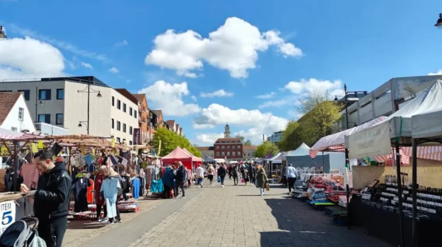
Romford (East London Times) October 19, 2026 – Archival images from the 1990s have highlighted the extensive physical, structural, and commercial transformation that Romford town centre and surrounding townships have undergone across three decades of urban development. As reported by local historical curators and regional archive contributors, visual records from the decade capture a distinct era when petrol averaged 50p per litre, local post offices operated in premises now occupied by fast-food outlets, and long-standing charitable infrastructure occupied landmark sites along Victoria Road. Looking down Victoria Road from the junction at Albert Road, contemporary comparisons reveal how substantially commercial footprints, transport links, and civic spaces have evolved throughout the London Borough of Havering.
What Do the 1990s Archival Photographs Reveal About Romford Town Centre?
The photographic record provides a detailed baseline of the socio-economic and structural character of Romford during the 1990s. As documented by local heritage reporters, key streetscapes such as Victoria Road served as primary corridors for both municipal services and local non-profit organizations.
During this era, the premises situated along Victoria Road housed Havering Mencap, an essential local support framework that has since transitioned into the modern Havering Learning Disability Society. The physical shift of such institutions highlights broader operational reorganizations within local social care and community outreach facilities over the intervening thirty years.
In addition to civic changes, commercial high streets in Romford have experienced widespread structural repurposing. Retail units that functioned as central postal branches, banking centers, and traditional newsagents during the 1990s have increasingly given way to hospitality venues, independent eateries, and service-oriented businesses.
How Have Hornchurch and Rainham Evolved Alongside Central Romford?
While central Romford experienced significant retail and infrastructure developments, neighbouring localities such as Hornchurch and Rainham reflected similar suburban shifts during the same period.
In Hornchurch, the 1990s marked a transition point between mid-century suburban street plans and modern pedestrianized retail zones. Archival imagery captures former local landmarks, family-run retail stores, and earlier generations of public transport infrastructure operating along Hornchurch High Street.
Rainham similarly reflected its industrial and agricultural origins during the late 20th century, prior to major East London regeneration initiatives. The decade preceded extensive environmental restoration projects around Rainham Marshes and subsequent highway upgrades connecting Havering to wider Thames Gateway transit corridors.
Background of the Development
The London Borough of Havering, located on the eastern outer fringe of Greater London, historically developed as a series of market towns and suburban settlements in Essex before being incorporated into Greater London under the London Government Act 1963. Throughout the latter half of the 20th century, Romford established itself as one of the major metropolitan retail and commercial hubs in East London.
During the 1990s, the region operated under a national economic climate characterized by lower commercial real estate costs, differing retail habits pre-dating widespread e-commerce, and distinct municipal planning frameworks. Over the subsequent three decades, successive national transport and housing initiatives—including the Thames Gateway redevelopment plan and the construction of high-frequency rail lines such as Elizabeth line connections—spurred increased density, commercial conversion, and modern housing developments across Romford, Hornchurch, and Rainham.
Prediction: How Will Ongoing Urban Transformation Affect Local Residents and Businesses?
The ongoing structural evolution of Romford, Hornchurch, and Rainham is expected to directly impact local residents, small business owners, and regional urban planners in several distinct ways:
- Commercial High Street Adaptation: As traditional brick-and-mortar retail continues to shift toward experiential dining, leisure, and localized services, property owners and independent retailers will need to adapt to changing footfall patterns and flexible commercial zoning policies.
- Housing and Infrastructure Demands: Continued population growth and transit-oriented development will increase pressure on municipal services, green spaces, and local transport infrastructure, necessitating balanced urban planning by borough authorities.
- Preservation of Heritage and Identity: Long-term residents and local historical societies will face the challenge of preserving Havering’s distinct historical character and suburban identity amid rising pressures for high-density residential development.