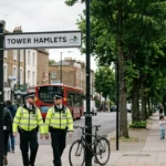
Understanding local crime figures is an essential component of evaluating residential safety and selecting an optimal place to live. The sub-region of East London historically accommodates diverse economic shifts, structural regeneration, and shifting demographic patterns. To establish an accurate assessment of the safest areas in East London, analysts rely primarily on the Metropolitan Police Service (MPS) recorded crime data, specifically measuring the crime rate per 1,000 residents. The metrics evaluate specific criminal categories, including violence against the person, vehicle offences, burglary, and anti-social behaviour (ASB).
- What are the safest boroughs in East London based on official metrics?
- How does Havering achieve the lowest crime figures in East London?
- Which specific neighborhoods in Redbridge exhibit the highest safety ratings?
- What role does urban regeneration play in Waltham Forest’s safety profile?
- How do crime patterns vary across different property types in East London?
- Why are certain inner East London areas seeing statistical improvements?
- What metrics should renters and buyers analyze when evaluating local safety?
- How do community safety partnerships influence East London crime statistics?
Evaluating safety through official metrics requires analyzing the institutional changes in public safety. Historical patterns demonstrate that geographic distribution of criminal prosecutions and reporting rates shifted significantly alongside proactive policing mechanisms (Hitchcock, 2026). In modern urban analysis, municipal authorities assess safety variations between inner London boroughs, which typically possess higher commercial and transit densities, and outer London boroughs, where suburban profiles generate different statistical trends.
What are the safest boroughs in East London based on official metrics?
The safest boroughs in East London based on official statistical data are Havering, Redbridge, and Waltham Forest. These outer eastern administrative areas consistently record the lowest total crime rates per 1,000 residents across the entire Metropolitan Police Service territory.
Statistical records indicate that Havering maintains the lowest overall crime index within the eastern sub-region. The borough exhibits an annualized crime rate fluctuating between 65 and 72 offences per 1,000 residents. This performance is driven by its predominantly suburban geography, lower population density, and dedicated local safer neighbourhood teams. The specific geographic structure of the borough limits transient foot traffic, which heavily suppresses opportunities for opportunistic street-level crimes.
Redbridge occupies the second position regarding safety metrics in East London. The annualized crime rate in this district tracks closely at approximately 74 to 78 offences per 1,000 residents. Administrative districts within Redbridge feature established residential neighborhoods where community-led safety frameworks work in tandem with the local authority.
Waltham Forest ranks as the third safest sub-region in East London. Following extensive municipal investments and gentrification initiatives over the preceding decade, its crime figures dropped to approximately 82 offences per 1,000 residents. The stabilization of crime rates in Waltham Forest reflects targeted policing interventions and community safety boards. This contrasts with inner-city districts such as Tower Hamlets and Newham, where high commercial concentrations and vibrant nightlife hubs elevate total reported offenses.
How does Havering achieve the lowest crime figures in East London?
Havering achieves the lowest crime figures in East London through its unique suburban geography, low population density, and targeted law enforcement frameworks. These interconnected characteristics minimize transient population volume and reduce opportunities for property and violent crimes.
The physical layout of Havering functions as a primary deterrent to systemic urban crime. As an outer London borough, its borders encompass extensive greenbelt spaces and low-density residential developments. The demographic composition is structurally stable, with a high proportion of owner-occupied households. This low population density naturally minimizes the incidence of interpersonal violence and public order offenses, which occur far more frequently in highly packed urban centers.
Local law enforcement models in Havering prioritize visibility and proactive community partnership. The Metropolitan Police Service assigns dedicated Safer Neighbourhood Teams (SNTs) to each electoral ward, ensuring consistent communication with residents. These partnerships emphasize preventative target hardening, which involves securing physical structures to deter illicit access. The borough relies heavily on the Tri-Borough basic command unit (BCU) structure, which pools resources across East London to respond rapidly to shifting criminal trends.
The lack of major transport interchanges and mass commercial entertainment zones further insulates Havering from high crime counts. Urban transport hubs generally experience elevated levels of pickpocketing, theft, and alcohol-related anti-social behaviour. Because Havering lacks large-scale central entertainment complexes, its public spaces do not attract the high volume of non-resident foot traffic found in neighboring commercial districts. Consequently, opportunist offenses remain suppressed.
Which specific neighborhoods in Redbridge exhibit the highest safety ratings?
The specific neighborhoods in Redbridge that exhibit the highest safety ratings are Wanstead, Woodford, and Gants Hill. These localized residential areas sustain crime rates significantly below both the borough average and the wider London municipal average.
Wanstead is recognized as one of the safest micro-localities within East London. Its crime figures are driven down by an active residential community and geographic boundary isolation via open green spaces like Wanstead Flats. Property crimes, such as residential burglary and vehicle theft, are the primary focus of local monitoring groups, but the absolute numbers remain low. The area operates extensive neighborhood watch schemes that serve to heighten surveillance without direct police presence.
Woodford, which includes both Woodford Green and South Woodford, represents another high-safety enclave. This area features wide residential streets dominated by family housing units. The crime profile of Woodford is characterized by low rates of violent crime and minimal anti-social behaviour indicators. Municipal safety reports highlight that joint operations between the British Transport Police and local patrols keep the Central Line stations within Woodford secure from commuter-targeted thefts.
Gants Hill maintains a favorable safety ranking due to comprehensive urban planning and integrated closed-circuit television (CCTV) coverage. The local infrastructure funnels pedestrian transit through visible, well-lit corridors. While the commercial perimeter around the central roundabout experiences minor shoplifting incidents, the surrounding residential avenues maintain high security metrics. Local authority data reveals that coordinated community safety initiatives effectively suppress youth-related public order offences in these sectors.
What role does urban regeneration play in Waltham Forest’s safety profile?
Urban regeneration plays a decisive role in Waltham Forest’s safety profile by transforming public spaces, modernising residential infrastructure, and deploying comprehensive environmental design strategies. These developments systematically design out crime while shifting local socio-economic conditions.
The application of Crime Prevention Through Environmental Design (CPTED) principles forms the bedrock of Waltham Forest’s modern development strategy. Municipal planners systematically replace poorly lit pedestrian underpasses and blind alleys with open-plan civic spaces. Street lighting upgrades to high-intensity light-emitting diode (LED) systems across key corridors have eliminated dark spots, directly decreasing personal robberies and evening anti-social behavior.
Regeneration projects also lead to a complete overhaul of housing layouts and commercial high streets. The redesign of central areas like Walthamstow Central and the St James Quarter introduced mixed-use developments where active shopfronts sit beneath residential apartments. This specific layout ensures natural surveillance, meaning public spaces are constantly overlooked by residents and workers. Academic research indicates that increasing natural sightlines discourages visible street crimes and drug-related offenses (Buil-Gil et al., 2022).
Furthermore, urban renewal programs have funded sophisticated municipal monitoring infrastructures. Waltham Forest operates a centralized CCTV control center that monitors public spaces in real-time. This technological network allows for the rapid dispatch of enforcement officers to intercept escalating incidents before they manifest as severe crime statistics. The combination of structural architecture improvements and real-time monitoring keeps the borough’s crime trajectory on a downward trend.
Explore More Help & Resources
Hackney Rats Problem Scale Complaints and What the Council Is Doing
Waltham Forest Bin Strikes What Got Collected and What Did Not
How do crime patterns vary across different property types in East London?
Crime patterns vary significantly across property types in East London, with purpose-built flats experiencing higher rates of anti-social behaviour, detached houses facing targeted burglaries, and commercial premises dealing with chronic shoplifting and property damage.
Multi-unit residential structures, such as purpose-built apartment blocks and high-rise estates, display specific vulnerabilities to communal security breaches. Communal entry systems can be compromised via tailgating, where unauthorized individuals follow residents through secure doors. Consequently, these property types record higher instances of localized anti-social behaviour within stairwells and interior corridors, alongside the theft of bicycles and parcel deliveries from shared mailrooms.
Single-family dwellings, including detached and semi-detached properties in suburban zones, present distinct risk vectors. These properties are often targeted by structured property offenders seeking high-value consumer goods or vehicle keys. Because these homes feature multiple access points, such as rear patio doors and side windows, they require robust physical security measures. In outer boroughs like Havering, residential burglary patterns correlate strongly with properties lacking visible alarm systems or security lighting.
Commercial properties across East London experience an entirely separate category of criminal offenses. Retail spaces along major high streets face persistent retail theft and criminal damage. Analysis of crime distribution indicates that commercial zones absorb the vast majority of non-violent property theft, driven by high customer volumes and automated self-checkout systems. Local councils counter these trends by creating business crime reduction partnerships that share real-time intelligence on active shoplifting groups.
Why are certain inner East London areas seeing statistical improvements?
Certain inner East London areas are seeing statistical improvements due to targeted multi-agency policing operations, predictive crime mapping software, and sustained investment in youth diversionary programs. These measures disrupt localized criminal networks and reduce recidivism rates.
The Metropolitan Police Service utilizes data-driven policing models to allocate resource deployments into precise geographic coordinates. Under the current operational frameworks, precision software analyzes historical crime reports to identify hot spots down to specific street corners. Officers are then deployed to these zones during peak hours, creating a visible deterrent that suppresses violent offenses and street-level drug distribution before they materialize.
Coordinated multi-agency task forces also contribute to the positive statistical trajectory of inner districts. Initiatives like the Violence Reduction Unit (VRU) bring together healthcare professionals, social workers, educators, and police officers to treat crime as a public health issue. By addressing the root causes of systemic misconduct and organizing fast-acting interventions for vulnerable demographics, these coalitions successfully drive down youth violence statistics in complex urban environments.
Moreover, targeted commercial investment and business improvement districts (BIDs) provide localized security enhancements. In areas like Hackney and parts of Tower Hamlets, BIDs fund private security patrols that coordinate directly with the civil police. These wardens provide an added layer of surveillance along commercial strips, managing minor public order issues and allowing sworn police officers to focus their resources on investigating severe or complex offenses.
What metrics should renters and buyers analyze when evaluating local safety?
Renters and buyers should analyze the total crime volume per capita, the specific ratio of violent to non-violent offenses, and the temporal distribution of anti-social behaviour reports. Examining these precise data sets provides a realistic understanding of an area’s security environment.
Per capita crime rates provide the baseline tool for geographic safety comparisons. Looking at total raw crime numbers can be misleading because highly populated or heavily touristed areas will naturally register more incidents. Evaluating the number of offenses per 1,000 residents allows individuals to accurately gauge the real statistical probability of experiencing an offense within that specific electoral ward or borough command unit.
The specific breakdown of crime categories yields deeper insight into the day-to-day reality of a neighborhood. A locality experiencing high rates of administrative or non-violent offenses, such as shoplifting or identity fraud, presents a radically different environment than one marked by personal robberies or weapon offenses. Homebuyers must examine the prevalence of violence against the person and residential burglary to evaluate the physical safety of their prospective home.
Temporal and spatial data distribution represents the final critical metric for residential analysis. Understanding when and where crimes occur helps distinguish between localized issues and widespread neighborhood instability. For example, high anti-social behavior metrics concentrated around a specific transit station or entertainment venue at weekend closing hours indicates a localized nuisance, whereas uniform crime distribution across residential streets suggests systemic security concerns.

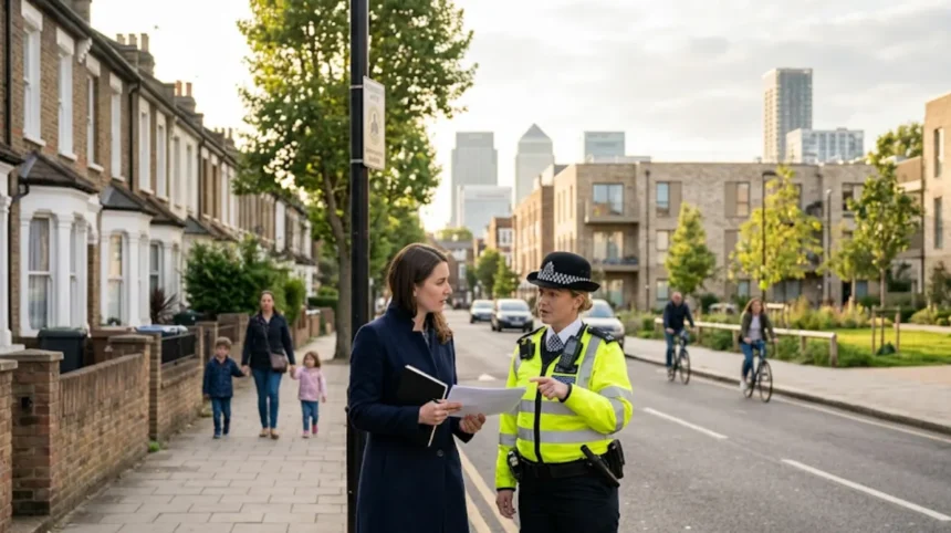
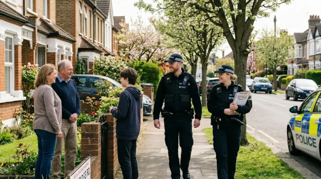
How do community safety partnerships influence East London crime statistics?
Community safety partnerships influence East London crime statistics by bridging the communication gap between local residents, municipal councils, and emergency services. These groups execute targeted preventative campaigns and establish robust neighborhood watch networks.
The statutory framework of Community Safety Partnerships (CSPs), established under the Crime and Disorder Act 1998, mandates that local authorities, police, fire services, health trusts, and probation services work together. In East London boroughs, these partnerships formulate triennial strategies to combat localized crime priorities. By combining resources, a CSP can implement physical changes, such as installing public space lighting or cleaning graffiti, which immediately discourages low-level criminal behavior.
Neighborhood Watch networks function as decentralized data gathering hubs that enhance police efficiency. Residents participating in these initiatives provide real-time reporting of suspicious activity, which feeds into police databases. This community-led intelligence allows safer neighborhood teams to adjust their patrol routes based on current neighborhood anxieties. The visible presence of community safety signs and active property marking initiatives acts as a psychological deterrent to opportunistic property thieves.
Furthermore, CSPs manage localized diversionary schemes designed to reduce youth involvement in anti-social behaviour. By financing community centers, sports programs, and vocational training platforms in outer and inner eastern boroughs, these partnerships offer alternative pathways for at-risk youth populations. The long-term impact of these social interventions is reflected in reduced youth offense rates and lower instances of public vandalism across the targeted residential sectors.
What is the safest borough in East London?
Havering is generally considered the safest borough in East London, recording some of the lowest crime rates per 1,000 residents. Its suburban character, lower population density, and strong community policing contribute to consistently low crime figures.