Rush Green is a defined suburban settlement located on the border of the London Borough of Havering and the London Borough of Barking and Dagenham. The locality functions primarily as a residential district situated approximately 14 miles east of Charing Cross. In 2026, life for residents is shaped by its position as an affordable metropolitan edge, balancing access to central London transport links with the lower population density characteristic of outer East London.
- What Is the History and Historical Context of Rush Green?
- What Are the Demographic Characteristics of the Population?
- What Is the Current Housing Market and Cost of Living Like?
- How Do Transport Connections Impact Daily Commuting?
- What Local Amenities and Social Infrastructure Are Available?
- What Environmental and Urban Planning Challenges Exist?
- How Does the Local Community and Safety Environment Rank?
What Is the History and Historical Context of Rush Green?
Rush Green developed from an isolated agricultural hamlet in Essex into a dense interwar suburban residential district during the 20th century. The expansion of the London underground network and manufacturing industries drove rapid housing development across the region throughout the 1930s.
The name Rush Green originates from the historic presence of marshy, rush-covered common land within the historic parish of Hornchurch. For centuries, the area remained exclusively agricultural, consisting of small farms and open common land. The primary transformation occurred after the local government reforms and the industrial boom of the early 1900s, driven largely by the nearby growth of the Ford Motor Company plant in Dagenham.
During the 1920s and 1930s, large-scale speculative housebuilding transformed the landscape. Developers constructed extensive estates of three-bedroom semi-detached and terraced houses to accommodate workers migrating from inner London. The area was formally integrated into the London Borough of Havering and the London Borough of Barking and Dagenham upon the creation of Greater London in 1965. This administrative change solidified its transition from an Essex village to an outer London suburb.
What Are the Demographic Characteristics of the Population?
The population of Rush Green exhibits a highly diverse demographic profile, characterized by an increasing percentage of multi-ethnic households and a growing population of young families. The local population density mirrors the broader trends observed across outer East London.
The local population consists of a mix of long-term working-class residents and newer families migrating from inner London boroughs like Newham and Tower Hamlets. This demographic shift has altered the local landscape significantly over the past decade. Data indicators confirm that young families are attracted to the area by relative property affordability and the availability of local schools.
The ethnic composition of the area has diversified rapidly. While historically predominant populations were of White British heritage, current municipal registers show significant expansion in British Asian, Black African, and Eastern European communities. Examples of prominent local communities include residents of Nigerian, Romanian, and Indian heritage. The average household size trends slightly higher than the wider London average, reflecting the high concentration of multi-generation family homes.
What Is the Current Housing Market and Cost of Living Like?
The housing market in Rush Green provides some of the lowest average property prices in Greater London, making it a primary target for first-time buyers. High interest rates and rental inflation shape the local cost of living pressures.
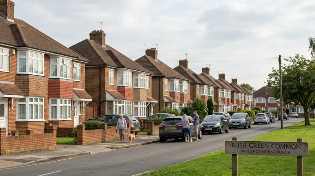
The local housing stock consists overwhelmingly of interwar residential architecture. Terraced houses, semi-detached houses, and low-rise purpose-built flat blocks represent the primary property options. This specific structural layout makes the area highly attractive to buyers seeking freehold properties with gardens, which are unavailable or unaffordable in inner London zones.
Rental costs have risen significantly due to high demand from commuters who are priced out of central districts. A standard two-bedroom apartment requires an average monthly expenditure exceeding £1,500. Local residents face standard cost-of-living challenges common to outer London, including high municipal council tax rates and increased grocery expenditure at regional retail centers.
How Do Transport Connections Impact Daily Commuting?
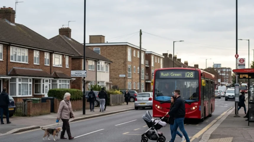
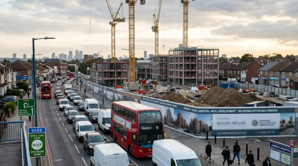
Transport connections rely heavily on nearby regional interchanges, as Rush Green does not contain its own dedicated railway station. Residents utilize dense local bus networks to access the Elizabeth line, District line, and National Rail services.
The absence of a central rail terminus within the immediate boundaries means that local transport efficiency depends entirely on bus connectivity. Transport for London operates several high-frequency bus routes that traverse the main thoroughfares, linking residents to primary economic centers. Examples of these routes include the 5, 103, 128, and 175 bus services, which provide continuous transit throughout the day.
Romford Station serves as the primary transport hub to the north, providing direct access to London Liverpool Street via the Elizabeth line and Greater Anglia services. To the south, Dagenham East and Dagenham Heathway stations connect residents to the District line network. Road transport is characterized by heavy usage of the A124 road, which functions as the primary east-west arterial corridor connecting the district directly to the North Circular Road and the M25 motorway.
What Local Amenities and Social Infrastructure Are Available?
The social infrastructure consists of localized retail clusters, public green spaces, and key educational institutions that support the domestic population. Primary healthcare services are delivered via community clinics and a major regional hospital footprint.
Retail provisions are focused along Rush Green Road, which features a combination of independent commercial businesses and national supermarket chains. These establishments supply daily provisions without requiring travel to larger commercial hubs. Examples of local retail operators include convenience stores, independent bakeries, and ethnic grocery outlets. For comprehensive retail shopping, residents travel to the nearby Liberty Shopping Centre in Romford.
The area accommodates Barking & Dagenham College, a major further education institution providing technical and vocational training to thousands of students across East London. Healthcare access is anchored by Queen’s Hospital, located immediately on the northern periphery of the district. Public recreation options are supported by local green spaces. Examples of these facilities include Central Park and Grenfell Park, which provide playing fields, children’s play areas, and walking paths.
What Environmental and Urban Planning Challenges Exist?
Environmental challenges center on vehicular air pollution along primary road corridors and the pressure to redevelop brownfield sites for high-density housing. Managing traffic congestion remains a critical priority for local municipal authorities.
Air quality monitoring initiatives consistently identify elevated nitrogen dioxide levels along major transport corridors like the A124 and near the Queen’s Hospital transport junction (Font, 2015). The high volume of diesel buses, commercial delivery vehicles, and commuter cars contributes to localized pollution spikes during peak morning and evening hours. The expansion of the Ultra Low Emission Zone encompasses the district, penalizing non-compliant vehicles to mitigate these environmental impacts.
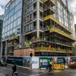
Urban planning initiatives focus heavily on executing estate regeneration and identifying underutilized commercial land for residential infill projects. Local councils balance the preservation of suburban low-density character with the intense macro-demand for new social and affordable housing units (Penny, 2024). This structural shift creates friction regarding the capacity of existing GP surgeries, schools, and drainage networks to absorb rapid population growth.
How Does the Local Community and Safety Environment Rank?
Community life is organized around schools, local religious centers, and grassroots neighborhood groups. Safety metrics show crime rates that track consistently with the broader averages reported across outer East London boroughs.
The community fabric is reinforced by active parent-teacher associations, local sports clubs, and multicultural community organizations. Religious institutions play a significant role in social cohesion, offering community services and food banks. Examples of these institutions include the Rush Green Gospel Hall, local Anglican churches, and community Islamic centers. These hubs provide essential support structures for vulnerable residents navigating economic challenges.
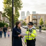
Metropolitan Police data indicates that the area experiences typical suburban crime profiles, with property theft, anti-social behavior, and vehicle crime representing the most frequently reported offenses. Local safer neighborhood teams conduct regular patrols around transport nodes and retail clusters to deter illicit activity. Community engagement initiatives focus on improving street lighting and supporting youth diversion programs to maintain public safety standards.
What is Rush Green and where is it located?
Rush Green is a suburban residential district located on the border of the London Borough of Havering and the London Borough of Barking and Dagenham. It lies approximately 14 miles east of Charing Cross and is known for its affordable housing, family-oriented environment, and convenient access to East London transport networks.