

Key Points
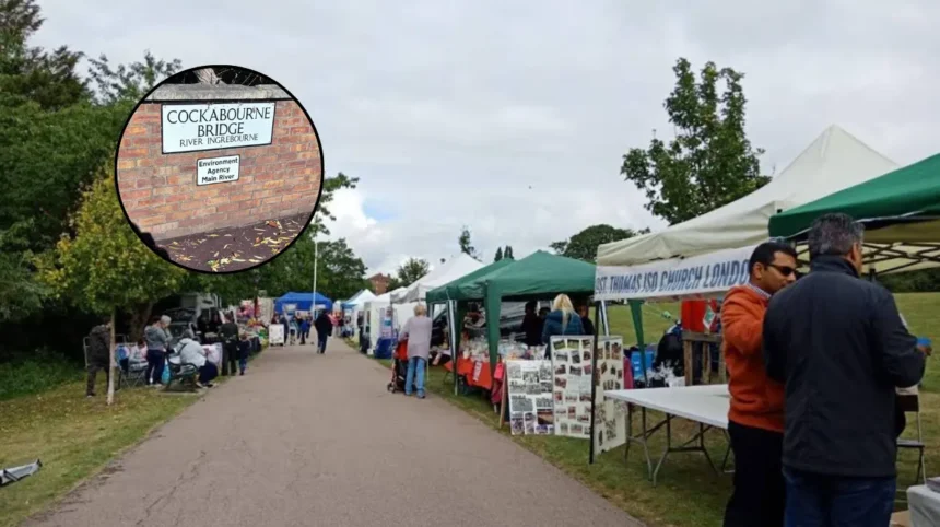
- Residents in Harold Wood have raised concerns over alleged traveller access to Green Belt land adjacent to Cockabourne Bridge.
- Reports indicate that preliminary works have commenced on the site, with a local resident claiming preparations are underway to lay cement.
- Fears have been highlighted regarding potential environmental damage to the local wildlife and the riverbank of the Ingrebourne, which crosses Cockabourne Bridge.
- The Environment Agency is understood to be aware of the ongoing situation near the riverbank.
- Local residents have formally contacted Havering councillors Brian Eagling and Keith Prince to voice their concerns.
- Havering Council Leader Councillor Keith Prince AM confirmed he was notified of the situation and promised immediate action, stating council officers would inspect the site.
- Concerns remain among the local community that unpermitted development or occupation could set a precedent for Green Belt land in the borough.
Harold Wood (East London Times) October 8, 2026 – Residents living in Harold Wood have raised concerns following claims that travellers have accessed open land close to Cockabourne Bridge, with reports indicating that unauthorised site works may have already commenced near the protected riverbank.
What actions have residents taken regarding the Harold Wood Green Belt site?
As reported by The Havering Daily, a local resident residing near Cockabourne Bridge contacted the publication to highlight that physical preparations appeared to be taking place on the parcel of land. According to the reporter at The Havering Daily, the resident stated that groundworks had begun and expressed a specific belief that preparations were actively being made to lay cement across the location.
The individual expressed severe apprehension over the prospect of unpermitted development or occupation taking hold in the area. Speaking directly to the reporting journalist at The Havering Daily, the resident stated: “There is so much green belt land in this area, it will surely set a precedent if not nipped in the bud.”
In addition to alerting regional media, concerned local householders have directly contacted Havering Ward Councillors Brian Eagling and Keith Prince to request urgent intervention and clarification on what legal or planning permissions, if any, exist for activity at the location.
How have local authorities and environmental bodies responded to the incident?
As reported by the journalistic team at The Havering Daily, Havering Council Leader Councillor Keith Prince AM confirmed that the local authority had been formally notified about the reports and was initiating an immediate operational response.
According to the reporting by The Havering Daily, Councillor Keith Prince AM stated: “I was made aware of this yesterday evening and as a council we will act on this immediately and council officers will be sent to the site today.”
Simultaneously, it is understood that the Environment Agency has been made aware of the developments. The site’s immediate proximity to the Ingrebourne—which flows directly under Cockabourne Bridge—has elevated concerns regarding potential ecological disruption, loss of local wildlife habitat, and structural harm to the riverbank if unsanctioned works or heavy ground alterations continue.
Why is the Cockabourne Bridge location environmentally significant?
The land surrounding Cockabourne Bridge in Harold Wood forms an integral portion of the London Borough of Havering’s designated Green Belt provision. The area is characteristically open terrain situated adjacent to Harold Wood Park and plays a key role in connecting local ecological corridors along the Ingrebourne valley.
According to Havering Council’s own Green Belt assessment documents, the land around Cockabourne Bridge holds official recognition for its contribution to preventing urban sprawl and preserving local biodiversity. Because the site abuts the natural course of the Ingrebourne, any earth-moving operations, paving, or laying of hardstanding materials pose immediate ecological considerations for riverbank stability and indigenous species.
Local community members remain watchful as council enforcement teams carry out site inspections to determine whether planning control breaches or environmental legislation violations have occurred, and to establish what formal enforcement measures may be required.
Background of the particular development
The London Borough of Havering contains extensive tracts of designated Green Belt land, particularly along its eastern boundary where urban East London transitions into the Essex countryside. The Ingrebourne river valley is one of the borough’s primary natural landscape features, running through various public parks and open countryside spaces including Harold Wood Park and land adjacent to Cockabourne Bridge.
Under national UK planning law, Green Belt land is subject to strict planning controls designed to prevent inappropriate development, preserve openness, and safeguard the countryside. Unauthorised developments or hardstanding works on Green Belt locations traditionally trigger prompt planning enforcement procedures by local planning authorities, alongside oversight from statutory bodies such as the Environment Agency when works occur within proximity to designated watercourses.
Prediction
This development is expected to heighten local scrutiny and engagement among residents, environmental groups, and property owners across Harold Wood and the wider Havering area.
If council officers confirm that unauthorised works or access have taken place without appropriate planning and environmental consents, local homeowners will likely press for swift enforcement action, including stop notices or reinstatement orders, to prevent potential long-term impacts on local property values and neighbourhood amenities. For local political leaders and Havering Council, the speed and effectiveness of the regulatory response will be viewed by the electorate as a benchmark for how strictly Green Belt protections and environmental safeguards are upheld across the borough.