



Key Points
- Havering is experiencing a major surge in residential planning applications across Hornchurch, Upminster, Rainham, Romford, and Harold Hill, encompassing Green Belt, agricultural, and brownfield land.
- London Assembly data provided by the Mayor of London reveals that 12 planning applications for housing on Green Belt land have been submitted in Havering since 1 April 2025—the second-highest number among London boroughs.
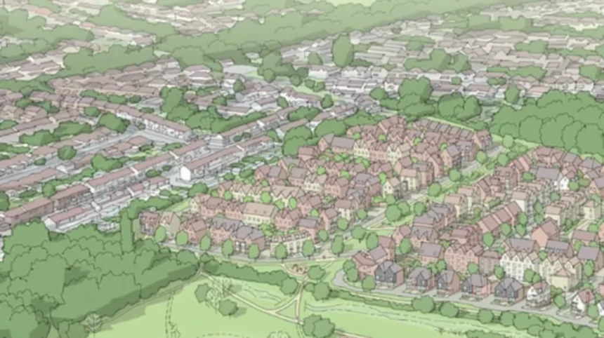
- Planning application P0417.26 proposes up to 475 homes on Grade 2 agricultural and Green Belt land north of Benets Road and east of Wingletye Lane in Hornchurch, sparking significant local opposition regarding infrastructure and ecology.
- Planning application P0810.26 in Rainham seeks outline permission for up to 411 homes on agricultural Green Belt land off Upminster Road North and Berwick Pond Road, which has been officially called in by Ward Councillor Sue Ospreay.
- Major urban brownfield redevelopments include up to 972 residential units approved at the former Romford Ice Rink site on Rom Valley Way, alongside approximately 383 homes planned for Phase 1 of the Bridge Close scheme.
- Havering Council’s 12 Sites Regeneration Programme aims to deliver over 3,500 homes across existing council estates, including 1,380 units at the Waterloo Estate in Romford.
- Regional regeneration frameworks, including Beam Park and the broader London Riverside Opportunity Area, continue to add thousands of additional homes to the south of the borough.
Havering (East London Times) September 8, 2026 — From Hornchurch and Upminster to Rainham, Romford, and Harold Hill, the London Borough of Havering is facing an unprecedented wave of residential planning proposals that threaten to transform its remaining Green Belt and agricultural landscapes. Local authority planning registers confirm a steady stream of applications ranging from minor urban infill to large-scale residential developments encompassing hundreds of units. When combined with major council-led regeneration programmes, urban brownfield schemes, and regional development targets set under the Draft London Plan, the cumulative scale of construction facing the borough represents one of the largest expansion movements in East London.
- Key Points
- What Is The Extent Of Green Belt Housing Applications In Havering?
- Why Is The Benets Road Proposal In Hornchurch Causing Controversy?
- How Are Rainham Residents Reacting To The Upminster Road North Proposals?
- How Are Urban Brownfield Sites Accommodating Housing Growth In Romford?
- What Role Does Havering Council’s Regeneration Programme Play?
- How Is South Havering Being Impacted By Regional Regeneration Targets?
- Background Of Housing Policies And Green Belt Allocations In Havering
- Future Impact Analysis: How This Housing Surge Will Affect Havering Residents
The expanding volume of applications has elevated local concern regarding civic infrastructure, road capacity, and environmental preservation. While municipal authorities receive fresh proposals on a weekly basis, the convergence of major schemes has intensified public scrutiny over whether Havering’s existing services can accommodate tens of thousands of potential new residents.
What Is The Extent Of Green Belt Housing Applications In Havering?
Official figures supplied by the Mayor of London to the London Assembly show that Havering received 12 separate planning applications for residential developments on Green Belt land between 1 April 2025 and mid-2026. This metric places Havering second among all Greater London boroughs for Green Belt development proposals during that period, behind only Bexley.
Planning officers emphasize that these submissions represent planning applications rather than granted permissions. A submitted outline application undergoes statutory public consultation, environmental assessments, and committee evaluation before any formal decision is rendered. Furthermore, an approval does not automatically guarantee immediate construction. However, planning data highlights an intense commercial interest from property developers targeting Havering’s open green spaces.
Why Is The Benets Road Proposal In Hornchurch Causing Controversy?
As detailed by local media reports and public notices, one of the largest outline submissions currently before the local authority is application P0417.26, which targets land situated north of Benets Road and east of Wingletye Lane in Hornchurch. The applicant is seeking outline planning consent to construct up to 475 residential dwellings alongside associated access routes, public open space, and structural landscaping.
The application site consists of open fields and Grade 2 agricultural land, positioning its Green Belt designation at the core of municipal debate. During preliminary deliberations, members of Havering’s Strategic Planning Committee voiced significant reservations regarding the development’s potential impact on local highway networks, vehicle congestion, wildlife habitats, and the adjacent River Ingrebourne ecological corridor. While the applicant has put forward arguments suggesting portions of the site meet the criteria for “Grey Belt” reclassification under emerging national policy frameworks, local residents and environmental campaigners maintain that approving the development would result in the permanent loss of productive farmland and natural habitat.
How Are Rainham Residents Reacting To The Upminster Road North Proposals?
In Rainham, a separate outline proposal designated as application P0810.26 seeks permission for up to 411 homes on agricultural land off Upminster Road North and Berwick Pond Road. The application incorporates residential units, sustainable drainage systems (SuDS), public open space, and a newly proposed roundabout at the junction of Upminster Road North and Berwick Pond Road to manage site access.
Rainham and Wennington Ward Councillor Sue Ospreay has officially called in application P0810.26 for formal determination by Havering Council’s Planning Committee. In her call-in request, Councillor Ospreay cited the proposal’s location on Green Belt land, expressing explicit concerns regarding the overall scale of construction, local highway safety, environmental degradation, and the loss of open countryside. Community groups have launched opposition campaigns, arguing that the surrounding rural infrastructure cannot sustain a multi-hundred-home expansion.
How Are Urban Brownfield Sites Accommodating Housing Growth In Romford?
While rural areas face Green Belt development pressures, urban centers within Havering are absorbing high-density redevelopment. At the former Romford Ice Rink site on Rom Valley Way, existing planning consents permit a comprehensive mixed-use development containing up to 972 residential units. Council planning records confirm that the approved master plan spans seven distinct building blocks ranging between two and 12 storeys, integrating healthcare facilities, retail space, community hubs, and an on-site energy centre. Subsequent planning amendments and detailed submissions regarding this scheme have continued throughout 2026.
Simultaneously, the Bridge Close regeneration scheme in Romford represents another major urban brownfield project. Phase one of the Bridge Close master plan is targeted to deliver approximately 383 new homes, with a minimum 35 per cent allocation designated as affordable housing. The broader infrastructure master plan incorporates commercial units, public space enhancements along the River Rom, and a three-form-entry primary school, illustrating the borough’s strategy of utilizing previously developed urban land to meet housing quotas.
What Role Does Havering Council’s Regeneration Programme Play?
Beyond private developments, Havering Council is actively executing its own municipal building strategy through its 12 Sites Regeneration Programme. The joint-venture initiative is designed to construct more than 3,500 new homes across 12 council-owned estates to upgrade existing housing stock and expand local council-rented housing options.
The largest individual project within this council-led portfolio is the Waterloo Estate regeneration in Romford, which is slated to yield 1,380 modern homes. Other active locations earmarked for estate overhauls include Chippenham Road, Farnham and Hilldene in Harold Hill, alongside Oldchurch Gardens, Maygreen Crescent, Brunswick Court, Dell Court, and Delderfield House. Council officials maintain that these redevelopments prioritize urban regeneration over rural expansion, recycling existing built environments to minimize greenfield loss.
How Is South Havering Being Impacted By Regional Regeneration Targets?
In the southern portion of the borough, construction activity remains anchored around the London Riverside Opportunity Area and the Beam Park master plan. Extending across the boundary between Havering and the neighbouring borough of Barking and Dagenham, Beam Park is in the process of delivering thousands of new dwellings on former industrial land.
The convergence of regional strategic growth corridors alongside localized infill applications means residents across Rainham, South Hornchurch, and Romford are witnessing a widespread transformation of their local environments.
Background Of Housing Policies And Green Belt Allocations In Havering
The current surge in planning activity across Havering follows years of evolving regional and national housing mandates designed to address London’s severe housing shortage. Under the Greater London Authority’s (GLA) Draft London Plan, outer London boroughs have been assigned elevated housing delivery targets, placing local planning authorities under statutory pressure to identify viable sites for development.
Historically, Havering’s urban footprint has been defined by its extensive green spaces, with approximately half of the borough’s total land area designated as Metropolitan Green Belt. However, national planning policy revisions introducing concepts such as “Grey Belt”—land within the Green Belt deemed to be of low environmental or aesthetic value—have created legal pathways for developers to challenge traditional greenfield protections. This shift, combined with Havering Council’s required publication of an updated Local Plan, has led to a sharp increase in outline applications on edge-of-settlement agricultural boundaries as developers test the local authority’s statutory five-year housing land supply metrics.
Future Impact Analysis: How This Housing Surge Will Affect Havering Residents
The ongoing expansion of residential planning proposals across Havering is expected to impact existing and prospective residents across several operational areas over the coming decade:
- Local Infrastructure and Public Services: The influx of thousands of new households will place significant operational demands on Havering’s primary healthcare networks, local GP surgeries, and accident and emergency facilities at Queen’s Hospital. Educational infrastructure will similarly require capital expansion or the construction of new facilities, such as the proposed primary school at Bridge Close, to accommodate expanding school-age populations.
- Highways and Public Transport: Roads including the A12, A127, A13, and local arterial routes such as Upminster Road North and Wingletye Lane face heightened risks of traffic congestion. While developments near Romford benefit from Elizabeth Line rail connectivity, semi-rural developments in Hornchurch and Rainham will increase local vehicle density, placing pressure on parking capacity and suburban highway junctions.
- Environmental Landscape and Biodiversity: The potential conversion of Grade 2 agricultural land and Green Belt parcels into residential estates will permanently alter the visual character of districts like Hornchurch and Rainham. Environmental advocates warn that developing green field sites risks fragmenting biodiversity corridors along the River Ingrebourne and River Rom, reducing local natural drainage capacity and elevating surface water flooding risks.
- Property Market and Housing Supply: The delivery of high-density urban schemes, alongside council-led estate regenerations, will increase the local supply of both market-rate and affordable housing stock. While this expansion may offer opportunities for first-time buyers and families on social housing waitlists, existing homeowners may experience fluctuations in localized property values and ongoing disruptions associated with long-term construction activities.