Key Points
- Redbridge is located in north-east London, bordered by Epping Forest District (Essex) to the north, Waltham Forest to the west, Havering to the east, Barking and Dagenham to the south-east, and Newham to the south-west.
- The borough is predominantly residential and leafy, popular with families and commuters due to high-performing schools, affordable housing relative to central London, and green spaces such as Hainault Forest.
- Key neighbourhoods include Ilford, Wanstead, Woodford, Gants Hill, Newbury Park, South Woodford, Barkingside, Seven Kings, Goodmayes, Fairlop, Hainault, Grange Hill, and Roding Valley.
- Notable places of interest are Valentines Park, Hainault Forest Country Park, Fairlop Waters Country Park, Redbridge Central Library and Museum, and Kenneth More Theatre.
- Redbridge is named after a 17th-century red brick bridge over the River Roding in Ilford, which was demolished in the 1920s.
- These details form part of short guides produced ahead of local elections on Thursday 7 May for London’s 32 boroughs.
Redbridge, London Borough of Redbridge (East London Times) April 8, 2026 –
- Key Points
- What is the location and borders of Redbridge borough?
- What defines Redbridge as a residential borough?
- Which are the main neighbourhoods in Redbridge?
- What places of interest are there in Redbridge?
- What is the pub quiz fact about Redbridge’s name?
- Why are these guides produced ahead of local elections?
- Background of the Development
- Prediction: How This Development Can Affect Redbridge Residents
What is the location and borders of Redbridge borough?
Redbridge occupies a position in north-east London, serving as a key residential area for many commuters and families. As detailed in guides ahead of the local elections on Thursday 7 May, the borough is bordered by Epping Forest District in Essex to the north, Waltham Forest to the west, Havering to the east, Barking and Dagenham to the south-east, and Newham to the south-west.
This positioning places Redbridge at the edge of London’s urban expanse, connecting inner city life with more suburban and semi-rural surroundings.
The borough’s geography supports its role as a gateway between London and Essex, with the River Roding running through it, historically significant as the site of the original red brick bridge that gave the area its name. Transport links, including the Central line, provide efficient connections to the City of London, making Redbridge accessible for daily commuters.
What defines Redbridge as a residential borough?
Redbridge stands out as a leafy and predominantly residential borough, attracting residents who value space and community over central urban density. It is popular with families due to its high-performing schools and housing that remains affordable when compared to central London districts.
Green spaces abound, with Hainault Forest offering extensive woodland walks and nature reserves.
As reported in pre-election borough guides covering London’s 32 local authorities, Redbridge’s appeal lies in its balance of suburban calm and proximity to employment hubs. Commuters benefit from reliable public transport, while the abundance of parks and forests contributes to a high quality of life.
The residential character is evident across its various neighbourhoods, each contributing to the borough’s diverse yet cohesive community fabric.
Which are the main neighbourhoods in Redbridge?
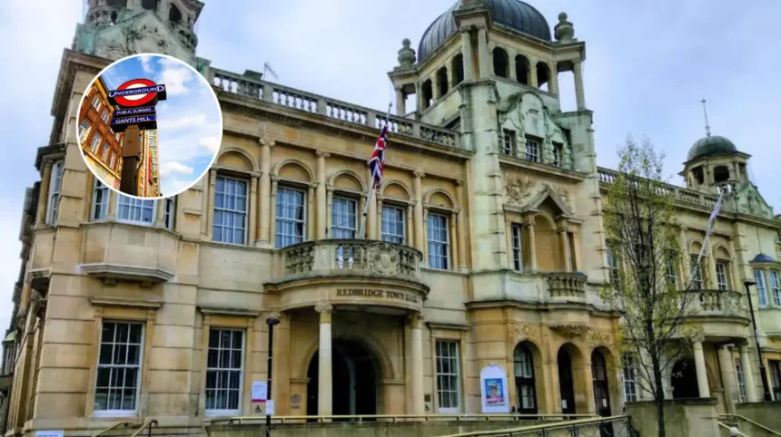
Recognisable neighbourhoods in Redbridge include Ilford, Wanstead, Woodford, Gants Hill, Newbury Park, South Woodford, Barkingside, Seven Kings, Goodmayes, Fairlop, Hainault, Grange Hill, and Roding Valley. Ilford serves as a bustling town centre with shopping and transport hubs, while Wanstead and South Woodford offer more upscale, village-like atmospheres with independent shops and cafes.
Gants Hill is known for its distinctive underground station architecture, reminiscent of Moscow’s metro, and Newbury Park provides family-oriented estates near country parks.
Barkingside features community-focused areas with historic elements, Seven Kings has seen rapid development with new schools, and Goodmayes maintains a quiet residential vibe. Further out, Fairlop, Hainault, Grange Hill, and Roding Valley border forested areas, appealing to those seeking proximity to nature.
These neighbourhoods collectively represent Redbridge’s spread, from urban commercial zones in Ilford to quieter, greener outskirts, catering to a wide range of residents ahead of the 7 May elections.
What places of interest are there in Redbridge?
Redbridge boasts several notable places of interest that enhance its community appeal. Valentines Park in Ilford provides expansive grounds with a mansion house, boating lake, and sports facilities, hosting events year-round. Hainault Forest Country Park covers over 140 hectares of ancient woodland, ideal for walking, cycling, and wildlife observation.
Fairlop Waters Country Park offers watersports, fishing, and an adventure playground on a former gravel pit site.
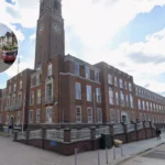
The Redbridge Central Library and Museum in Ilford houses local history exhibits and educational resources, while the Kenneth More Theatre in Ilford presents amateur and professional drama productions. These sites underscore Redbridge’s commitment to leisure and culture, drawing both residents and visitors.
What is the pub quiz fact about Redbridge’s name?
Redbridge derives its name from a literal red brick bridge, constructed in the 17th century over the River Roding in Ilford.
This historic crossing was a prominent landmark until its demolition in the 1920s. As noted in borough profiles ahead of the 7 May local elections, this origin story serves as a quirky piece of trivia, highlighting the area’s tangible connection to its past.
The bridge’s red bricks, made from local clay, distinguished it from other structures, embedding the name into the borough’s identity upon its formation in 1965. Such facts often feature in community quizzes and local history talks, reinforcing Redbridge’s heritage.
Why are these guides produced ahead of local elections?
Short guides to London’s 32 boroughs, including this profile on Redbridge, have been produced ahead of the local elections scheduled for Thursday 7 May.
These resources aim to inform voters about each area’s characteristics, geography, and amenities, enabling informed decisions at the polls. Coverage spans location, lifestyle, neighbourhoods, attractions, and historical trivia, providing a comprehensive snapshot.
In Redbridge’s case, the guide emphasises its residential strengths, transport links, and green credentials, matters that frequently influence local council priorities such as housing, education, and environmental maintenance. Voters in Ilford, Wanstead, and other wards can use this information to assess candidates’ plans for their neighbourhoods.
Background of the Development
The production of these borough profiles stems from standard journalistic practice ahead of local elections in the UK. For the 7 May vote, media outlets compile such guides to assist voters across London’s 32 boroughs, drawing on official borough data, historical records, and community feedback. Redbridge’s profile, in particular, reflects its evolution since the borough’s creation in 1965 through the merger of former Ilford and Wanstead and Woodford districts.
Ongoing developments, such as Central line expansions and forest conservation efforts, inform these updates, ensuring accuracy for election-season relevance.
Prediction: How This Development Can Affect Redbridge Residents
This pre-election profiling can affect Redbridge residents by heightening awareness of local assets like schools, parks, and housing affordability, prompting greater voter turnout on 7 May. Commuters and families may focus on candidates addressing transport reliability and green space protection, while neighbourhood-specific details could influence ward-level campaigning.
Overall, it equips the borough’s diverse population—spanning Ilford’s commercial hub to Hainault’s rural edges—with factual baselines for evaluating council policies on services and development.