

Key Points
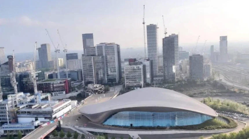
- A major planning application has been submitted for significant construction work at Plot S10 within Stratford Cross, situated adjacent to the Queen Elizabeth Olympic Park.
- Proposals submitted to local authority planners incorporate multi-storey residential schemes alongside flexible commercial spaces, public open areas, and urban green infrastructure.
- Adjacent administrative submissions filed across the London Borough of Newham and Hackney Council outline vital infrastructure updates, highway alterations, and community service integration.
- Comprehensive assessments focus on sustainable urban transport, pedestrian accessibility, and integration with the nearby East Bank cultural precinct.
Hackney Council (East London Times) August 19, 2026 – In local government reporting collated across municipal filings this week, proposals have been formally validated by municipal planning divisions covering both the London Borough of Newham and Hackney Council. As reported by local news outlets covering municipal developments in the area, the formal submission addresses critical land-use permissions, height provisions, and environmental strategies for the continuing regeneration of the former Olympic site.
- Key Points
- What specific infrastructural upgrades and environmental measures are included within the latest municipal filings for Newham and Hackney?
- What statements have been made regarding public consultation and the administrative process governing these proposals?
- Background to the Stratford Cross Development
- What Future Effects Can Local Communities and Businesses Expect from This Development?
As reported by local governance correspondents, the primary application focuses on the ongoing transformation of Stratford Cross—a key sector historically designated under the broader International Quarter London masterplan. According to official planning documentation filed with the planning authority, the updated proposals seek reserved matters and outline consents for Plot S10, positioned at the critical junction connecting commercial blocks, the vibrant East Bank cultural cluster, and the surrounding residential communities.
The submitted documentation details a mixed-use strategy designed to integrate housing demands with ground-level retail, corporate space, and extensive public realm improvements. According to municipal submissions documented across local planning portals, the scheme emphasizes active ground-floor frontages intended to boost footfall between Westfield Stratford City, Stratford Station, and the interior green spaces of the Queen Elizabeth Olympic Park.
What specific infrastructural upgrades and environmental measures are included within the latest municipal filings for Newham and Hackney?
Beyond the core structural blueprints for Stratford Cross, corresponding planning registers published by Newham and Hackney Council outline a series of connected public realm works. The documentation details extensive highway, signaling, and cycleway modifications along Westfield Avenue and Waterden Road—a primary transport artery linking Stratford Station to the London Borough of Hackney.
According to reporting on municipal infrastructure filings, these public works focus on Phase 3 design improvements, including upgraded two-way segregated cycle corridors, refined pedestrian crossings, and reconfigured signal systems at key junctions including Olympic Park Avenue and Anthems Way. The municipal documentation outlines how these physical interventions aim to reduce vehicular congestion, improve local air quality metrics, and provide safer non-motorised transit routes for thousands of daily commuters and visitors traveling across borough boundaries.
In municipal planning reports published by local media, environmental standards form a core component of the submitted schemes. The proposals incorporate biodiversity net-gain measures, urban greening frameworks, sustainable drainage systems (SuDS), and strict carbon-reduction targets aligned with regional development strategies. The applications state that building designs will utilize low-carbon material selection, connection to district heating networks, and high-performance building envelopes to minimize operational energy demands throughout their lifecycle.
What statements have been made regarding public consultation and the administrative process governing these proposals?
Public consultation details embedded within the statutory notices confirm that community feedback has actively shaped the designs prior to formal submission. In local coverage tracking the scheme’s progress, project representatives noted that extensive engagement events were held across the area to collect direct feedback from nearby residents, business owners, and civic groups regarding building heights, green space provisions, and community amenities.
As reported by civic reporters covering local council proceedings, planning officers from the respective authorities are now initiating the statutory public notification and internal consultation phase. Technical officers across highway departments, environmental health units, and urban design teams are conducting rigorous reviews of the submitted technical assessments, environmental impact statements, and transport evaluations. Members of the public and local stakeholders have been invited to inspect the public register, review site layouts, and submit formal representations before the applications are presented to the relevant planning committees for final decision.
Explore More Local East London News
Woodberry Down Masterplan Phase Approved in Hackney 2026
Hackney Council Demands Urgent National Childcare System Reform Hackney 2026
Background to the Stratford Cross Development
The formal submission of planning applications for Stratford Cross marks the latest chapter in a multi-decade urban regeneration trajectory initiated by the London 2012 Olympic and Paralympic Games. Following the conclusion of the Games, the London Legacy Development Corporation (LLDC) was tasked with overseeing the transformation of the industrial and rail lands surrounding Stratford into a thriving, multi-use urban district.
Stratford Cross—originally designated as the International Quarter London (IQL)—was envisioned as a major commercial and residential hub linking the established transport nodes at Stratford Station with the vast public grounds of the Queen Elizabeth Olympic Park. Over the past decade, the precinct has seen the successful delivery of landmark commercial office space, high-density residential towers, and major cultural institutions forming the East Bank development, including outposts for the Victoria and Albert Museum, BBC Music, Sadler’s Wells, and University College London.
As the legacy governance framework transitions responsibility back to the individual host boroughs—including the London Borough of Newham and Hackney Council—the final remaining development plots, such as Plot S10, represent the concluding phases of the original post-Games masterplan. The current submissions reflect an evolving planning context that increasingly prioritizes residential density, high-quality public open spaces, and climate-resilient infrastructure.
What Future Effects Can Local Communities and Businesses Expect from This Development?
The determination and ultimate execution of the Stratford Cross development proposals are anticipated to generate wide-ranging impacts across several primary target audiences:
- Local Residents and Community Members: Nearby residents in Stratford, Hackney Wick, and surrounding neighbourhoods will experience both direct short-term operational impacts and long-term amenities. During the construction phase, temporary traffic management schemes, acoustic variances, and construction transit may cause localized disruptions. Upon completion, residents will gain access to expanded public green spaces, enhanced pedestrian routes, and new local retail services, alongside an increase in available housing inventory across multiple tenure types.
- Commuters and Cyclists: The highway and active travel improvements detailed in the accompanying Newham and Hackney planning submissions will significantly alter local transport dynamics. The provision of fully segregated two-way cycling infrastructure along Westfield Avenue and improved junction signaling will create safer, faster east-west transit options, reducing vehicular friction and encouraging modal shifts toward active travel for daily commuters.
- Local Businesses and Commercial Stakeholders: Retailers, service providers, and corporate tenants within Westfield Stratford City and the broader Olympic Park footprint stand to benefit from increased footfall and improved urban permeability. The seamless physical integration between commercial plots, transport hubs, and cultural institutions is designed to sustain visitor dwell time, driving economic activity across the regional retail and leisure economy.
- Municipal Authorities and Infrastructure Providers: For Newham Council and Hackney Council, the successful implementation of these plans supports long-term housing delivery targets, expands the non-domestic rate base, and delivers modern physical infrastructure managed through secured Section 106 contributions and community infrastructure levies.