


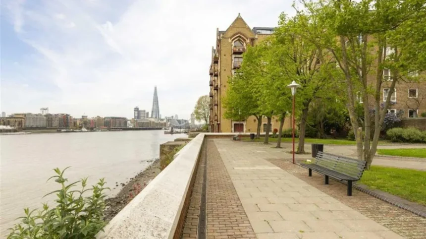
Tower Hamlets is one of East London’s most varied walking destinations. The London borough combines the River Thames, historic docks, canals, Victorian parks, former industrial districts, residential streets, markets and modern Docklands architecture. Its geography creates walking experiences that move between centuries within relatively short distances.
- What makes Tower Hamlets a strong walking destination for tourists?
- Which waterfront walks offer the best views in Tower Hamlets?
- How can tourists explore Limehouse Basin and the Regent’s Canal?
- Which canal walks connect parks and green spaces?
- Why is Victoria Park one of the best places for a long walk?
- Which historic streets and neighbourhoods should tourists explore on foot?
- Where can visitors find quieter historic gardens and green spaces?
- What is the best walking experience around the Isle of Dogs and Docklands?
- Which walking route is best for combining history, nature and waterways?
- Which Tower Hamlets walks are best for visitors with limited time?
- How should tourists plan a walking day in Tower Hamlets?
- What makes Tower Hamlets walking experiences historically important?
- Which walking experiences are best for nature and wildlife?
- How can tourists experience Tower Hamlets beyond the main attractions?
- What are the most important walking experiences to prioritise in Tower Hamlets?
For tourists, walking is an effective way to understand the borough because many of its defining places sit along connected routes. Limehouse links the Regent’s Canal with the Thames. Wapping follows the historic river edge. The Isle of Dogs combines former docklands with modern Canary Wharf. Victoria Park and Mile End Park provide extensive green space in the north-western part of the borough.
Tower Hamlets Council also provides dedicated walking resources. Its one-hour walking programme includes routes through Bethnal Green, Bromley-by-Bow, the Isle of Dogs, Poplar, Shadwell, Spitalfields, Stepney and Victoria Park. These routes were developed with Walk England and NHS Tower Hamlets and generally take between 30 minutes and one hour.
The borough also has six regular wellbeing walking groups through the Walk Tower Hamlets scheme. These walks normally last 60 to 90 minutes and welcome different walking abilities.
For independent visitors, the strongest walking experiences fall into several connected themes: waterfront exploration, canal walking, historic neighbourhoods, major parks, docklands landscapes and quieter green spaces.
What makes Tower Hamlets a strong walking destination for tourists?
Tower Hamlets is a strong walking destination because its compact urban landscape connects historic streets, canals, docks, parks, markets and Thames viewpoints. Visitors can combine heritage, architecture, nature and waterfront scenery without relying entirely on private transport.
The borough occupies a strategic part of East London between the City of London, the River Thames, Hackney, Newham and the historic East End. This position created a landscape shaped by trade, industry, migration, housing development, transport and regeneration.
Its waterways are particularly important. The River Thames forms the southern boundary, while the Regent’s Canal, Limehouse Cut, Hertford Union Canal and Lea Navigation create additional walking corridors. Tower Hamlets Council identifies London’s canals, the River Thames and Bow Creek, the Lea Valley and several docklands landscapes as Sites of Importance for Nature Conservation.
The borough also contains nationally important historic landscapes. Victoria Park is Grade II* on the Register of Parks and Gardens of Special Historic Interest. Boundary Gardens, Island Gardens, Museum Gardens and the Novo Cemetery have Grade II status.
This combination gives visitors several distinct walking environments. A single day can include Victorian parkland, canal towpaths, maritime heritage and modern skyscrapers.
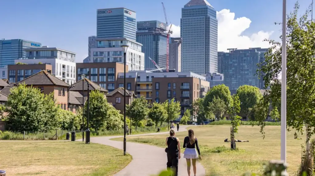
Which waterfront walks offer the best views in Tower Hamlets?
The best waterfront walks follow the Thames through Wapping and the Isle of Dogs, with additional routes around Limehouse Basin, Shadwell Basin and the West India Docks. These paths combine river views, historic warehouses, docks, bridges, boats and modern skylines.
The Thames is the defining waterfront landscape of southern Tower Hamlets. The riverside around Wapping contains historic warehouses, converted riverside buildings and long views towards central London. The area also connects naturally with Shadwell and the historic docklands around Limehouse.
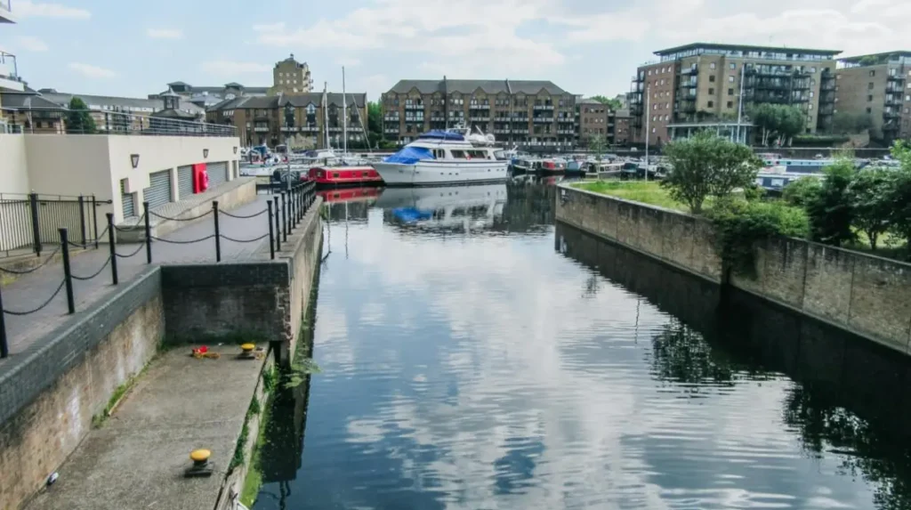
Limehouse Basin is one of the most accessible starting points. The Canal & River Trust describes it as the gateway between the River Thames and more than 2,000 miles of navigable canals and rivers. It is now a marina with narrowboats, yachts, cafés and waterside paths.
The Canal & River Trust provides a one-mile circular walk from Limehouse Station. The 1.6-kilometre route follows Limehouse Basin and combines canal, dock and Thames scenery. Historical records associated with the route state that 1,500 ships and 15,336 barges entered the dock in 1865.
Wapping provides a different waterfront experience. Its narrow streets and riverside buildings reflect the area’s historic relationship with maritime trade. Visitors can combine the river path with Wapping’s older streets before continuing towards St Katharine Docks and Tower Bridge.
Tower Bridge provides one of the most recognisable visual landmarks in the borough. The bridge opened on 30 June 1894 and was designed to maintain road access while allowing ships to reach the busy Pool of London docks.
The Isle of Dogs offers another major waterfront landscape. The walking environment around Millwall and West India Docks contrasts historic dock basins with the high-rise skyline of Canary Wharf.
These routes work especially well for photographers, architecture enthusiasts and visitors interested in London’s maritime history.
How can tourists explore Limehouse Basin and the Regent’s Canal?
Limehouse Basin provides one of Tower Hamlets’ most accessible walking experiences, connecting the Regent’s Canal with the Thames. The surrounding paths offer boats, marina views, historic infrastructure, wildlife and direct connections towards Limehouse, Mile End and other East London districts.
Limehouse Basin was historically known as Regent’s Canal Dock. The Regent’s Canal was completed in 1820 and connected the Grand Junction Canal system with Limehouse and the Thames. It became part of London’s inland freight network, carrying materials including timber, coal, building supplies and food.
The dock closed to commercial shipping in 1969. The former industrial landscape subsequently changed into a marina and residential waterfront. Today, visitors walk beside boats rather than commercial cargo vessels.
The Limehouse Basin circular walk is particularly useful for first-time visitors because it is only one mile long. The route starts and finishes at Limehouse Station and includes the Grade II-listed DLR viaduct, the basin, Limehouse Ship Lock and nearby waterways.
Limehouse Cut provides another important walking connection. The waterway was authorised by the River Lea Act 1766 and opened in 1770. It created a direct route between the Lee Navigation at Bromley-by-Bow and the Thames at Limehouse, reducing the need for barges to follow the longer tidal route around the Isle of Dogs.
The Regent’s Canal continues north-east from Limehouse towards Mile End and Victoria Park. This creates an extended walking experience for visitors who want more than a short waterfront circuit.
As you explore the modern waterside, you are crossing land shaped by centuries of trade, transport and dock activity. Read about the full to understand its origins.
Which canal walks connect parks and green spaces?
The Regent’s Canal and Hertford Union Canal create connected walking corridors between Victoria Park, Mile End Park, Limehouse and surrounding neighbourhoods. These routes combine water, vegetation, bridges, towpaths and urban views while providing a quieter alternative to major roads.
Mile End Park is particularly important because it functions as a linear green corridor. The park covers 32 hectares and follows the Regent’s Canal from Victoria Park towards Limehouse Basin. Roads, railways and waterways divide parts of the park, while pedestrian infrastructure connects its different sections.
The park was planned after the Second World War on land affected by bombing and industrial use. Development continued during the later twentieth century. The Green Bridge across Mile End Road opened in July 1999 and became an important pedestrian connection within the park.
Wildlife is another defining feature. More than 400 beetle species have been recorded in Mile End Park, including the rare streaked bombardier. Meadows, woodland and waterways support birds, butterflies and bees.
The Hertford Union Canal provides another useful walking link. The canal was authorised in 1824 and opened in 1830. It connects the Regent’s Canal with the Lee Navigation and forms part of the wider waterway network around Victoria Park and the East London waterways.
This network makes it possible to create longer walks without repeatedly returning to major roads. Visitors can start around Victoria Park, follow waterways through Mile End and continue towards Limehouse Basin.
Why is Victoria Park one of the best places for a long walk?
Victoria Park is one of Tower Hamlets’ premier walking destinations because it combines 86 hectares of historic parkland with lakes, mature trees, landscaped areas, monuments, sports facilities and connections to the Regent’s Canal and wider East London green corridor.
Victoria Park opened in 1845 and is London’s oldest public park. It was created specifically to provide open space for the rapidly growing population of the East End. Tower Hamlets Council records that a petition signed by 30,000 residents was presented to Queen Victoria in 1840 requesting a public park.
The park covers approximately 86 hectares and receives more than nine million visits each year. It remains the largest park in Tower Hamlets.
Its historic landscape contains several recognisable features. These include the boating lakes, the Burdett Coutts Memorial, the bandstand and two original stone alcoves from London Bridge.
The park’s design reflects nineteenth-century ideas about public health and urban recreation. Its creation followed concerns about overcrowding, pollution and poor health in the East End. The government acquired land that had previously been used for market gardens, grazing and gravel extraction.
Visitors can approach the park from Bethnal Green, Bow, Hackney Wick or Mile End. The Regent’s Canal and Hertford Union Canal provide particularly useful walking connections.
The park is also part of a broader green corridor stretching through Mile End towards Limehouse and connecting with the Queen Elizabeth Olympic Park area.
For visitors seeking a substantial walk rather than a short sightseeing circuit, Victoria Park provides the strongest combination of open space, historic design and water features.
Which historic streets and neighbourhoods should tourists explore on foot?
Historic walking in Tower Hamlets centres on Wapping, Limehouse, Stepney, Whitechapel, Spitalfields, Shadwell and Poplar. These neighbourhoods reveal the borough’s changing identity through historic churches, markets, housing, former docks, public gardens and surviving industrial architecture.
Spitalfields is particularly useful for visitors interested in urban history and cultural change. Its streets connect historic market activity with Georgian and Victorian architecture, religious buildings, independent businesses and later regeneration.
Whitechapel provides a dense urban walking environment shaped by commerce, migration, religious communities and public institutions. Altab Ali Park occupies the former churchyard of St Mary Matfelon and forms an important green space near Whitechapel Road. Tower Hamlets Council identifies several former churchyards across the borough that became public gardens during the nineteenth century.
Stepney offers another layer of history. Stepney Green Gardens and Stepney Green Park preserve parts of the area’s historic open-space network. Stepney’s streets also connect towards Limehouse, Mile End and the Thames.
Limehouse has a strong maritime and canal identity. Narrow Street and the basin area provide a direct connection between historic residential streets and the former dock system.
Wapping is particularly suitable for visitors interested in the Thames and historic warehouses. The area preserves a strong relationship with the river and the former Pool of London.
Poplar adds another dimension through its association with the docks, housing estates and twentieth-century social history. Visitors can connect Poplar with the Isle of Dogs through several walking routes.
These neighbourhoods are most effective when explored as connected districts rather than isolated attractions. Walking between them exposes changes in building scale, street layout and land use.
Where can visitors find quieter historic gardens and green spaces?
Quieter walking experiences are found in St George’s Gardens, Meath Gardens, Wapping Gardens, Stepney Green and smaller historic squares. These spaces provide short walking breaks between larger attractions and reveal the borough’s long tradition of public gardens.
Tower Hamlets contains numerous small green spaces with historic origins. The council records 52 publicly accessible open spaces of historic interest in its London Inventory of Historic Green Spaces.
St George’s Gardens is particularly valuable for heritage-focused walkers. The garden occupies the former churchyard of St George-in-the-East, one of three Tower Hamlets churches designed by architect Nicholas Hawksmoor. The other two are Christ Church, Spitalfields and St Anne’s, Limehouse. The gardens opened to the public in 1875.
Meath Gardens provides another historic green-space experience. The site began as Victoria Park Cemetery in 1842 and closed to burials in 1876. It reopened as a public garden in 1894 and was renamed Meath Gardens after the Earl of Meath, who chaired the Metropolitan Public Gardens Association.
These spaces demonstrate how former burial grounds, churchyards and private landscapes became public recreation areas. This transformation was particularly important during the nineteenth century when dense urban development created pressure for accessible open space.
For tourists, these gardens are useful as short stops rather than destinations requiring an entire afternoon. They fit naturally into walking routes through Stepney, Shadwell, Whitechapel and the surrounding neighbourhoods.
What is the best walking experience around the Isle of Dogs and Docklands?
The Isle of Dogs provides a distinctive walking experience built around former commercial docks, modern skyscrapers, riverside paths, marinas and landscaped public spaces. The contrast between industrial heritage and Canary Wharf architecture defines this part of Tower Hamlets.
The Isle of Dogs occupies a large peninsula surrounded by the Thames. Its modern identity is closely connected with Docklands regeneration and Canary Wharf.
West India Docks form the historic core of the area. The docks were built to accommodate large volumes of imported goods and became central to London’s international trade. Today, their waters are surrounded by offices, restaurants, public spaces and high-rise buildings.
The walking environment changes significantly around the peninsula. Visitors encounter wide dock basins, modern plazas, older warehouse structures, residential areas and riverside landscapes.
Millwall provides a more residential side of the Isle of Dogs. Millwall Park and nearby waterways create opportunities for quieter walks away from the busiest commercial areas. Tower Hamlets identifies Millwall and West India Docks as sites of borough importance for nature conservation.
Island Gardens provides another important viewpoint. The park opened in 1895 on land preserved to protect views towards Greenwich and has Grade II status on the national Register of Parks and Gardens of Special Historic Interest.
For visitors interested in architecture, the Isle of Dogs creates one of the borough’s clearest contrasts. Historic dock infrastructure sits directly beside some of London’s tallest commercial buildings.
Which walking route is best for combining history, nature and waterways?
A strong full-day route links Victoria Park, Mile End Park, the Regent’s Canal, Limehouse Basin, the Thames, Wapping and Tower Bridge. This route combines historic parkland, canals, docks, residential streets, riverside scenery and major London landmarks.
Start at Victoria Park and walk south-west or south through the park before joining the Hertford Union Canal or Regent’s Canal.
Continue through Mile End Park. The linear layout makes the park particularly suitable for a through-route rather than a circular park visit. The route passes ecological areas, landscaped sections and pedestrian infrastructure.
Continue towards Limehouse Basin. Here the walking environment changes from parkland to marina and former dock infrastructure.
From Limehouse Basin, visitors can continue towards the Thames and follow the riverside towards Wapping. This section introduces maritime architecture, historic warehouses and river views.
The final section towards Tower Bridge provides a strong architectural finish. Tower Bridge opened in 1894 and remains a working river crossing. Its high-level walkways provide views over the Thames and the surrounding cityscape.
The full route requires substantially more time than the dedicated one-mile Limehouse circular walk. Visitors should therefore divide it into sections when walking speed, weather or sightseeing priorities require shorter distances.
This route demonstrates why Tower Hamlets works well as a walking destination. The landscape changes repeatedly without requiring long transfers between different environments.
Which Tower Hamlets walks are best for visitors with limited time?
Visitors with limited time should choose a compact route around Limehouse Basin, Victoria Park, Wapping or St George’s Gardens. Each provides a concentrated combination of scenery and heritage without requiring a full-day walking commitment.
The Limehouse Basin circular route is the simplest short option. The Canal & River Trust lists it as a one-mile, 1.6-kilometre circular walk beginning and ending at Limehouse Station.
Victoria Park works well for visitors who want open space and historic landscapes. Its large size allows visitors to create short or extended circuits according to available time.
St George’s Gardens suits visitors already exploring Shadwell and Cable Street. Its location near The Highway and Cable Street makes it easy to combine with a wider East London heritage walk.
Tower Hamlets Council’s one-hour walking resources provide another structured option. The borough has published routes for Bethnal Green, Bromley-by-Bow, the Isle of Dogs, Poplar, Shadwell, Spitalfields, Stepney and Victoria Park.
These routes provide useful frameworks for tourists who want defined distances rather than creating routes independently.
How should tourists plan a walking day in Tower Hamlets?
Tourists should plan Tower Hamlets walks around public transport access, daylight, weather, route length and the location of food and rest stops. Combining one major walking route with nearby attractions creates a practical and efficient sightseeing day.
Start by selecting one geographic area. Limehouse and Wapping work well together because their waterfront environments connect naturally. Victoria Park and Mile End form another strong combination. The Isle of Dogs works best as a dedicated walking area because its docklands landscape rewards slower exploration.
Public transport is important because Tower Hamlets contains several Underground, DLR and rail connections. Limehouse is particularly accessible through the DLR, while many routes connect with Underground stations.
Visitors should also distinguish between a walking route and a sightseeing route. A walking route prioritises continuous movement. A sightseeing route includes stops at museums, churches, markets, parks and viewpoints.
The borough’s parks operate under local byelaws covering wildlife, cycling, vehicles, fires, camping, water activities and other uses. Visitors should follow posted rules and avoid swimming in ponds, lakes or waterways.
Weather also affects waterfront walks. Open areas around the Thames and docks have less shelter than enclosed streets or parks with mature tree cover.
Comfortable footwear is important because an urban walking day can involve pavement, towpaths, park paths and uneven historic surfaces.
What makes Tower Hamlets walking experiences historically important?
Tower Hamlets walking routes reveal the physical development of London from medieval settlements and maritime trade to Victorian public parks, industrial transport networks, post-war redevelopment and modern Docklands. Walking connects these periods through surviving buildings, waterways, streets and landscapes.
The borough’s history is particularly visible because many transport routes remain active. The Regent’s Canal still carries boats. Limehouse Basin still contains a marina. The Thames remains a working river. Former docks remain as water-filled basins surrounded by new development.
Victoria Park demonstrates the nineteenth-century response to overcrowding and poor urban health. The park was specifically planned as public open space for East London’s population.
Tower Hamlets Cemetery Park demonstrates a different historical process. The cemetery opened in 1841 and closed to burials in 1966 following an Act of Parliament. It subsequently became a public park. The site is now a Local Nature Reserve and a Metropolitan Site of Importance for Nature Conservation.
The park covers more than 12 hectares including Ackroyd Drive Greenlink according to the council’s detailed site information, while the council’s park directory describes the Cemetery Park itself as approximately 10.93 hectares and highlights its woodland, meadows, glades and nature-reserve status.
These examples demonstrate how walking routes function as heritage corridors. The landscape itself contains evidence of London’s changing social, economic and environmental priorities.
Which walking experiences are best for nature and wildlife?
Nature-focused walks are strongest in Victoria Park, Mile End Park, Tower Hamlets Cemetery Park, the Lea waterways, canal corridors and selected docklands habitats. These locations combine urban greenery with habitats supporting birds, insects, plants and aquatic wildlife.
Tower Hamlets contains several formally recognised nature sites. The council lists Victoria Park, Mile End Park, Tower Hamlets Cemetery Park, Mudchute Park and Farm, the East India Dock Basin, the Greenway and several waterways within its nature-conservation framework.
Mile End Park supports extensive wildlife despite its urban setting. More than 400 beetle species have been recorded there, alongside birds, butterflies and bees.
Tower Hamlets Cemetery Park provides an even stronger nature experience. Its woodland, meadows and glades support plants and wildlife that are uncommon in highly urbanised parts of London. The site retains Green Flag status and is recognised for both biodiversity and heritage.
The canal system also provides ecological corridors. Waterways connect habitats across otherwise fragmented urban areas. Limehouse Basin supports waterbirds including swans, geese, coots, moorhens, cormorants and grey herons, according to the Canal & River Trust’s walking guide.
Visitors should observe wildlife without feeding animals. Tower Hamlets Council specifically advises visitors not to feed wildlife in its parks because this encourages vermin.
Explore More Area Guide
Tower Hamlets Attractions Every Tourist Should See 2026
Top Tower Hamlets Attractions for Visitors | East London 2026
How can tourists experience Tower Hamlets beyond the main attractions?
Tourists can experience a quieter side of Tower Hamlets by leaving major landmarks and following local parks, canal towpaths, historic squares, former churchyards, residential streets and smaller waterways. These routes reveal everyday neighbourhoods alongside the borough’s major attractions.
The strongest hidden walking experiences often sit between famous destinations. A visitor walking from Whitechapel towards Stepney encounters smaller gardens and historic streets before reaching Limehouse.
Another option is to connect Spitalfields with Bethnal Green and Victoria Park. This route moves from dense historic streets into larger open spaces.
The borough’s historic squares also add architectural interest. Tower Hamlets Council identifies locations including Trinity Square Gardens, Arbour Square, Albert Gardens and the Oval among historic open spaces shaped by eighteenth- and nineteenth-century urban design.
Cable Street and Shadwell provide another useful walking area. St George’s Gardens sits near Cable Street and preserves the former churchyard of St George-in-the-East.
Visitors seeking local experiences should also consider Stepney City Farm, Spitalfields Farm and other community-oriented green spaces identified within the borough’s nature-conservation network.
These routes create a more detailed understanding of East London. They show how public gardens, community spaces, transport infrastructure and residential districts fit around the major heritage landmarks.
What are the most important walking experiences to prioritise in Tower Hamlets?
The highest-priority experiences are Limehouse Basin, the Regent’s Canal, Victoria Park, Mile End Park, Wapping, the Isle of Dogs, Tower Bridge, St George’s Gardens and Tower Hamlets Cemetery Park because they collectively represent the borough’s waterways, parks, heritage and urban transformation.
Limehouse Basin is the strongest compact introduction to canal and maritime heritage. Its one-mile circular route is accessible and clearly defined.
Victoria Park is the strongest major green-space experience. Its 86 hectares, historic design and more than nine million annual visits demonstrate its continuing importance.
Mile End Park is the strongest linear park experience because its 32-hectare landscape follows the Regent’s Canal and connects different parts of East London.
Wapping is the strongest Thames-side historic neighbourhood experience. The Isle of Dogs provides the clearest combination of docklands heritage and modern architecture.
Tower Hamlets Cemetery Park provides the most distinctive combination of heritage and urban nature. Its history as an 1841 cemetery and its current conservation status create a rare walking environment.
St George’s Gardens provides a compact heritage stop, while Tower Bridge supplies one of the borough’s most recognisable architectural landmarks.
Together, these destinations provide a complete walking overview of Tower Hamlets. They cover the Thames, canals, docks, parks, historic streets, religious heritage, industrial infrastructure, biodiversity and modern regeneration.
For tourists, the main advantage is connectivity. Tower Hamlets does not depend on one isolated attraction. Its walking experiences form a network in which waterways, parks, historic districts and transport corridors connect across East London.
What are the best walking experiences in Tower Hamlets?
The best walking experiences include Victoria Park, Mile End Park, Limehouse Basin, the Regent’s Canal, Wapping, the Isle of Dogs, Tower Hamlets Cemetery Park and the Thames Path. These routes combine history, nature, waterfront views and architecture.