Tower Hamlets offers a varied mix of waterfront scenery, historic streets, landscaped parks and contemporary architecture. Visitors can photograph Canary Wharf’s skyscrapers, the River Thames at Island Gardens, the canals around Limehouse Basin and the green landscapes of Victoria Park. These locations provide different perspectives on East London, from modern urban design to historic docklands and natural habitats.
- Which Waterfront Locations in Tower Hamlets Offer the Best Views?
- Where Can Visitors Photograph the River Thames at Island Gardens?
- What Can Photographers Capture at Limehouse Basin?
- Which Parks in Tower Hamlets Are Best for Scenic Photography?
- Why Is Victoria Park a Major Photography Destination?
- What Makes Mile End Park Suitable for Urban Nature Photography?
- Where Can Visitors Find Open Landscapes Near Canary Wharf?
- Where Can Visitors Photograph Canary Wharf’s Modern Architecture?
- Which Historic Streets and Buildings Are Worth Photographing in Tower Hamlets?
- Where Can Visitors Explore Wapping’s Historic Architecture?
- What Historic Details Can Photographers Find Around Whitechapel?
- How Does Spitalfields Combine Historic Buildings and Street Photography?
- Where Can Visitors Photograph Canals and Historic Waterways in Tower Hamlets?
- What Can Photographers See Along the Regent’s Canal?
- How Can Visitors Combine Canal Photography with a Scenic Walk?
- Which Scenic Locations in Tower Hamlets Are Best for Wildlife Photography?
- What Makes Tower Hamlets Cemetery Park a Distinctive Nature Location?
- Where Can Visitors Photograph Wildlife Around Mudchute Park and Farm?
- When Is the Best Time to Photograph Scenic Spots in Tower Hamlets?
- When Should Visitors Photograph Waterfronts and Skylines?
- How Do Seasons Affect Photography in Tower Hamlets?
- How Can Visitors Plan a Scenic Photography Route Through Tower Hamlets?
- Which Route Suits Visitors Interested in Architecture and Waterfront Views?
- Which Route Suits Visitors Interested in Nature and Historic Waterways?
- What Photography Etiquette Should Visitors Follow in Tower Hamlets?
- Why Are Tower Hamlets’ Scenic Locations Important to East London’s Future?
- Final Guide to Scenic Spots in Tower Hamlets
Tower Hamlets is a London borough on the eastern side of central London. Its landscape reflects centuries of maritime trade, industrial development, migration and urban regeneration. The borough includes neighbourhoods such as Whitechapel, Bethnal Green, Bow, Poplar, Limehouse, the Isle of Dogs and Canary Wharf.
The most useful scenic locations depend on the subject being photographed. Waterfronts suit reflections and architectural compositions. Parks provide open landscapes and wildlife. Historic neighbourhoods offer brickwork, traditional buildings and street-level details. Exploring these different environments gives visitors a broad understanding of the borough.
Which Waterfront Locations in Tower Hamlets Offer the Best Views?
Tower Hamlets has several waterfront locations for photography, including Island Gardens, Limehouse Basin and the riverside paths around Canary Wharf. These places offer views of the River Thames, historic dock infrastructure, modern buildings and boats, with different perspectives throughout the day.
Waterfront scenery is one of the defining features of Tower Hamlets. The River Thames forms part of the borough’s southern boundary, while canals and former docks connect its neighbourhoods.
The relationship between water and architecture creates distinctive photographic opportunities. Reflections, moored vessels, riverside walkways and contrasting building styles provide clear subjects for landscape and travel photography.
Where Can Visitors Photograph the River Thames at Island Gardens?
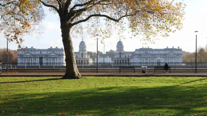
Island Gardens is a riverside park on the Isle of Dogs. It provides views across the Thames towards Greenwich, where the historic buildings of the Old Royal Naval College and the surrounding riverside landscape form a distinctive skyline.
The park is suitable for wide-angle photographs, riverside portraits and landscape compositions. Trees and lawns create foreground elements, while the river separates the photographer from the architecture on the opposite bank.
The location also helps visitors understand the historic relationship between East London’s docklands and Greenwich. The Thames supported shipping, trade and shipbuilding, shaping the communities on both sides of the river.
Photographers should visit during daylight for architectural details or around sunset for softer light. River conditions, cloud cover and the position of the sun influence the final composition.
What Can Photographers Capture at Limehouse Basin?
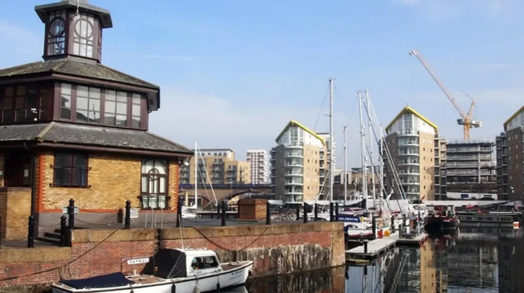
Limehouse Basin is a marina and canal junction connecting the inland waterway network with the Thames. Its scenery combines moored boats, waterside buildings, bridges and pedestrian routes.
The basin reflects London’s industrial history. It developed as part of the infrastructure that connected inland transport routes with the port and river trade. Today, the surrounding built environment includes residential developments and surviving elements of the area’s maritime character.
Photographers can use the basin’s water as a reflective surface, frame boats against brick buildings and capture the lines created by railings and canal edges. Close-up photographs of ropes, hulls, mooring points and architectural textures also document the working-waterway atmosphere.
Visitors should remain on public paths and respect private residential spaces. Boat access and operational areas are not automatically open to pedestrians.
Which Parks in Tower Hamlets Are Best for Scenic Photography?
Victoria Park, Mile End Park and Millwall Park provide contrasting green landscapes in Tower Hamlets. Their lakes, mature trees, lawns, gardens and open views support nature photography, family portraits and relaxed walking routes away from the borough’s busiest commercial streets.
Parks are important parts of Tower Hamlets’ urban environment. They provide public recreational space, habitats for wildlife and visual contrast with densely developed neighbourhoods.
Tower Hamlets Council manages more than 120 parks and green spaces, ranging from large historic parks to smaller neighbourhood gardens. Its parks include designated landscapes and sites with conservation value.
Why Is Victoria Park a Major Photography Destination?
Victoria Park opened in 1845 and covers approximately 86 hectares. It is the largest park in Tower Hamlets and is recognised for its historic landscape, lakes, mature trees and recreational facilities. The council records more than nine million visits each year.
The park offers several distinct photographic subjects. Its lakes provide opportunities for reflections and waterfowl photography. Tree-lined paths create depth, while historic features, including the bandstand and original London Bridge stone alcoves, provide architectural interest.
Open lawns are useful for panoramic compositions and environmental portraits. Mature trees and planted areas provide seasonal changes in colour and texture.
The park’s scale makes it suitable for longer photography walks. Visitors can move between landscaped areas, water features and quieter paths without leaving the grounds.
Victoria Park is open daily from 7am until dusk, with seasonal closing times displayed at its entrances. The nearest Underground station is Mile End, followed by a walk of approximately 10–15 minutes.
What Makes Mile End Park Suitable for Urban Nature Photography?
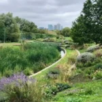
Mile End Park is a linear park covering approximately 32 hectares. It follows the Regent’s Canal between Victoria Park and Limehouse Basin and incorporates landscaped areas, ecological spaces, recreation facilities and the Green Bridge over Mile End Road.
The park offers a different visual experience from the broad lawns of Victoria Park. Its linear layout connects urban infrastructure with greenery, making it useful for photographs that show how nature and transport networks coexist.
The Green Bridge is a notable subject because it carries the park landscape across a busy road. Photographers can document the contrast between traffic infrastructure, planted areas and pedestrian routes.
The Ecology Park and Arts Pavilion also provide subjects related to urban biodiversity and public design. The canal-side sections are suitable for walking photography, with views of towpaths, water and passing boats.
Mile End Park works well for visitors interested in documenting everyday East London rather than concentrating solely on landmark architecture.
Where Can Visitors Find Open Landscapes Near Canary Wharf?
Millwall Park offers lawns, planted areas, trees, meadows and views towards Canary Wharf. Its landscape reflects the area’s former docklands and industrial railway infrastructure. The council identifies the park as part of a group of green spaces that includes Island Gardens and Mudchute Park and Farm.
The combination of open ground and high-rise buildings creates useful compositions for urban landscape photography. A wide frame can include the skyline and parkland, while a longer focal length can isolate individual buildings above the trees.
The park also accommodates sporting activities and community use. Visitors should choose photography positions that do not obstruct paths, sports areas or other park users.
Where Can Visitors Photograph Canary Wharf’s Modern Architecture?
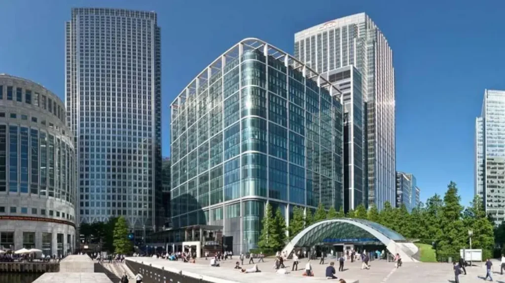
Canary Wharf is a major business district on the Isle of Dogs, recognised for its tall office buildings, contemporary public spaces, landscaped plazas and waterside settings. Photographers can capture geometric façades, skyline views, reflections and contrasts between modern architecture and older docklands infrastructure.
Canary Wharf illustrates the transformation of East London’s former docklands into a major financial and commercial centre. Its architecture includes glass office towers, large commercial buildings, pedestrian routes and landscaped public areas.
The area’s visual character changes with weather and light. Bright conditions reveal reflections in glass façades, while overcast skies create softer contrasts across building surfaces. After dark, illuminated offices and public spaces introduce artificial light into compositions.
Which Areas of Canary Wharf Provide Distinctive Architectural Views?
The waterfront around Canary Wharf provides broad views of office towers and buildings reflected in the docks. Pedestrian routes offer changing angles as visitors move between water, plazas and commercial streets.
Public spaces around the estate introduce landscaped planting and contemporary design. These settings suit architectural photography because they combine strong lines, open surfaces and clearly defined building forms.
For a close-up composition, photographers can focus on the patterns of glass, steel and concrete. For a wider image, they can include water or pedestrians to establish scale.
Canary Wharf also provides useful subjects for street photography. Commuters, public art and the interaction between people and large buildings document the district’s daily activity.
Visitors should distinguish publicly accessible outdoor areas from privately managed spaces with access conditions. Commercial buildings and private interiors require permission for entry or photography where applicable.
Which Historic Streets and Buildings Are Worth Photographing in Tower Hamlets?
Historic streets in Tower Hamlets reveal the borough’s maritime, commercial and residential development. Wapping, parts of Limehouse, Whitechapel and Spitalfields offer brick façades, traditional shopfronts, former warehouses, religious buildings and street details that document different periods of East London’s history.
Tower Hamlets has a layered architectural landscape. Industrial buildings, historic religious sites, traditional residential streets and modern developments exist within the same borough.
Photography helps visitors examine these changes at street level. Brickwork, building entrances, old signs, rooflines and differences in construction materials provide details that broad skyline photographs often miss.
Where Can Visitors Explore Wapping’s Historic Architecture?
Wapping lies beside the Thames and has a strong association with London’s maritime past. Its riverside setting, former warehouses and historic street pattern reflect the area’s relationship with shipping and dock work.
The surviving built environment provides opportunities for photographs of brick façades, narrow streets and riverside architecture. The contrast between older buildings and newer residential developments also illustrates how waterfront neighbourhoods have changed.
Visitors should explore public streets and accessible riverside routes, taking care not to enter private courtyards or residential premises. Architectural photography is most effective when the frame shows the building’s context rather than isolating decorative details alone.
What Historic Details Can Photographers Find Around Whitechapel?
Whitechapel contains a mixture of historic commercial buildings, religious architecture, traditional shopfronts and contemporary urban development. Its streets document the growth of East London’s commercial and residential communities.
Photographers can focus on building entrances, street signs, masonry, markets and the relationship between old structures and modern streetscape improvements. These subjects provide a record of the neighbourhood’s changing appearance.
For visitors interested in the context behind these locations, explore the full [Tower Hamlets history and heritage guide] to understand how maritime trade, migration and industrial growth shaped the borough’s present-day landscape.
Whitechapel is an active urban neighbourhood rather than an outdoor museum. Visitors should photograph people respectfully, particularly in religious settings, markets and residential streets.
How Does Spitalfields Combine Historic Buildings and Street Photography?
Spitalfields, near the western edge of Tower Hamlets, contains historic commercial architecture and streets associated with centuries of migration and trade. The area is known for its market environment, older buildings and changing mix of independent businesses and modern developments.
The streets provide subjects for architectural details, shopfront photography and everyday urban scenes. Older façades sit alongside contemporary retail spaces, creating opportunities to compare different design periods within a single walk.
Visitors should check market opening arrangements before planning a photography trip around stalls and traders. Market activity varies by day, and the appearance of the streets changes according to business hours and visitor numbers.
Where Can Visitors Photograph Canals and Historic Waterways in Tower Hamlets?
The Regent’s Canal, Hertford Union Canal and Limehouse Basin provide connected waterside environments for photography in Tower Hamlets. Their towpaths, bridges, moored boats and surrounding buildings reveal how London’s inland waterways link residential neighbourhoods, historic docklands and urban green spaces.
Canals are important features of East London’s transport and industrial heritage. They once supported the movement of goods between industrial districts, docks and inland destinations. Today, many stretches function as walking routes and recreational waterways.
The scenery changes along each route. Some sections are enclosed by buildings, while others open towards parks and larger stretches of water. This variation allows photographers to capture both intimate details and wider urban landscapes.
What Can Photographers See Along the Regent’s Canal?
The Regent’s Canal passes through Tower Hamlets and connects with Limehouse Basin. Sections near Mile End Park and Victoria Park combine towpaths, bridges, vegetation and residential or commercial buildings.
The canal is suitable for photographs of boats moving through confined waterways, reflections on still water and repeating bridge structures. Vegetation along the banks introduces seasonal colour, while built-up sections show how waterways fit into the modern city.
Visitors should remain aware of cyclists, pedestrians and moving boats. Towpaths are shared routes, and setting up equipment should not obstruct other users.
How Can Visitors Combine Canal Photography with a Scenic Walk?
A practical route links Victoria Park, Mile End Park and Limehouse Basin. This approach combines a major historic park, a linear urban landscape and a marina without requiring separate journeys across the borough.
Visitors can start at Victoria Park, follow accessible paths towards the canal connections and continue through Mile End Park towards Limehouse Basin. The precise route depends on the chosen entrances and any temporary closures.
The walk is suitable for photography because the scenery changes progressively. Parkland gives way to canal-side infrastructure, followed by the boats and buildings around the basin.
Check current maps and path conditions before setting out. Canal towpaths include narrow sections, uneven surfaces and places where water lies close to the path.
Which Scenic Locations in Tower Hamlets Are Best for Wildlife Photography?
Tower Hamlets offers wildlife photography in Victoria Park, Tower Hamlets Cemetery Park, Mudchute Park and Farm, and other green spaces. These environments support photographs of birds, insects, plants and urban habitats, with opportunities shaped by season, vegetation and visitor activity.
Urban wildlife photography documents the species that live alongside London’s built environment. Parks, meadows, ponds and planted areas provide feeding grounds, shelter and nesting habitats for different forms of wildlife.
The best results depend on patience, suitable equipment and responsible behaviour. Visitors should avoid disturbing nesting birds, damaging plants or approaching wildlife too closely.
What Makes Tower Hamlets Cemetery Park a Distinctive Nature Location?
Tower Hamlets Cemetery Park is a former cemetery that now serves as a woodland and nature conservation site. Its mature trees, paths, historic memorials and vegetation create a distinctive landscape within the urban borough.
Photographers can capture woodland textures, lichens, seasonal plants and the relationship between historic monuments and natural growth. The site is particularly relevant to visitors interested in urban ecology and heritage landscapes.
The cemetery’s atmosphere differs from that of a formal park. Vegetation and historic features create layered compositions, while narrow paths encourage close-up photography rather than extensive panoramic views.
Visitors should follow site guidance, respect memorials and avoid damaging vegetation or disturbing wildlife.
Where Can Visitors Photograph Wildlife Around Mudchute Park and Farm?
Mudchute Park and Farm combines open green space, farm animals and views of the surrounding urban environment. It provides a different setting from the commercial district nearby, allowing photographers to frame rural-style subjects against London’s skyline.
Visitors can focus on animal portraits, grassland, planted areas and the contrast between open ground and tall buildings. Wildlife and livestock photography require different approaches: farm animals are managed animals, while wild birds and insects should be observed without interference.
Access to farm facilities, animal areas and particular paths depends on the site’s rules and opening arrangements. Visitors should check current visitor information before travelling.
When Is the Best Time to Photograph Scenic Spots in Tower Hamlets?
Early morning, late afternoon and the period around sunset offer different lighting conditions for photography in Tower Hamlets. Morning light suits quieter parks and waterfronts, while late-day light highlights building façades and riverside scenes. Seasonal weather also changes vegetation, reflections and skyline visibility.
Photography results depend on the direction, quality and intensity of light. The same location looks different under direct sunshine, cloud cover, mist or artificial lighting.
Planning a visit around the intended subject is more useful than relying on a single time of day for every location.
When Should Visitors Photograph Waterfronts and Skylines?
Early morning provides opportunities for calmer waterfront compositions and fewer people in the frame. It is particularly useful around Limehouse Basin and public paths near Canary Wharf.
Late afternoon can produce directional light across building façades and the water. Sunset offers changing colours, although the exact effect depends on the season, cloud cover and the photographer’s position.
Blue hour, the period after sunset when the sky retains some light, suits illuminated architecture. A tripod is useful for long exposures, but photographers should check local restrictions and avoid obstructing public paths.
How Do Seasons Affect Photography in Tower Hamlets?
Spring brings fresh foliage and flowering plants to parks. Summer provides longer daylight hours and fuller tree canopies. Autumn introduces changing leaf colours and textures, while winter reveals building outlines through bare branches.
Wildlife activity also changes with the seasons. Bird behaviour, flowering periods and insect activity depend on species and weather conditions.
Visitors should plan around daylight hours and current weather forecasts. Wet surfaces create reflections, but rain also affects equipment handling and access to outdoor paths.
How Can Visitors Plan a Scenic Photography Route Through Tower Hamlets?
A practical Tower Hamlets photography route combines locations within the same area to reduce unnecessary travel. Visitors can focus on Canary Wharf and the Isle of Dogs for architecture and river views, or connect Victoria Park, Mile End Park and Limehouse Basin for greenery and canal scenery.
The borough contains varied landscapes, so selecting a coherent route saves time. A short visit benefits from concentrating on one geographical area rather than travelling between distant locations.
Which Route Suits Visitors Interested in Architecture and Waterfront Views?
A Canary Wharf and Isle of Dogs route can include modern buildings, dockside public spaces and Island Gardens. This combination provides contemporary architecture alongside views across the Thames.
Visitors can spend time on building details before moving towards the waterfront for wider compositions. Island Gardens offers a different perspective from the business district because the river separates the viewer from the Greenwich skyline.
The route is appropriate for visitors who want architectural photographs without dedicating the entire day to walking.
Which Route Suits Visitors Interested in Nature and Historic Waterways?
A Victoria Park, Mile End Park and Limehouse Basin route combines landscaped parkland, canals and a marina. It provides variety without moving repeatedly between separate parts of East London.
Visitors interested in wildlife can allocate more time to Victoria Park or Tower Hamlets Cemetery Park. Those prioritising water and industrial heritage can spend longer around Limehouse Basin and the canal connections.
Before travelling, check transport connections, current access information and the opening arrangements of any managed site.
What Photography Etiquette Should Visitors Follow in Tower Hamlets?
Responsible photography in Tower Hamlets means using public access routes, respecting privacy, protecting wildlife and following site rules. Visitors should obtain permission before photographing private property or restricted interiors, avoid blocking pedestrian paths and follow any restrictions applying to commercial photography or organised shoots.
Most outdoor photography for personal use can be undertaken from public places, subject to applicable laws and site rules. Private land, managed commercial spaces and sensitive locations have different access conditions.
Respect is particularly important in residential streets, markets, places of worship and community spaces. Visitors should ask before making identifiable portraits of strangers in situations where consent is appropriate.
Wildlife photography requires additional care. Feeding birds, disturbing nesting sites or trampling plants damages the environments that make these locations attractive.
Visitors using tripods, lighting equipment or professional crews should check whether permission is required. Commercial filming and photography arrangements differ between public parks, private estates and other managed locations.
Explore More Area Guide
Best Quiet Places to Visit in Tower Hamlets, East London
Tower Hamlets Parks Guide: Picnics, Walks and Relaxation
Why Are Tower Hamlets’ Scenic Locations Important to East London’s Future?
Tower Hamlets’ scenic locations preserve a connection between urban development, public green space, waterways and local heritage. Parks support recreation and biodiversity, waterfronts maintain the borough’s relationship with the Thames, and historic buildings document the industries and communities that shaped East London.
The borough’s landscape reflects long-term changes in London’s economy and population. Former docklands have developed into residential and commercial districts, while canals and riverside routes continue to provide public spaces and transport-related heritage.
Green spaces also contribute to the environmental quality of dense urban neighbourhoods. Trees and vegetation provide habitats, shade and visual relief from built-up surroundings. Waterways create corridors through the city and support recreational use.
These features remain relevant to residents and visitors as East London continues to evolve. Photography records the changing relationship between architecture, nature and public life, creating a visual record of places that are both historic and contemporary.
For visitors, the value of exploring Tower Hamlets lies in the variety of landscapes within a relatively compact part of London. A single trip can include glass skyscrapers, traditional streets, historic canals, riverside views and substantial parkland.
Final Guide to Scenic Spots in Tower Hamlets
Tower Hamlets provides scenic locations for different interests and photography styles. Canary Wharf suits contemporary architecture, Island Gardens offers Thames views, Limehouse Basin provides canal and marina scenes, and Victoria Park delivers historic landscapes and greenery. Wapping, Whitechapel and Spitalfields add architectural detail and street-level context.
Visitors planning a short trip should choose locations according to their main subject and available time. A waterfront itinerary suits skyline photography, while a park-and-canal walk provides more opportunities for nature and landscape images.Check official council information for park opening times, access conditions and current facilities before visiting.
What are the best scenic spots in Tower Hamlets?
Popular scenic spots include Victoria Park, Island Gardens, Limehouse Basin, Canary Wharf, Mile End Park and Tower Hamlets Cemetery Park. These locations offer park landscapes, waterfront views, modern architecture and historic surroundings.