Key Points
- Hackney Council has published detailed proposals for new traffic filters, a 24-hour bus gate, new School Streets, and pedestrian crossings in Dalston to combat “dangerous” levels of motor vehicle traffic.
- The local transport scheme is backed by nearly £3 million ($3.9 million) in funding secured from Transport for London (TfL), alongside an extra £350,000 for public realm upgrades such as rain gardens, trees, and benches.
- Key structural proposals include a 24-hour bus-only gate on Shacklewell Lane between Shacklewell Road and Amhurst Road, as well as new vehicle turn bans on Cecilia Road and Ridley Road.
- New School Streets will cover Arcola Street outside Halley House School, alongside Cecilia Road and Downs Park Road near Excelsior Academy.
- The final statutory 21-day public consultation began on October 15 and will run through November 4 before implementation.
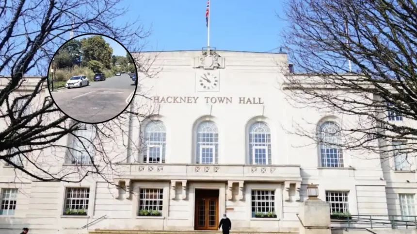
Hackney Council (East London Times) October 22, 2026 — An East London local authority is moving forward with comprehensive proposals to restrict drivers from using residential thoroughfares as shortcuts, putting forward plans for a major traffic intervention scheme in Dalston. Funded through almost £3 million provided by Transport for London (TfL), the initiative by Hackney Council introduces new traffic filters, a 24-hour bus gate, expanded pedestrian crossings, and timed School Street closures. The scheme targets streets suffering from heavy through traffic and unsafe conditions, with the explicit goal of improving local air quality and enabling safer walking and cycling routes.
- Key Points
- What specific traffic measures are included in the new Hackney Council proposals?
- How will the new School Streets and pedestrian zones function?
- What did the public consultation reveal about transport habits in Dalston?
- Background of the Dalston Traffic Development
- Prediction: How this development will affect local residents, businesses, and commuters
What specific traffic measures are included in the new Hackney Council proposals?
As reported by Ruby Gregory of MyLondon, Hackney Council’s updated scheme incorporates a series of street redesigns aimed at reducing motor vehicle volumes on residential side streets. The headline measure is a 24-hour bus-only gate situated on Shacklewell Lane between Shacklewell Road and Amhurst Road. Under these rules, general motor traffic will be strictly prohibited from entering the bus gate at all times, with exemptions granted solely to emergency service vehicles, council refuse collection trucks, pedal cyclists, and authorized local residents possessing specific permits, such as Blue Badge holders.
In addition to the bus gate, motor vehicle restrictions are slated for Cecilia Road, which links Shacklewell with Dalston Lane, to prevent drivers from making straight-through trips. Following feedback from initial engagement, council engineers revised their earlier draft plans. As noted by Ruby Gregory of MyLondon, the council formally abandoned its original plan to convert Shacklewell Road into a two-way street after local residents raised safety warnings that the road layout was overly narrow.
The refined measures incorporate new mandatory left-turn prohibitions: drivers will be banned from turning left from Dalston Lane into Cecilia Road, and motor vehicles exiting Ridley Road will no longer be permitted to turn onto Dalston Lane. This specific turning restriction is designated to stop drivers from utilizing Ridley Road Market as a shortcut between the A10 and Pembury Circus.
How will the new School Streets and pedestrian zones function?
As reported by Ruby Gregory of MyLondon, the scheme significantly expands Hackney’s established School Streets footprint to protect children and encourage active travel during peak school hours. New School Streets will be introduced on Arcola Street, serving Halley House School, as well as along sections of Cecilia Road and Downs Park Road adjacent to Excelsior Academy. During designated drop-off and pick-up hours on weekdays in term time, general motor traffic will be prohibited from entering these street segments, enforced via automatic number plate recognition (ANPR) cameras and physical signage.
As noted by Ruby Gregory of MyLondon, the School Streets initiative received the strongest public backing among all proposed measures during preliminary public engagement, with 57 per cent of consultation respondents declaring support for the timed closures. To support pedestrian movement outside school zones, the scheme also incorporates two new controlled pedestrian crossings within the Dalston area.
Complementing the road traffic closures, council planning documents disclose that Hackney has secured an additional £350,000 in dedicated funding for broader public realm improvements. Council reports confirm these funds will be allocated toward environmental upgrades across Dalston, including the installation of new public benches, rain gardens, street trees, expanded cycle hire docking bays, additional cycle parking, and enhanced green public spaces.
What did the public consultation reveal about transport habits in Dalston?
As reported by Ruby Gregory of MyLondon, the current statutory consultation follows an extensive public engagement exercise conducted across the borough. The earlier consultation saw feedback submitted by more than 1,000 local residents and commercial businesses. Analysis of the consultation demographic showed that approximately 90 per cent of all respondents were borough residents, with 51 per cent residing directly inside the defined scheme boundaries.
The travel survey highlighted a notable contrast between resident transit habits and vehicle reliance:
- Nearly half (46 per cent) of the total survey respondents cited a car or van as their primary mode of personal transport.
- According to official 2021 Census data cited within the council’s reports, only 30 per cent of households across the borough of Hackney actually own a private vehicle, representing one of the lowest car ownership figures in the United Kingdom.
- In baseline surveys conducted with market traders at Ridley Road Market, the majority of traders who rely on motor vehicles reported utilizing Dalston Lane as their primary entry or exit point. While many traders rely on public transport options, feedback indicated that light commercial vans and cars remain the preferred operational method for transporting commercial goods and stall infrastructure to the market.
Before any permanent physical alterations or camera installations are deployed, the local authority initiated a final 21-day statutory consultation period. As noted by Ruby Gregory of MyLondon, this statutory process formally commenced on October 15 and is scheduled to conclude on November 4, allowing residents, market traders, and local road users a final window to inspect statutory orders and log formal comments or objections on the council’s public web portal.
Background of the Dalston Traffic Development
Hackney Council has been at the forefront of urban traffic reduction strategies in Greater London, famously pioneering the widespread rollout of Low Traffic Neighbourhoods (LTNs) and timed School Streets during the late 2010s and expanding them heavily during the 2020 emergency active travel frameworks. The overarching strategy focuses on removing non-local traffic from residential streets, re-routing long-distance vehicular trips onto major arterial routes like the A10.
Historically, the neighbourhood of Dalston has faced complex traffic management challenges due to its position as a major commercial and cultural hub in East London. Intersected by high-density transit corridors and anchored by the historic Ridley Road Market, the residential side streets surrounding Shacklewell Lane, Cecilia Road, and Amhurst Road have long been subject to high volumes of through traffic—commonly referred to as “rat running.” Drivers routinely bypass major junctions like Pembury Circus by cutting through narrow residential avenues, leading to elevated localized air pollution, high noise levels, and increased risk of pedestrian collisions.
To address these systemic issues, Hackney Council secured almost £3 million in capital transport funding from Transport for London’s Liveable Neighbourhoods initiative. The current proposal represents the culmination of multi-year traffic monitoring, air quality modeling, and iterative public consultations aimed at reallocating street space to pedestrians, cyclists, and public buses.
Prediction: How this development will affect local residents, businesses, and commuters
The implementation of the Dalston traffic scheme will bring structural changes to daily transit routines for several distinct groups across East London:
1. Local Residents and Families
For residents living directly within the restricted streets, motor vehicle traffic volumes are expected to decline sharply, resulting in lower localized emissions, reduced noise pollution, and safer walking conditions. Families attending Halley House School and Excelsior Academy will experience safer road conditions during school drop-off and pick-up hours. However, residents who own private cars but lack specific exemption permits may face slightly longer driving routes and minor detours when accessing their properties, as direct access via traditional shortcut routes will be blocked by the 24-hour bus gate and turning bans.
2. Market Traders and Commercial Businesses
Traders at Ridley Road Market and local business owners along Dalston Lane will experience operational adjustments. While the removal of heavy through traffic will create a cleaner, more pleasant shopping environment for pedestrians, market stallholders who rely on commercial vans for transporting inventory will need to adapt to the new turn bans out of Ridley Road and onto Dalston Lane. Vehicle deliveries will require careful route planning to avoid ANPR camera fines at restricted junctions.
3. Public Transport Users and Cyclists
Bus passengers and cyclists stand to gain significant travel time improvements. The 24-hour bus gate on Shacklewell Lane will prevent public transport buses from getting delayed in general vehicular congestion, improving route reliability and journey times. Cyclists will benefit from lower overall traffic volumes on secondary roads, creating a safer connection between Dalston’s retail core and surrounding residential neighbourhoods.
4. Motorists and Surrounding Arterial Networks
Commuters who currently drive through Dalston as a shortcut will be forced to remain on primary arterial roads such as the A10. In the short term, this displacement may cause increased traffic density and temporary delays on major surrounding thoroughfares during peak hours until driving patterns adjust to the new restrictions.