
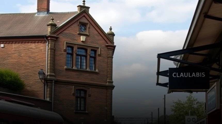
Historic railway architecture in Tower Hamlets is best discovered as a connected landscape rather than as a single landmark. Former stations, surviving viaducts, goods yards, dock railways, bridges and reused industrial buildings reveal how rail transport shaped the East End, the Port of London and the modern Docklands. The most rewarding areas to explore are Whitechapel and Shoreditch, Bow, Limehouse, Poplar, the Isle of Dogs and the streets around the old Bishopsgate Goods Yard.
- What makes Tower Hamlets important for railway architecture?
- Where can you see railway heritage around Shoreditch and Whitechapel?
- Which historic railway sites can be found in Bow?
- Where can you find railway architecture beside the docks?
- How did dock railways influence the architecture of Tower Hamlets?
- Which railway features should you look for during a walking tour?
- How can tourists and locals plan a railway architecture route?
- Why does historic railway architecture matter in Tower Hamlets today?
- What are the best ways to interpret railway remains responsibly?
What makes Tower Hamlets important for railway architecture?
Tower Hamlets contains railway structures from the Victorian main-line, dock, suburban and modern light-rail eras, making the borough a concentrated record of London’s industrial and transport history. Its railway heritage is closely connected with the expansion of the East End, the growth of the London docks and the movement of passengers, goods and dock workers.
The borough developed around several overlapping transport systems. The Eastern Counties Railway reached the area in the nineteenth century, while the London and Blackwall Railway connected the City with the docks. Branch lines served warehouses, wharves and factories, and later the Docklands Light Railway reused parts of the historic railway corridor.
This layered history explains why railway architecture in Tower Hamlets appears in different forms. Some buildings remain as stations or operational railway structures. Others survive as fragments, including brick viaducts, arched warehouse elevations, bridge abutments and sections of former track alignment. In several places, modern transport infrastructure stands directly beside older industrial fabric.
Where can you see railway heritage around Shoreditch and Whitechapel?
Shoreditch and the northern edge of Tower Hamlets offer some of the clearest evidence of Victorian railway infrastructure, especially around Bishopsgate Goods Yard, the Braithwaite Viaduct and the former railway buildings near Brick Lane.
Bishopsgate Goods Yard was built in 1840 by the Eastern Counties Railway to serve Bishopsgate Goods Station on Commercial Street. It operated as a major freight facility and linked the railway with the commercial districts, markets and warehouses of the East End.
Although much of the original complex has disappeared, the historic Braithwaite Viaduct remains an important surviving structure. Its brick arches demonstrate how Victorian engineers carried railway traffic above streets and industrial land. The viaduct is particularly significant because it connects the history of rail transport with the wider architectural character of Shoreditch and Spitalfields.
Visitors can also look for a fragment of the former station near Quaker Street. The surviving warehouse structure has arched windows and front-facing gables that indicate the architectural language of the original railway complex. The nearby Brick Lane area adds context through its brewery buildings, warehouses and former industrial premises.
How should visitors explore the Bishopsgate railway remains?
Begin near Brick Lane and Quaker Street, then walk towards the former goods-yard area while observing changes in brickwork, arches, loading bays and building scale. The route is best treated as an urban archaeology walk because several important railway elements survive as partial structures rather than complete buildings.
Look for the relationship between the railway remains and surrounding commercial architecture. Goods yards were designed for handling freight, so their buildings often feature robust brick construction, large openings, high floors and direct connections to roads, markets or canals. These characteristics distinguish them from passenger stations, which prioritised entrances, platforms and public circulation.
Which historic railway sites can be found in Bow?
Bow contains the remains and former alignments of several important railway routes, including the site of Bow Station, Bow Road’s historic railway corridor and sections later incorporated into the Docklands Light Railway.
Bow Station opened in 1850 on the East and West India Docks and Birmingham Junction Railway. It was a substantial Victorian station associated with a large concert hall above the railway. The station served local passengers and formed part of the expanding network linking east London with the docks and wider railway system.
The original station was badly damaged during the Second World War and was subsequently lost. Its platforms and tracks were removed later, although part of the former route towards Poplar was reused by the Docklands Light Railway. This makes Bow an important place for understanding adaptive reuse: railway history survives not only in preserved buildings but also in the continued use of historic alignments.
Bow also had more than one railway station in the same vicinity. Bow Station should not be confused with Bow Road station or Bow Road Underground station. Their different histories reflect the complex development of transport in the area, where main-line, local and underground services were built close together but served different routes and purposes.
What architectural clues remain at Bow?
The clearest evidence is often found in the alignment of railway land, elevated track sections, bridge structures and the relationship between the current DLR route and older industrial streets. The grand station building itself is no longer intact, so interpretation depends on combining surviving infrastructure with historical maps and local heritage information.
Bow is also useful for understanding the social role of railway architecture. Stations were not isolated engineering objects. They shaped nearby streets, supported employment, connected workers with docks and factories, and influenced the development of shops, housing and public buildings.
Where can you find railway architecture beside the docks?
Limehouse, Poplar and the Isle of Dogs provide the strongest examples of railway infrastructure integrated with dock landscapes, including elevated DLR viaducts, historic corridors, station sites and industrial buildings.
The London and Blackwall Railway opened a route between the City and the eastern dock areas. Its purpose was closely related to the movement of people and goods through the Port of London. Although the original railway no longer operates as a separate line, sections of its corridor helped establish the route later used by the Docklands Light Railway.
The DLR opened in the 1980s as part of the regeneration of the former docklands. Its original network connected Tower Gateway and Stratford with destinations including Island Gardens. In Tower Hamlets, elevated sections provide a direct visual connection between contemporary public transport and the historic dock railway landscape.
Limehouse is especially valuable because National Rail infrastructure, the DLR viaduct and dock-related industrial sites appear within the same urban setting. The area demonstrates how railways were engineered around waterways, warehouses and constrained industrial land. Brick viaducts, metal components, retaining walls and station platforms should be read together as parts of one transport system.
What can be seen around Poplar and the Isle of Dogs?
Explore the area around West India Quay, Poplar, Mudchute and Island Gardens to understand how railways served the docks. Elevated DLR stations and viaducts cross former dock landscapes, while surviving dock walls, warehouses and industrial buildings provide context for the railway’s original purpose.
At East India Dock, railway infrastructure can be viewed alongside the former dock setting and historic industrial buildings. The former hydraulic pumping station in Naval Row is not itself a railway station, but it helps explain the industrial systems that railways supported. Railway architecture in the docks should therefore be interpreted alongside hydraulic power, warehouses, quays and dock engineering.
Island Gardens is a useful endpoint for a walking or viewing route because it sits at the southern side of the Isle of Dogs and illustrates the connection between the former dock network and modern light rail. The elevated railway is both transport infrastructure and a way of observing the changing relationship between historic docks, housing and commercial development.
How did dock railways influence the architecture of Tower Hamlets?
Dock railways influenced Tower Hamlets by creating specialised infrastructure for freight handling, linking quays and warehouses with main lines, and encouraging durable industrial architecture around stations and sidings.
Unlike passenger railways, dock railways were designed around cargo movement. Their buildings needed loading doors, cranes, storage areas, sidings and connections to wharves. Tracks often ran through dense industrial districts, over roads and beside water, producing a distinctive mixture of viaducts, bridges, warehouses and retaining structures.
This functional purpose explains the robust appearance of many surviving railway-related buildings. Stock brick, cast iron, timber and stone were used for durability and fire resistance. Large arched openings allowed goods to pass between railway and warehouse spaces, while elevated structures conserved valuable ground space in crowded commercial areas.
The dock railway system also affected the wider borough. It supported employment, connected communities with workplaces and helped integrate the docks into national distribution networks. When the docks declined, many railway structures became redundant, but their remains later became important evidence of the area’s industrial past.
Which railway features should you look for during a walking tour?
During a Tower Hamlets railway walk, look for elevated brick arches, bridge abutments, platform fragments, warehouse openings, station approaches, track alignments and the relationship between railway structures and docks or markets.
Brick viaducts are among the most recognisable features. Repeated arches carried trains above streets and industrial yards, while their masonry piers transferred heavy loads into the ground. Changes in brick colour, blocked arches and later infill can show how buildings were altered after railway use ended.
Goods-yard architecture is identified by scale and access. Large entrances, loading bays, upper-floor hoists and broad service roads indicate that buildings handled freight rather than passengers. Former railway warehouses may now contain offices, shops or cultural venues, but their structural proportions often remain visible.
Station architecture requires a different approach. Look for entrance locations, platform canopies, ticket-hall footprints, stairways and the direction of former tracks. Even when a station has disappeared, its position may be indicated by an unusually wide street, a surviving bridge or a modern railway line following the historic route.
Modern DLR infrastructure should also be included. Its viaducts and stations are contemporary structures, but many occupy historic railway corridors. Comparing the materials, engineering methods and station design of the DLR with older brick railways shows how transport architecture changed while the underlying geography remained influential.
How can tourists and locals plan a railway architecture route?
A practical route can connect Shoreditch, Bow, Limehouse, Poplar and the Isle of Dogs by combining short walks with public transport, while checking access conditions and treating active railway areas as places to view from public spaces only.
A northern route can begin around Brick Lane and Quaker Street, continue towards the former Bishopsgate Goods Yard and then move east towards Bow. This route focuses on Victorian freight infrastructure, station history and the relationship between railway buildings and the commercial East End.
A docklands route can begin at Limehouse and follow the DLR towards Poplar, West India Quay or Island Gardens. This journey makes it possible to compare National Rail, historic dock railway alignments and modern elevated light rail within one continuous landscape.
Use Transport for London services for the journey between districts, and allow time to view structures from pavements, bridges, public squares and station platforms. Do not enter railway land, climb structures or photograph restricted areas. Some heritage sites are visible only from surrounding streets and may change as regeneration projects progress.
Historic maps, conservation-area documents and local heritage material can improve the experience by explaining what has disappeared and what has survived. The absence of a station building does not mean that the site lacks heritage value. Railway history often survives through alignment, scale, materials and urban form.
Why does historic railway architecture matter in Tower Hamlets today?
Historic railway architecture matters because it explains how Tower Hamlets became connected to London’s industrial economy and helps communities interpret surviving structures during continuing urban change.
Railways transformed the borough’s geography. They connected docks with inland markets, enabled daily commuting, supported manufacturing and influenced the location of housing and commercial premises. Railway infrastructure therefore forms part of the social and economic history of Tower Hamlets, not only its architectural history.
Conservation is particularly important where railway structures are incomplete or embedded within new developments. A viaduct, warehouse fragment or station site can retain historical meaning even when its original function has ended. Recording these elements helps maintain continuity between the historic landscape and new public spaces.
For visitors, railway architecture offers a way to explore areas beyond conventional landmarks. For residents, it provides evidence of local identity and the borough’s working past. Together, the surviving structures create an accessible heritage network linking Shoreditch, Bow, Limehouse, Poplar and the Isle of Dogs.
What are the best ways to interpret railway remains responsibly?
The most responsible approach is to distinguish surviving buildings from reconstructed or reused structures, verify historical claims with heritage records and observe all railway, construction and private-property restrictions.
Not every old brick building near a railway is a railway building. Breweries, warehouses, dock facilities and workshops often stood beside tracks and may share similar materials. Reliable interpretation depends on comparing architectural evidence with conservation documents, historic maps and recognised heritage records.
Visitors should also avoid treating modern DLR structures as untouched Victorian survivals. The DLR is a later transport system that reused historic corridors in parts of Tower Hamlets. Its significance lies in the relationship between twentieth-century regeneration, older dock infrastructure and the continuing importance of rail transport.
Responsible exploration supports conservation. Photograph from public places, avoid trespassing, respect residents and businesses, and do not remove bricks, fittings or other material. The value of railway heritage depends on preserving both physical remains and the historical context that gives them meaning.
Which five places are most useful for a first visit?
- Bishopsgate Goods Yard and the Braithwaite Viaduct near Shoreditch and Brick Lane.
- The former Bow Station area and surviving railway alignments in Bow.
- Limehouse, where National Rail, DLR and dock-related infrastructure meet.
- West India Quay and Poplar, where elevated DLR structures cross the dock landscape.
- Island Gardens and the southern Isle of Dogs, where modern light rail connects with former dock railway geography.
Is Tower Hamlets suitable for a self-guided railway architecture walk?
Yes. The borough has a connected network of publicly visible railway remains, active stations and historic industrial areas. A self-guided walk works best when divided into smaller districts and combined with DLR or Underground travel between locations.
Can you still see the original Bow Station?
The original Bow Station building no longer survives as a complete structure. Its history can be understood through the former site, nearby railway alignments and the section of route later incorporated into the Docklands Light Railway.
Is the Docklands Light Railway Victorian?
No. The DLR opened in the 1980s, although parts of its route reuse or follow older railway corridors associated with the London and Blackwall Railway and dock transport. It should be interpreted as modern infrastructure within a historic landscape.
What is the Braithwaite Viaduct?
The Braithwaite Viaduct is a surviving Victorian railway structure associated with the former Bishopsgate Goods Yard. Its brick arches provide evidence of how freight railways were carried above streets and industrial land near Shoreditch and Brick Lane.
Where can I find reliable information while visiting?
Use Tower Hamlets Council conservation documents, Historic England heritage records, Transport for London information and recognised local archives. These sources help distinguish documented railway remains from later buildings or unsupported local stories.
SEO title: Where to Discover Historic Railway Architecture in Tower Hamlets
Meta description: Discover historic railway architecture in Tower Hamlets, from Bishopsgate Goods Yard and Bow to Limehouse, Poplar and the Isle of Dogs.
Strategic internal linking plan:
- Link “Tower Hamlets heritage” to an existing borough heritage or local history page.
- Link “Bishopsgate Goods Yard” to a dedicated Shoreditch, Brick Lane or railway heritage page.
- Link “Braithwaite Viaduct” to a page about historic bridges, viaducts or conservation areas.
- Link “Bow Station” to a Bow history or East London railway history page.
- Link “Docklands Light Railway” to a transport, Docklands or Isle of Dogs guide.
- Link “Limehouse, Poplar and the Isle of Dogs” to neighbourhood guides for each area.
- Link “self-guided railway architecture walk” to a walking itineraries or London architecture page.