


Tower Hamlets is an East London borough covering historic East End neighbourhoods, major waterfront districts, busy markets, large parks, cultural institutions and internationally recognised landmarks. Its visitor geography stretches from the Tower of London and Tower Bridge in the west to Canary Wharf and the Isle of Dogs in the east.
- What does a Tower Hamlets visitor map show?
- Which Tower Hamlets areas should visitors identify on a map?
- Where are the main historic landmarks on the Tower Hamlets map?
- Which Tower Hamlets markets are worth locating on a visitor map?
- Which Tower Hamlets parks should visitors find on the map?
- Where are the best waterfront areas on a Tower Hamlets visitor map?
- What museums and cultural attractions appear on the Tower Hamlets map?
- How can visitors use Tower Hamlets transport links to plan a map-based itinerary?
- Which Tower Hamlets areas are best for markets, food and local shopping?
- Where can digital nomads and business travellers spend downtime in Tower Hamlets?
- What historic geography should visitors understand before exploring Tower Hamlets?
- How should a first-time visitor organise Tower Hamlets on a map?
- Why is a Tower Hamlets visitor map useful for understanding East London?
A visitor map of Tower Hamlets is useful because the borough is not a single compact attraction district. Its places have distinct identities and different reasons to visit. Whitechapel connects historic markets with major cultural and transport facilities. Spitalfields and Brick Lane combine markets, food, street art and East End heritage. Bethnal Green and Columbia Road provide independent shops, cultural venues and local streets. Mile End and Bow connect green space with traditional East London neighbourhoods. Poplar, Limehouse and the Isle of Dogs introduce docks, canals and waterfront landscapes. Canary Wharf provides a modern business district beside the River Thames.
Tower Hamlets Council describes the borough as a place with historic landmarks, markets, museums, parks and modern developments. Its planning documents identify 24 distinct places, including Canary Wharf, Whitechapel, Bow, Stepney and Shoreditch, each with different characteristics.
What does a Tower Hamlets visitor map show?
A Tower Hamlets visitor map shows how the borough’s major neighbourhoods, landmarks, markets, parks, museums, transport hubs and waterfront districts fit together across East London. It helps visitors organise attractions by location rather than treating the borough as one destination.
The borough has a dense mixture of historic and modern environments. A visitor map therefore works best when it is divided into geographical zones rather than individual attractions.
The western side contains the Tower of London, Tower Bridge, St Katharine Docks and parts of the historic City Fringe. Whitechapel, Aldgate and Spitalfields sit further east and provide access to markets, galleries, restaurants and historic streets.
Central Tower Hamlets contains Bethnal Green, Shoreditch, Mile End, Stepney and Bow. These areas combine residential streets with parks, markets, cultural venues and historic buildings.
The southern part of the borough includes Limehouse, Poplar, the Isle of Dogs and Canary Wharf. This area is closely associated with docks, waterways, financial services, modern architecture and riverside public spaces.
Tower Hamlets has more than 120 parks and green spaces. Fourteen currently hold Green Flag Awards, giving the borough a substantial network of mapped outdoor destinations.
Which Tower Hamlets areas should visitors identify on a map?
Visitors should identify Whitechapel, Spitalfields, Brick Lane, Bethnal Green, Columbia Road, Mile End, Bow, Stepney, Limehouse, Poplar, Wapping, the Isle of Dogs and Canary Wharf because these areas contain major attractions, markets, parks, heritage sites and transport connections.
Whitechapel is one of the most useful starting points for understanding the eastern part of central London. It combines Whitechapel Market, the Royal London Hospital area, cultural institutions and strong Underground, Overground and Elizabeth line connections.
Spitalfields and Brick Lane form a major visitor district around Commercial Street and the surrounding streets. The area has long connections with immigrant communities, markets, food businesses and East End commerce.
Bethnal Green provides access to the Young V&A, Bethnal Green Market and Victoria Park. Columbia Road sits nearby and becomes particularly busy around its Sunday flower market.
Mile End provides a geographical link between central East London and the eastern districts. Mile End Park creates an extensive green corridor beside the Regent’s Canal.
Bow and Stepney provide a different visitor experience, with historic streets, churches, residential architecture, markets and connections to the wider East End.
Limehouse is associated with former docks, canals and riverside heritage. Poplar and the Isle of Dogs connect historic dockland landscapes with modern residential and commercial development.
Canary Wharf forms the most recognisable modern business district in the borough. Canary Wharf station is served by the Jubilee line, DLR and Elizabeth line, making it a major transport point for visitors.
Where are the main historic landmarks on the Tower Hamlets map?
The principal historic landmarks are concentrated around the western and central parts of Tower Hamlets, with the Tower of London, Tower Bridge, St Katharine Docks, Brick Lane, Spitalfields and historic East End streets forming important heritage locations.
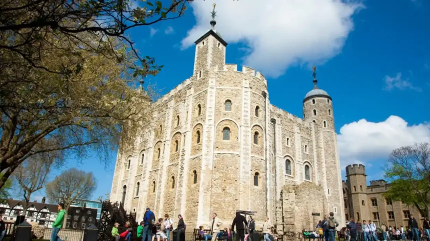
The Tower of London is one of the borough’s defining landmarks. The medieval fortress stands beside the River Thames and forms a major part of London’s historic riverside landscape.
Tower Bridge is immediately south-east of the Tower of London. The bridge opened in 1894 and remains one of London’s most recognisable structures. Historic England records Tower Bridge and its approach as listed heritage assets.
St Katharine Docks provides another historic waterfront destination near Tower Bridge. Its location makes it practical to combine with the Tower of London and riverside walking routes.
Further east, Spitalfields and Brick Lane reveal the commercial and social history of the East End. Brick Lane has connections with French Huguenot, Jewish and Bangladeshi communities. Tower Hamlets Council records Brick Lane Market as established in 1888.
Historic England’s records also demonstrate the architectural depth of the borough. The Boundary Estate, for example, includes buildings dating from the late nineteenth and early twentieth centuries around Arnold Circus.
As you explore these modern visitor areas, you are crossing land with a deep heritage. Read about the full [Tower Hamlets historical background and heritage story] to understand its origins.
Which Tower Hamlets markets are worth locating on a visitor map?
Tower Hamlets has a substantial network of markets, including Brick Lane Market, Columbia Road Flower Market, Whitechapel Market, Roman Road Market, Chrisp Street Market, Watney Market, Bethnal Green Market and Petticoat Lane, each serving a distinct visitor area.
Brick Lane Market is concentrated around Brick Lane in E1. Sunday is the principal market day, with fashion, food, art, vintage goods and other independent trading.
Columbia Road Flower Market occupies Columbia Road in E2. It is especially associated with flowers and plants and operates on Sundays. The surrounding street contains independent shops, cafés, galleries and other small businesses.
Whitechapel Market follows Whitechapel Road and provides fresh produce, spices, clothing, jewellery and other goods. Its location makes it easy to connect with Whitechapel station and nearby cultural destinations.
Petticoat Lane is associated with Wentworth Street and the surrounding streets around Middlesex Street. Weekday trading includes street food and other goods.
Roman Road Market serves the Bow and Mile End side of the borough. Trading takes place on Tuesday, Thursday and Saturday, with clothing, household goods, food and other products.
Chrisp Street Market is located in Poplar. It has Victorian origins and continues to serve the local community with food, household goods, clothing and other everyday products.
Watney Market sits between Whitechapel and Shadwell. It provides another useful market stop for visitors exploring the eastern side of central Tower Hamlets.
Tower Hamlets Council currently identifies ten street markets, including Brick Lane, Bethnal Green Road, Chrisp Street, Columbia Road, Petticoat Lane, Roman Road, Roman Road Square, Sclater Street, Watney Market and Whitechapel Market.

Which Tower Hamlets parks should visitors find on the map?
Victoria Park, Mile End Park, Mudchute Park and Farm and Tower Hamlets Cemetery Park are key green destinations, while smaller gardens and open spaces provide additional places for walking, recreation, nature and quieter breaks between attractions.
Victoria Park is the borough’s oldest and largest park. Tower Hamlets Council states that it receives around nine million visits each year. The park contains historic features including lakes, a bandstand, the Burdett-Coutts Memorial and original London Bridge stone alcoves.
Victoria Park sits between Bethnal Green, Bow and Hackney Wick. Its location makes it useful for visitors who want to combine green space with East London markets and cultural attractions.
Mile End Park runs through central Tower Hamlets. It includes Mile End Stadium, the Ecology Park and the Arts Pavilion. The park also provides access to walking and cycling routes and connects several neighbourhoods.
Mudchute Park and Farm occupies part of the Isle of Dogs. It is one of the borough’s local nature reserves and provides an unusual rural landscape within the urban environment.
Tower Hamlets Cemetery Park is another local nature reserve. Its historic cemetery landscape contains mature vegetation, paths and wildlife habitats.
The council records more than 120 parks and green spaces across the borough. Five registered parks and gardens include Victoria Park, Boundary Gardens, Island Gardens, Museum Gardens and the Novo Cemetery.
Where are the best waterfront areas on a Tower Hamlets visitor map?
The main waterfront areas are concentrated along the River Thames and former docklands, particularly Wapping, Limehouse, Poplar, the Isle of Dogs, Canary Wharf, Shadwell Basin and Island Gardens, where historic waterways meet modern development.
Wapping occupies the western waterfront and has strong connections with London’s former port. Its riverside streets provide views towards the Thames and access to historic buildings and waterside spaces.
Shadwell Basin forms another important waterfront area. The basin is part of the former dock system and now sits within a largely residential environment.
Limehouse provides a connection between the Thames and the inland canal network. Limehouse Basin is particularly relevant to visitors interested in waterways, walking and former industrial landscapes.
Poplar and the Isle of Dogs contain numerous former dock sites. The area changed dramatically as London’s docks declined and large-scale redevelopment transformed the waterfront.
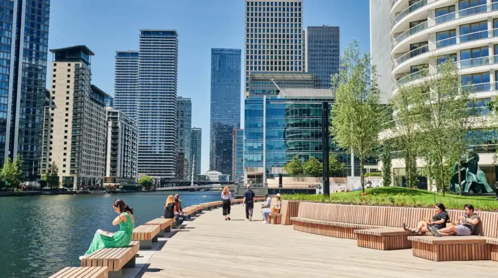
Canary Wharf represents the modern stage of that transformation. High-rise offices, public squares, shops, restaurants and transport infrastructure now occupy an area that was once dominated by commercial docks.
Island Gardens sits on the southern side of the Isle of Dogs and provides views across the River Thames towards Greenwich. It is one of the borough’s registered historic parks and gardens.
What museums and cultural attractions appear on the Tower Hamlets map?
Tower Hamlets contains museums, galleries, music venues and cultural institutions that explain the borough’s social, maritime, artistic and East End history, including the Museum of London Docklands, Whitechapel Gallery, Young V&A and Wilton’s Music Hall.
The Museum of London Docklands is one of the most important places for understanding the relationship between Tower Hamlets and London’s port. It explores the history of the River Thames, docks, trade, migration and dockland communities.
The Young V&A is located in Bethnal Green and focuses on design, creativity and objects relevant to children and young people. Its location makes it easy to combine with Bethnal Green and Victoria Park.
Whitechapel Gallery provides a major contemporary art destination near Whitechapel and Aldgate. Its location places it close to Brick Lane and Spitalfields.
Wilton’s Music Hall in Whitechapel is an important historic performance venue. It is recognised for its preserved music-hall architecture and cultural programming.
Rich Mix in Bethnal Green provides cinema, arts and cultural events within the East End.
Tower Hamlets Council identifies museums, galleries, music venues and cultural destinations as major parts of the borough’s visitor offer. Its wider local information also identifies more than 20 art galleries across the borough.
How can visitors use Tower Hamlets transport links to plan a map-based itinerary?
Visitors can organise Tower Hamlets trips around Underground, DLR, Elizabeth line, Overground, bus, walking and cycling connections, using stations such as Whitechapel and Canary Wharf as practical points for moving between neighbourhoods.
Whitechapel is a particularly useful transport hub. It has District and Hammersmith & City Underground services, the Elizabeth line and London Overground services.
Canary Wharf has connections through the Jubilee line, DLR and Elizabeth line. This makes the area accessible from central London, Stratford, the City and other parts of the capital.
Bethnal Green provides access to the Central line, while Bethnal Green Overground station provides another route through East London.
Mile End station provides Central, District and Hammersmith & City line connections. Bow Road and Bow Church provide additional access to the Bow area.
For visitors, the most efficient approach is to group destinations geographically. A western itinerary can focus on the Tower of London, Tower Bridge and St Katharine Docks. A central itinerary can connect Whitechapel, Brick Lane, Spitalfields and Bethnal Green. An eastern itinerary can concentrate on Canary Wharf, Poplar, the Isle of Dogs and the surrounding waterfront.
Transport conditions and service patterns change, so visitors should check Transport for London’s current journey information before travelling.
Which Tower Hamlets areas are best for markets, food and local shopping?
Brick Lane, Spitalfields, Whitechapel, Bethnal Green, Roman Road, Columbia Road and Chrisp Street provide strong combinations of markets, independent shops, cafés, restaurants and street food, giving visitors several distinct local shopping areas across the borough.
Brick Lane is closely associated with Bangladeshi food businesses, independent fashion, vintage shops, cafés and market trading.
Spitalfields provides a more formal market environment alongside restaurants, independent retailers and historic streets.
Whitechapel offers a strong concentration of South Asian food businesses, market stalls and shops. Its location makes it practical for visitors combining food with cultural attractions.
Columbia Road is strongly associated with flowers and plants on Sundays. Its surrounding shops create a different shopping environment from the larger markets around Brick Lane and Whitechapel.
Roman Road provides a traditional high-street and market environment in Bow. Chrisp Street performs a similar local role in Poplar.
These markets also provide evidence of the borough’s long commercial history. Tower Hamlets’ conservation strategy describes markets as important elements of local townscape, community life and local economies.
Where can digital nomads and business travellers spend downtime in Tower Hamlets?
Digital nomads and business travellers can base downtime around Canary Wharf, Whitechapel, Spitalfields, Bethnal Green and local Idea Stores, where transport, cafés, public spaces, shops, cultural venues and business facilities are concentrated.
Canary Wharf is the borough’s principal international business district. The area contains offices, shops, cafés, restaurants, public spaces and transport connections.
Its combination of commercial infrastructure and transport makes it particularly relevant to business travellers staying in or travelling through East London.
Whitechapel provides a different environment. It combines major transport connections with cafés, restaurants, cultural venues, markets and educational institutions.
Spitalfields and Brick Lane offer dense concentrations of independent businesses and food venues. Their proximity to Liverpool Street and the City also makes them practical for short periods between meetings.
Tower Hamlets’ Idea Stores combine library, learning and information services. The council describes them as part of the borough’s network of public learning facilities.
For remote workers, the most useful approach is to choose a neighbourhood according to the type of downtime required. Canary Wharf suits business-oriented environments. Whitechapel suits central East London access. Bethnal Green and Mile End provide stronger connections to parks and cultural destinations.
What historic geography should visitors understand before exploring Tower Hamlets?
Tower Hamlets developed from historic hamlets around the Tower of London into a densely populated East London borough shaped by trade, immigration, industry, docks, housing, transport and regeneration, creating the varied neighbourhood map visible today.
The name Tower Hamlets reflects the historic relationship between the Tower of London and surrounding hamlets.
The borough’s history is strongly connected with the River Thames. The docks turned southern Tower Hamlets into a major centre of international trade. Warehouses, canals, basins and dock infrastructure shaped neighbourhoods including Wapping, Limehouse, Poplar and the Isle of Dogs.
Migration also shaped the borough. Different communities settled in the East End over successive periods, creating cultural connections visible in food, markets, religious buildings, shops and community institutions.
Industrialisation transformed the central and eastern districts. Housing estates, factories, railways and commercial streets expanded around growing employment centres.
The twentieth century brought major changes to the docks and their surrounding communities. Later regeneration transformed former industrial land into new residential, cultural, commercial and public spaces.
Tower Hamlets Council describes the borough as an area where historic East End communities and major modern business districts coexist.
Historic England also records numerous listed buildings and heritage assets across Tower Hamlets, providing an official record of the built environment that survives from different periods.
Explore More Area Guide
Tower Hamlets Guide: First-Time Visitor Guide to East London
Tower Hamlets on Foot: East London Walking Guide
How should a first-time visitor organise Tower Hamlets on a map?
A first-time visitor should divide Tower Hamlets into western, central, northern and southern zones, then group nearby landmarks into walking sections instead of attempting to cover the entire borough in one continuous route.
The western zone centres on the Tower of London, Tower Bridge and St Katharine Docks. This area suits visitors focused on major landmarks and riverside heritage.
The central-western zone includes Aldgate, Whitechapel, Spitalfields and Brick Lane. Markets, galleries, restaurants, historic streets and transport links dominate this part of the map.
The central-northern zone includes Bethnal Green, Columbia Road, Mile End and Bow. It combines markets, parks, museums, residential streets and cultural venues.
The southern zone includes Wapping, Shadwell, Limehouse, Poplar, the Isle of Dogs and Canary Wharf. Its main themes are the River Thames, former docks, modern architecture and waterfront regeneration.
Visitors should also account for market opening days. Columbia Road Flower Market and Brick Lane Market are particularly associated with Sundays, while other markets operate on weekdays or selected weekdays.
This geographical approach reduces unnecessary cross-borough travel and allows visitors to combine attractions with similar themes.
Why is a Tower Hamlets visitor map useful for understanding East London?
A Tower Hamlets visitor map connects landmarks, neighbourhoods, markets, parks, museums and waterfront districts into one geographical picture, showing how historic East London communities and modern business areas developed alongside one another.
Tower Hamlets contains unusually varied urban landscapes within a relatively compact London borough. Its western edge connects directly with some of London’s best-known historic landmarks. Its central districts contain the markets and streets traditionally associated with the East End. Its southern districts show the transformation of London’s former docklands into modern residential and commercial areas.
The borough also has a substantial green-space network. More than 120 parks and open spaces provide alternatives to the dense streets and commercial districts.
Its market network provides another layer of geographical identity. Brick Lane, Columbia Road, Whitechapel, Roman Road and Chrisp Street each serve different parts of the borough and different visitor interests.
The transport network reinforces these connections. Whitechapel and Canary Wharf are particularly important interchange points, while the Underground, DLR, Elizabeth line and Overground connect the borough with wider London.
For tourists, the map is therefore more than a navigation tool. It explains the structure of the destination. Visitors can see where historic landmarks sit in relation to markets, where parks interrupt dense neighbourhoods, and where former docklands transition into modern business districts.
Tower Hamlets works best as a collection of connected places rather than a single sightseeing zone. Understanding that geography allows visitors to plan shorter routes, combine complementary attractions and experience more of East London’s historic and contemporary character within the same trip.
What are the main areas to visit in Tower Hamlets?
The main visitor areas include Whitechapel, Spitalfields, Brick Lane, Bethnal Green, Mile End, Bow, Stepney, Limehouse, Wapping, Poplar, the Isle of Dogs and Canary Wharf.