


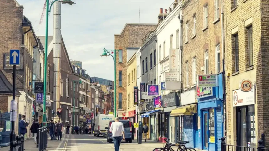
Tower Hamlets is one of London’s most varied boroughs for walking, connecting historic East End streets, markets, canals, docks, parks, riverside paths and major cultural destinations. Its neighbourhoods include Whitechapel, Spitalfields, Bethnal Green, Stepney, Limehouse, Poplar, Wapping, Isle of Dogs and Canary Wharf.
- Why is Tower Hamlets suitable for exploring on foot?
- Which areas of Tower Hamlets are best for a walking route?
- How can you walk from Whitechapel to Spitalfields and Brick Lane?
- What historic streets should you explore in Tower Hamlets?
- Where can you combine parks and walking routes in Tower Hamlets?
- How can you follow canals and waterways through Tower Hamlets?
- Which Tower Hamlets markets are worth visiting on foot?
- How can you explore Tower Hamlets through its docklands heritage?
- What cultural destinations can you reach while walking around Tower Hamlets?
- Which Tower Hamlets walking routes suit a short visit?
- How can visitors plan a full day walking around Tower Hamlets?
- What should visitors know before walking in Tower Hamlets?
- Why does walking reveal more of Tower Hamlets than travelling directly between attractions?
The borough has changed substantially over the past two centuries. Former industrial and dockland areas now sit alongside residential districts, cultural venues, financial centres and large public parks. Census 2021 recorded around 310,300 residents, an increase of 22.1% from around 254,100 in 2011. The Office for National Statistics also identified Tower Hamlets as the most densely populated local authority in England in 2021, with 15,695 residents per square kilometre.
Walking provides a practical way to understand this dense urban landscape because many destinations sit within connected neighbourhoods rather than isolated tourist zones. Tower Hamlets Council itself provides a series of half-hour to one-hour walks covering areas including Bethnal Green, Bromley-by-Bow, Isle of Dogs, Poplar, Shadwell, Spitalfields, Stepney and Victoria Park.
Why is Tower Hamlets suitable for exploring on foot?
Tower Hamlets is highly suited to walking because historic streets, markets, parks, canals, docks and cultural destinations are concentrated across connected neighbourhoods, allowing visitors to combine several different experiences within one walking day.
The borough’s geography creates several distinct walking environments. Whitechapel and Spitalfields provide dense historic streets and markets. Bethnal Green and Mile End provide parks, museums and community spaces. Limehouse and Wapping provide waterways, docks and riverside heritage. The Isle of Dogs provides docklands landscapes and modern architecture.
Walking also reveals changes that are less obvious when travelling directly between Tube stations. Former industrial buildings sit beside modern residential developments. Historic churches stand close to contemporary commercial districts. Canals cross neighbourhoods that were shaped by manufacturing, transport and London’s expanding population.
Tower Hamlets contains 58 conservation areas, according to the council. These include Brick Lane and Fournier Street, Boundary Estate, Narrow Street, Limehouse Cut, Roman Road Market, Victoria Park, Wapping Wall, West India Dock and Whitechapel Market.
This concentration of protected historic environments gives walking routes an important architectural dimension.
Which areas of Tower Hamlets are best for a walking route?
The strongest walking areas include Whitechapel, Spitalfields, Bethnal Green, Stepney, Limehouse, Wapping, Poplar, the Isle of Dogs and Victoria Park because each combines distinct streets, heritage sites, public spaces and waterways.
Whitechapel provides a useful starting point for understanding the East End. Whitechapel Road and surrounding streets connect transport infrastructure with markets, historic buildings, community institutions and cultural destinations.
Spitalfields offers a different urban character. Brick Lane, Fournier Street and surrounding streets contain architecture associated with successive immigrant communities and the area’s historic trading economy. The council identifies Brick Lane and Fournier Street as a conservation area.
Bethnal Green links residential streets with Victoria Park, museums and green spaces. Roman Road provides another historic commercial corridor, while nearby Victoria Park creates a major open-space destination.
Stepney provides historic churches, residential streets and green spaces. Limehouse adds canals, warehouses, docks and riverside routes. Narrow Street is particularly associated with the historic Limehouse waterfront.
Wapping offers another waterfront environment, with St Katharine Docks, Wapping Wall and riverside streets close to the Tower of London. Visit London describes St Katharine Docks as a former commercial dock transformed into a marina with shops, restaurants and a pub.
The Isle of Dogs changes the visual character again. Former docklands now contain Canary Wharf, residential neighbourhoods, waterside paths, public spaces and Island Gardens.
How can you walk from Whitechapel to Spitalfields and Brick Lane?
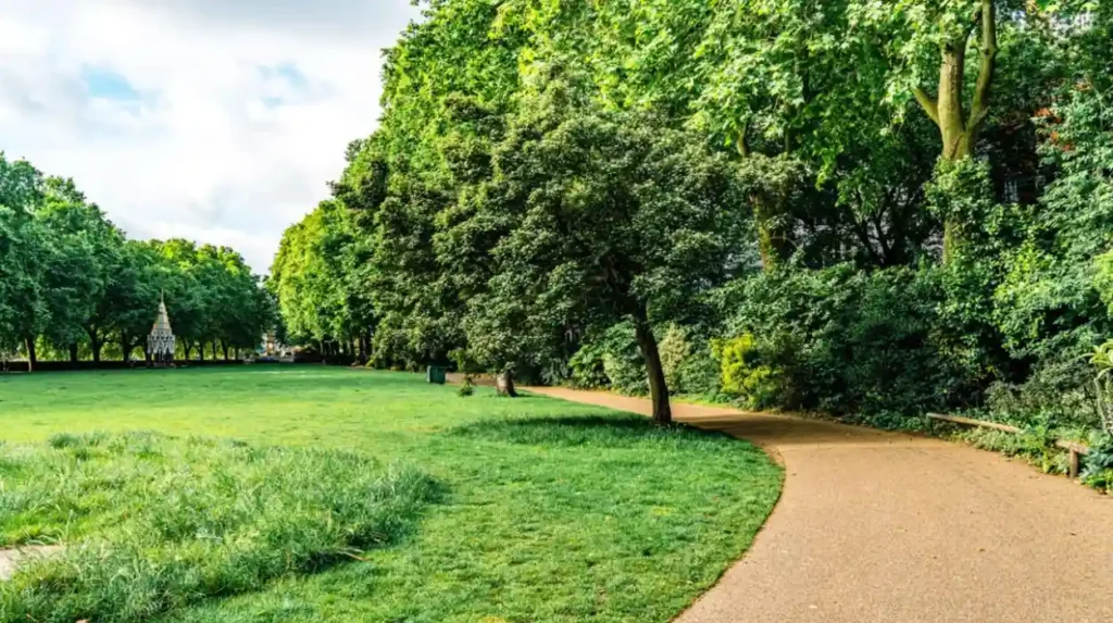
A Whitechapel-to-Spitalfields walk connects major East End streets with historic markets, Brick Lane, Fournier Street and nearby cultural destinations, creating a compact route that combines architecture, commerce, migration history and contemporary East London culture.
Whitechapel is an effective starting point because it sits at the western edge of several East End neighbourhoods.
From Whitechapel, a walking route can continue towards Commercial Street and Spitalfields. The streets around Spitalfields contain historic buildings, independent businesses, galleries, restaurants and market spaces.
Brick Lane forms one of the most recognisable pedestrian destinations in this part of London. Tower Hamlets Council describes Brick Lane Market as an established market dating from 1888, with fashion, food, art, household goods, jewellery and vintage-related businesses. The council also identifies the street’s connections with French Huguenot, Jewish and Bangladeshi communities.
Fournier Street provides an architectural contrast. Its historic buildings sit close to the market environment and demonstrate how residential, religious and commercial histories overlap in the area.
Visitors interested in architecture should also look beyond the main commercial streets. Smaller roads reveal older building forms, courtyards, workshops and residential terraces.
As you explore the modern streets around Spitalfields and Brick Lane, you are crossing land with a deep East End heritage. Read about the full [Insert Anchor Text for History Article Here] to understand its origins.
What historic streets should you explore in Tower Hamlets?
Historic streets worth exploring include Fournier Street, Narrow Street, Wapping Wall, Artillery Passage, Commercial Street, Cable Street and streets around Stepney Green because they preserve architectural evidence of trade, migration, industry and residential development.
Fournier Street is particularly notable for its historic townhouses and connection with Spitalfields.
Artillery Passage provides another compact historic street environment. It connects with the wider Spitalfields area and contains buildings and passages associated with the area’s historic commercial character.
Cable Street is important for both social and political history. Its location between Whitechapel and the docks reflects the relationship between the East End’s residential communities and the industrial waterfront.
Narrow Street in Limehouse provides a different experience. The street runs alongside Limehouse Reach and contains historic buildings connected with the former riverside district.
Wapping Wall provides another historic waterfront environment. The street forms part of Wapping’s relationship with the River Thames and former dock infrastructure.
Stepney Green provides a quieter historic setting with residential architecture and open space. The surrounding conservation area is one of the borough’s recognised historic districts.
Tower Hamlets Council states that conservation areas are locations of special architectural or historic interest where land, buildings and trees receive additional protection through the planning system.
Where can you combine parks and walking routes in Tower Hamlets?
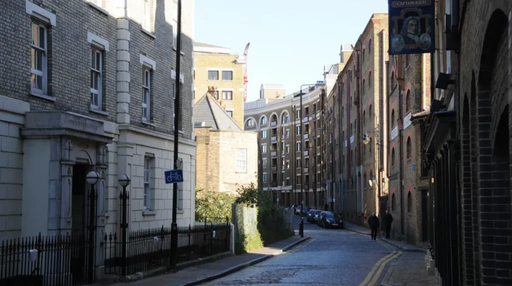
Victoria Park, Mile End Park, Mudchute Park and Farm, Island Gardens and smaller green spaces provide natural breaks within Tower Hamlets walking routes, allowing visitors to combine urban streets with landscaped parks, waterways, gardens and open views.
Tower Hamlets contains more than 120 parks and green spaces, according to the council. Fourteen parks hold Green Flag Awards, while the borough also reports nine London in Bloom gold awards.
Victoria Park is the borough’s largest and oldest park. It receives more than nine million visits each year and forms part of a wider green corridor linking the Regent’s Canal, Mile End Park and the Queen Elizabeth Olympic Park area.
The park contains historic lakes, a bandstand, the Burdett-Coutts Memorial and two original London Bridge stone alcoves. These features make it both a recreational space and a heritage destination.
Mile End Park provides another important walking connection. It is a 32-hectare linear park following the Regent’s Canal between Victoria Park and Limehouse Basin. The council states that the park was created on industrial land affected by Second World War bombing.
Mudchute Park and Farm provides an alternative green-space environment on the Isle of Dogs. The council identifies Mudchute as a Site of Metropolitan Importance for Nature Conservation. Other sites with similar metropolitan importance include Mile End Park, Tower Hamlets Cemetery Park, London’s canals and the River Thames.
How can you follow canals and waterways through Tower Hamlets?
Tower Hamlets has an extensive network of walkable waterways, including the Regent’s Canal, Limehouse Cut, Limehouse Basin, Hertford Union Canal, River Thames and Lea Navigation, creating routes through industrial, residential and dockland landscapes.
Waterways explain much of Tower Hamlets’ historic geography. Canals and docks were built to transport goods and connect London’s industrial districts with the River Thames.
The Regent’s Canal is particularly useful for walking because it provides a continuous waterside environment through parts of north-east Tower Hamlets. Mile End Park follows the canal between Victoria Park and Limehouse Basin.
Limehouse Basin provides an important meeting point between canal and dockland environments. From here, routes can continue towards the Thames or through nearby Limehouse streets.
Limehouse Cut provides another historic waterway. It links the Limehouse area with the wider canal network and forms part of the borough’s recognised conservation and environmental heritage.
The Hertford Union Canal separates Mile End Park from the southern edge of Victoria Park. This creates an opportunity to combine parkland and canal walking within the same outing.
The River Thames forms the southern edge of many Tower Hamlets neighbourhoods. Riverside walking around Wapping, Limehouse and the Isle of Dogs provides views across London’s historic and modern waterfront.
The council identifies London’s canals, the River Thames and Bow Creek, and the Lea Valley and Lea Navigation among its Sites of Metropolitan Importance for Nature Conservation.
Which Tower Hamlets markets are worth visiting on foot?
Brick Lane Market, Columbia Road Market, Whitechapel Market and Roman Road Market provide distinct walking destinations, combining food, plants, clothing, household goods, art and local commerce within different East London neighbourhoods.
Markets are central to the walking experience in Tower Hamlets because they provide reasons to move between neighbouring streets rather than remaining inside one attraction.
Brick Lane Market operates on Sundays and is associated with food, fashion, art, vintage goods and street trading. Tower Hamlets Council dates the market’s establishment to 1888.
Columbia Road Market is particularly associated with flowers and plants. It creates a different atmosphere from Brick Lane because its trading identity is concentrated around horticulture.
Whitechapel Market serves the surrounding community and forms part of the wider Whitechapel High Street environment.
Roman Road Market provides another established East London shopping corridor near Bethnal Green and Victoria Park.
Market opening days and trading arrangements can change, so visitors should check current council information before planning a route around a specific market.
The wider market network demonstrates the commercial diversity of Tower Hamlets. Walking between markets also provides a practical way to understand how individual neighbourhoods maintain distinct identities within one borough.
How can you explore Tower Hamlets through its docklands heritage?
Docklands walking routes connect Limehouse, Wapping, Poplar, West India Dock and the Isle of Dogs, revealing how warehouses, canals, basins and wharves shaped East London before many dock areas were redeveloped for modern residential and commercial uses.
The historic docklands are essential to understanding Tower Hamlets.
The West India Docks transformed the Isle of Dogs after their opening in the early nineteenth century. The docks handled imported goods and became a major component of London’s commercial waterfront.
Today, Canary Wharf occupies part of this former dockland landscape. Modern office towers stand beside retained water spaces and historic dock structures.
Limehouse provides another connection between industrial heritage and modern London. Limehouse Basin connects the Regent’s Canal and Limehouse Cut with the River Thames.
Wapping contains former dockland streets and warehouses close to the river. St Katharine Docks, just west of Wapping, demonstrates how former commercial infrastructure has been converted into a mixed-use marina environment.
Poplar also forms part of the borough’s dockland history. Its streets connect historic residential areas with former industrial and maritime landscapes.
Walking these districts shows the physical relationship between water, transport and economic development. It also explains why so much modern development is concentrated around former docklands.
What cultural destinations can you reach while walking around Tower Hamlets?
Cultural destinations across Tower Hamlets include museums, historic buildings, galleries, music venues, community spaces and heritage sites, allowing walking routes to combine outdoor exploration with structured cultural visits.
The borough’s cultural landscape is distributed rather than concentrated in one district.
The Museum of London Docklands in West India Quay provides a major cultural destination for understanding London’s relationship with the River Thames, docks and global trade.
Wilton’s Music Hall near Whitechapel is another significant heritage venue. The building is recognised within Tower Hamlets’ conservation framework, which lists Wilton’s Music Hall among the borough’s conservation areas.
The Tower of London stands at the western edge of the borough and is a UNESCO World Heritage Site. Tower Hamlets Council identifies it as both a World Heritage Site and a Grade I listed building.
Island Gardens provides views towards Greenwich across the River Thames. The council identifies Island Gardens as part of the setting of the Maritime Greenwich World Heritage Site.
These destinations demonstrate the range of cultural history available within walking distance of residential neighbourhoods, commercial centres and waterways.
Which Tower Hamlets walking routes suit a short visit?
Short visits work well around Spitalfields, Whitechapel, Victoria Park, Limehouse or the Isle of Dogs because each area offers a concentrated combination of streets, landmarks, public spaces and transport connections without requiring a full-day itinerary.
For a two-hour visit, Whitechapel and Spitalfields provide a compact route. The walk can include Whitechapel High Street, Commercial Street, Brick Lane, Fournier Street and nearby historic streets.
For a park-focused visit, Mile End and Victoria Park provide a strong combination. Mile End Underground station provides access to Mile End Park, which then connects towards Victoria Park. The council states that the walk from Mile End station to Victoria Park takes around 10 to 15 minutes along Grove Road, with an alternative route through Mile End Park.
For a waterfront visit, Limehouse Basin and Narrow Street provide a compact route combining canals and historic streets.
For modern docklands, West India Dock and Canary Wharf provide a concentrated urban walking environment. Island Gardens extends the route towards the southern end of the Isle of Dogs.
The council’s own walking programme also provides eight local half-hour-to-one-hour routes, covering Bethnal Green, Bromley-by-Bow, Isle of Dogs, Poplar, Shadwell, Spitalfields, Stepney and Victoria Park.
How can visitors plan a full day walking around Tower Hamlets?
A full-day Tower Hamlets walking itinerary works best by linking neighbouring districts rather than attempting the whole borough, with Whitechapel, Spitalfields, Bethnal Green, Mile End, Limehouse or Wapping providing logical connected sections.
A full day can begin in Whitechapel and continue east towards Spitalfields. The morning section can focus on historic streets, markets and architecture.
The route can then continue towards Bethnal Green and Victoria Park. Victoria Park provides space for a longer break while retaining historical features and landscaped areas.
From Victoria Park, Mile End Park creates a green corridor towards Limehouse Basin. The 32-hectare linear park provides a substantial walking environment along the Regent’s Canal.
The route can then continue through Limehouse towards the Thames. Narrow Street provides a historic riverside section before the route reaches the broader docklands.
Another full-day option begins around Tower Hill and moves through Wapping, St Katharine Docks, Wapping Wall and Limehouse before continuing towards the Isle of Dogs.
Visitors should select one geographic corridor rather than trying to cover every major district. Tower Hamlets is compact but densely populated, and a route that includes several neighbourhoods quickly accumulates walking distance.
Explore More Area Guide
What to See in Tower Hamlets Before Leaving East London
Tower Hamlets Itinerary: Full Day of East London Sightseeing
What should visitors know before walking in Tower Hamlets?
Visitors should plan routes around opening times, market days, park hours, weather, footwear, pedestrian crossings and accessible alternatives, while checking current local information because attractions, construction works and public spaces change over time.
Victoria Park opens from 7am until dusk throughout the year, according to Tower Hamlets Council. Specific opening information is displayed at park entrances.
Mile End Park provides step-free route information from Mile End Underground station to the Children’s Park and Art Pavilion. This makes it useful for visitors who need accessible route planning.
Walking routes near busy roads require attention at crossings, particularly around Whitechapel Road, Commercial Road and major dockland approaches.
Waterfront paths can have different surfaces from ordinary pavements. Comfortable footwear is therefore useful for longer walks.
Market visits should be planned around trading days. Brick Lane Market, for example, is specifically identified by the council as a Sunday market.
Visitors should also respect residential streets and public spaces. Tower Hamlets is a working borough rather than an exclusively tourist district. Walking routes pass homes, schools, businesses, places of worship and community facilities.
Why does walking reveal more of Tower Hamlets than travelling directly between attractions?
Walking exposes the connections between Tower Hamlets’ historic streets, communities, waterways, markets, parks and modern developments, making it easier to understand how the borough evolved from docklands and industrial districts into a diverse part of contemporary London.
Tower Hamlets is particularly suitable for this type of exploration because its modern landscape preserves evidence of earlier economic and social systems.
The borough’s conservation framework recognises 58 conservation areas, while its environmental framework identifies canals, rivers, parks, cemeteries and other green spaces as important ecological assets.
Its population structure also reflects significant demographic change. Census 2021 recorded a population of around 310,300, compared with around 254,100 in 2011. The population therefore increased by 22.1% over the decade.
This growth sits alongside layers of older history. Markets remain active. Historic streets remain residential and commercial spaces. Former docks continue to shape the geography of Canary Wharf, Poplar, Limehouse and Wapping. Parks provide green corridors through dense neighbourhoods.
For tourists, walking therefore connects attractions into a coherent geographical experience. For residents, it provides access to smaller streets, green spaces and local destinations outside the main visitor corridors. For digital nomads and business travellers, short walking routes provide practical ways to explore East London around work commitments.
Tower Hamlets on foot is ultimately an exploration of connected urban environments. The borough combines East End markets, protected historic streets, canals, docklands, parks, cultural destinations and modern commercial districts within one of London’s most densely populated local authority areas. Its walking routes remain relevant because the physical relationship between these places continues to shape how East London functions today.
Is Tower Hamlets good for walking?
Yes. Tower Hamlets is well suited to walking because it combines historic streets, markets, parks, canals, docks, riverside paths and cultural attractions across connected East London neighbourhoods.