The Thames Path through Tower Hamlets offers one of East London’s most distinctive riverside walking experiences. The route connects historic waterfront districts, former commercial docks, traditional riverside buildings, Limehouse Basin and the modern Canary Wharf skyline. It provides leisure visitors with opportunities to explore London’s maritime heritage, enjoy river views, discover architectural landmarks and experience public spaces along the River Thames.
- What Is the Thames Path Through Tower Hamlets?
- Why Is the Thames Path Historically Important in Tower Hamlets?
- Where Does the Thames Path Start in Tower Hamlets?
- What Can Visitors See Along the Thames Path in Wapping?
- What Makes Limehouse Basin an Important Thames Path Stop?
- What Riverside Attractions Can Visitors Explore Near Canary Wharf?
- Which Parks and Green Spaces Can Visitors Access Near the Thames Path?
- How Can Visitors Plan a Comfortable Thames Path Walk Through Tower Hamlets?
- Is the Thames Path Through Tower Hamlets Suitable for Different Types of Leisure Visitors?
- What Is the Best Time to Explore the Thames Path in Tower Hamlets?
- What Safety and Accessibility Information Should Walkers Know?
- How Does the Thames Path Reflect the Future of Tower Hamlets?
- Why Should Leisure Visitors Include the Thames Path in Their Tower Hamlets Itinerary?
Tower Hamlets occupies the northern bank of the Thames, east of the City of London. Its riverside landscape reflects centuries of international trade, industrial development, migration and urban regeneration. Historic areas such as Wapping and Limehouse sit alongside modern developments around Canary Wharf.
The Thames Path makes these contrasting environments accessible on foot. Visitors can follow the river, stop at historic locations, explore dockside spaces and connect the walk with nearby attractions. The section between Tower Bridge and Canary Wharf provides a particularly useful introduction to the borough’s waterfront.
What Is the Thames Path Through Tower Hamlets?
The Thames Path through Tower Hamlets is a riverside walking route along the northern bank of the River Thames. It connects Tower Bridge, St Katharine Docks, Wapping, Limehouse and Canary Wharf, combining historic docklands, waterfront architecture and modern public spaces.
The Thames Path forms part of a much longer walking network following the River Thames from its source in the Cotswolds towards the Thames Estuary. The National Trail covers approximately 185 miles (298 kilometres), passing through rural landscapes, historic settlements and central London.
Transport for London also promotes sections of the Thames Path as part of its Walk London routes. Its north-bank route includes the section between Tower Bridge and Greenwich, followed by the route towards East India Docks.
Within Tower Hamlets, the riverside path provides access to several historically important neighbourhoods. These include Wapping, Limehouse and the Isle of Dogs. Each area has a different relationship with the river.
Wapping retains evidence of London’s former shipping and warehouse industries. Limehouse combines historic waterways with residential developments. Canary Wharf represents the transformation of former commercial docklands into an international financial district.
The route primarily serves pedestrians interested in sightseeing, photography, heritage and outdoor recreation. Visitors also use it to reach riverside restaurants, public gardens, museums and transport connections.
The Tower Bridge to Canary Wharf section is particularly suitable for visitors seeking a half-day walking experience. The exact walking distance and duration depend on the selected riverside access points, diversions and time spent exploring attractions.
Why Is the Thames Path Historically Important in Tower Hamlets?
The Thames Path follows a waterfront shaped by centuries of maritime trade, shipbuilding and migration. Tower Hamlets became a major centre of London’s port economy, with commercial docks, warehouses and riverside industries transforming Wapping, Limehouse and the Isle of Dogs.
The River Thames served as a major transport and trading route long before modern roads and railways developed. Its waterfront supported shipping, fishing, shipbuilding and the movement of commercial goods.
By the late medieval period, shipbuilding was established in parts of Tower Hamlets. The borough later became increasingly important to London’s maritime economy.
The development of enclosed docks during the late eighteenth and early nineteenth centuries changed the area’s physical structure. These facilities provided protected spaces for ships to unload cargo and store imported goods.
The West India Docks opened in 1802 on the Isle of Dogs. They became an important part of London’s international trading network. Their warehouses handled goods arriving from overseas markets.
Limehouse also developed as a major maritime neighbourhood. Its location connected the River Thames with inland waterways and commercial routes. The Regent’s Canal and Limehouse Basin strengthened these connections.
Wapping developed around warehouses, wharves and shipping facilities. The London Dock opened in 1805 and handled commodities including tobacco, tea, wine and spices. The surviving historic buildings provide evidence of this commercial activity.
The decline of London’s traditional shipping industry during the twentieth century changed the area’s economic role. Containerisation and changes in cargo handling encouraged shipping operations to move towards larger ports outside central London.
The closure and redevelopment of several docks created opportunities for new residential, commercial and recreational uses.
As you explore the modern waterfront, you are crossing land shaped by international trade and migration. Discover the complete [Maritime History of Tower Hamlets and London’s Historic Docklands] to understand the origins of its riverside communities, warehouses and commercial districts.
Today, the contrast between historic industrial structures and modern buildings defines much of the Thames Path experience in Tower Hamlets.
Where Does the Thames Path Start in Tower Hamlets?
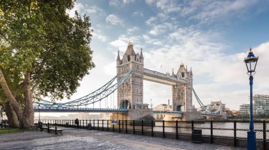
Tower Bridge provides a convenient western starting point for exploring the Thames Path through Tower Hamlets. From here, walkers follow the northern riverbank towards St Katharine Docks, Wapping, Limehouse Basin and Canary Wharf.
Tower Bridge is one of London’s best-known landmarks. The Victorian bascule and suspension bridge opened in 1894 and connects Tower Hamlets with the southern bank of the Thames.
The surrounding waterfront provides an accessible starting point for visitors arriving from central London. Tower Hill Underground Station and Tower Gateway DLR Station are both within walking distance.
The first major riverside destination is St Katharine Docks. This historic dock complex sits immediately east of the Tower of London and contains marina facilities, restaurants, pedestrian spaces and historic buildings.
The route then continues towards Wapping. This neighbourhood preserves several features associated with London’s former dock economy, including converted warehouses, narrow streets and traditional riverside buildings.
Walkers eventually reach Limehouse Basin, where the Regent’s Canal connects with the Thames. The route continues towards the Isle of Dogs and Canary Wharf.
The main landmarks provide natural stopping points. Visitors can divide the journey into shorter sections instead of completing the entire route in one walk.
The following locations provide a practical route sequence:
- Tower Bridge and the western riverside entrance.
- St Katharine Docks and its historic marina.
- Wapping and its converted warehouses.
- Limehouse Basin and the Regent’s Canal connection.
- Canary Wharf and its modern waterfront spaces.
Visitors should follow current pedestrian access signs because individual riverside sections sometimes have temporary closures or diversions.
What Can Visitors See Along the Thames Path in Wapping?
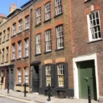
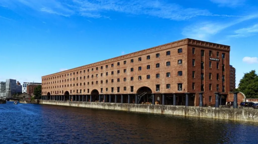
Wapping offers some of the strongest connections to London’s historic docklands. Visitors encounter converted warehouses, traditional riverside buildings, former commercial wharves, historic pubs and views across the Thames while following the pedestrian route eastwards.
Wapping developed as a maritime settlement because of its direct access to the River Thames. Its waterfront supported shipping, warehousing and other activities associated with London’s port economy.
The neighbourhood retains a distinctive architectural character. Former warehouses stand alongside converted residential buildings and modern developments.
The Prospect of Whitby
The Prospect of Whitby is a historic riverside public house on Wapping Wall. Its location beside the Thames makes it a recognisable stopping point for walkers.
The building is associated with Wapping’s maritime past. Its riverside position also provides views of passing vessels and the opposite bank.
Wapping High Street
Wapping High Street follows part of the historic waterfront district. The surrounding buildings illustrate how commercial warehouses and industrial premises have been adapted for modern residential and commercial use.
Visitors can explore the adjoining streets to see surviving dockland architecture. The area provides a quieter walking environment than the busy approaches around Tower Bridge.
Former London Dock
London Dock opened in 1805 and operated until 1968. It handled imported commodities such as tobacco, wine, tea and spices.
Tobacco Dock is one of the best-known surviving structures associated with the former dock complex. Its historic warehouse architecture demonstrates the scale of London’s former maritime trade.
The London Museum documents the dock’s commercial history and its connection with Britain’s imperial trading networks, including the role of profits from the transatlantic slave trade in financing dock construction.
Wapping therefore offers more than attractive riverside scenery. It provides an opportunity to understand the economic and social history behind London’s waterfront.
What Makes Limehouse Basin an Important Thames Path Stop?
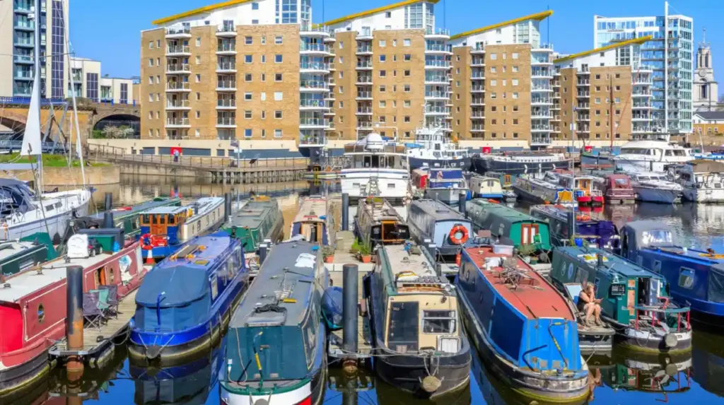
Limehouse Basin is a historic marina connecting the River Thames with the Regent’s Canal and Limehouse Cut. It provides a distinctive waterfront environment where historic waterways, narrowboats, modern residential buildings and pedestrian routes meet.
Limehouse Basin is one of the most interesting locations along the Tower Hamlets waterfront. Its waterways connect the Thames with Britain’s wider inland canal network.
The basin has a long association with commercial transport. It supported the movement of cargo between ocean-going vessels on the Thames and inland waterways serving industrial and commercial centres.
The Regent’s Canal opened in 1820. It created an important transport connection between the Thames and other parts of London.
Limehouse Basin subsequently became a significant interchange for goods and vessels. Its location helped strengthen the area’s role in London’s commercial network.
Today, the basin operates primarily as a marina and recreational waterfront. Narrowboats and leisure vessels occupy the water, while residential buildings and pedestrian routes surround the basin.
What can visitors explore at Limehouse Basin?
The main attractions include:
- The marina: Visitors can observe narrowboats, yachts and other vessels moored within the basin.
- Historic dock structures: Surviving walls, entrances and industrial features provide evidence of the area’s former transport function.
- Regent’s Canal connection: Walkers can explore the relationship between London’s canal network and the Thames.
- Waterfront residential architecture: Modern developments demonstrate the area’s transition from industrial transport facilities to residential use.
The Canal and River Trust provides a one-mile circular walking route around Limehouse Basin. The walk starts and finishes near Limehouse Station and offers a shorter alternative for visitors who do not want to complete the longer Thames Path section.
This circular walk is particularly useful for visitors with limited time. It provides access to the marina and nearby historic waterways without requiring a full-day walking commitment.
Limehouse Basin also offers a useful opportunity to observe the relationship between the Thames Path and other pedestrian routes. Visitors can continue towards Canary Wharf or explore the Regent’s Canal towards Mile End and Bethnal Green.
What Riverside Attractions Can Visitors Explore Near Canary Wharf?
Canary Wharf combines modern architecture, landscaped public spaces, dockside walkways and cultural attractions. Its waterfront provides a striking contrast with Wapping and Limehouse, making it an important eastern destination on the Tower Hamlets Thames Path.
Canary Wharf occupies the northern part of the Isle of Dogs. The area developed from former commercial docklands into one of London’s principal financial and business districts.
The West India Docks played a central role in its earlier development. Their commercial importance declined during the twentieth century as shipping operations changed.
Large-scale redevelopment transformed the area through new office buildings, residential developments, public spaces and transport infrastructure.
Visitors following the Thames Path towards Canary Wharf encounter a modern urban waterfront.
Canary Wharf waterfront
The dockside walkways provide access to open water, modern buildings and public spaces. Several areas contain seating and pedestrian routes that support leisure activities.
Jubilee Park
Jubilee Park is a landscaped public space in Canary Wharf. It contains planted areas, paths and water features.
The park provides a green break from the surrounding commercial architecture. It is suitable for short rests, photography and relaxed outdoor visits.
Crossrail Place Roof Garden
Crossrail Place Roof Garden sits above the Elizabeth line station and forms part of the Crossrail Place development.
The covered garden contains plants from different regions of the world. Its design provides a sheltered environment for visitors exploring the Canary Wharf district.
The Museum of London Docklands
The Museum of London Docklands is one of the most valuable cultural stops near the route. It occupies a historic warehouse at West India Quay.
The museum explores the history of the River Thames, London’s port, maritime trade, migration and the development of Docklands.
Its collections help visitors understand the transformation from commercial shipping facilities to the modern Canary Wharf business district.
The museum is particularly useful for travellers who want historical context beyond what is visible from the riverside path.
Which Parks and Green Spaces Can Visitors Access Near the Thames Path?
Tower Hamlets offers several parks and landscaped spaces near its riverside walking network. These include Jubilee Park, Island Gardens, Millwall Park and Mudchute Park and Farm, providing opportunities for relaxation, open-air recreation and additional sightseeing.
The borough’s green spaces provide alternatives to continuous riverside walking. Some are directly connected to the waterfront, while others require a short detour.
Island Gardens
Island Gardens occupies the southern end of the Isle of Dogs. It offers views across the Thames towards Greenwich and the Old Royal Naval College.
The park opened in 1895 and provides an important public viewing point. Visitors can observe the historic Greenwich waterfront from the northern bank.
The Greenwich Foot Tunnel also connects Island Gardens with the southern bank. Pedestrians use the tunnel to cross beneath the Thames.
Mudchute Park and Farm
Mudchute Park and Farm is a large urban green space on the Isle of Dogs. It combines open grassland, walking routes and a working city farm.
The site provides a different experience from Canary Wharf’s landscaped business district. Visitors encounter open countryside-style surroundings within an urban environment.
Millwall Park
Millwall Park provides open recreational space on the Isle of Dogs. Its facilities and open areas support walking, informal exercise and community activities.
Jubilee Park
Jubilee Park is a convenient green space for people exploring Canary Wharf. Its central location makes it an accessible resting point during a waterfront visit.
These locations demonstrate the variety of outdoor environments available around the Thames Path. Visitors can combine riverside walking with parks, gardens and recreational attractions according to their available time.
How Can Visitors Plan a Comfortable Thames Path Walk Through Tower Hamlets?
Visitors should plan the Thames Path around their starting point, walking distance, weather, tide conditions and preferred attractions. Dividing the route into manageable sections provides enough time for photography, historic exploration, refreshments and transport connections.
The Tower Bridge to Canary Wharf route is suitable for a half-day sightseeing programme. Visitors who stop at museums, parks and historic locations should allow additional time.
A practical itinerary follows the natural geographical sequence of the waterfront.
Morning: Tower Bridge and St Katharine Docks
Start near Tower Bridge and explore the surrounding riverside area. Continue east towards St Katharine Docks and spend time viewing the marina and historic buildings.
The morning provides opportunities for photography before moving into Wapping.
Late morning: Wapping
Walk through the historic streets and waterfront sections of Wapping. Explore the surviving warehouse architecture and visit the Prospect of Whitby area.
Visitors interested in maritime history should allow time to examine the historic dock buildings.
Afternoon: Limehouse Basin
Continue towards Limehouse Basin. Explore the marina and the connection between the Thames and Regent’s Canal.
Visitors with limited walking time can use Limehouse Station as an exit point. The nearby DLR provides connections to other parts of East London.
Later afternoon: Canary Wharf
Continue towards Canary Wharf and explore its dockside spaces, public gardens and modern architecture.
Visitors with additional time can visit the Museum of London Docklands or Crossrail Place Roof Garden.
The route can also be shortened by using public transport between selected destinations. This approach helps visitors focus on their preferred attractions rather than completing every section on foot.
What should visitors bring?
Suitable walking shoes are important because some historic waterfront areas contain uneven paving and older street surfaces.
A charged mobile phone helps with navigation and transport information. Visitors should also carry drinking water and weather-appropriate clothing.
A camera or smartphone is useful for photographing Tower Bridge, historic warehouses, marina views and Canary Wharf’s skyline.
Is the Thames Path Through Tower Hamlets Suitable for Different Types of Leisure Visitors?
The Thames Path supports several types of leisure visits, including sightseeing, heritage exploration, photography, recreational walking and short outdoor breaks. Its transport connections and nearby attractions also make it suitable for families, independent travellers and business visitors.
The route’s variety makes it accessible to people with different interests and schedules.
Tourists and first-time London visitors
First-time visitors benefit from the combination of major landmarks and less familiar neighbourhoods. Tower Bridge provides an internationally recognised starting point, while Wapping and Limehouse reveal a different side of London.
Canary Wharf adds a modern architectural perspective to the experience.
History and architecture enthusiasts
Visitors interested in London’s maritime history can explore former warehouses, historic dock buildings and surviving waterfront structures.
The Museum of London Docklands provides additional context about the development of the port and its relationship with international trade.
Photography enthusiasts
The route contains several distinct photographic environments. Tower Bridge provides recognisable architectural views, Wapping offers historic streetscapes, and Limehouse Basin provides marina photography opportunities.
Canary Wharf offers modern skyscrapers and reflections across dockside water.
Early morning and late afternoon provide changing natural light conditions. Weather and seasonal daylight influence the best photography opportunities.
Families
Families can combine manageable walking sections with parks and open spaces. Island Gardens, Mudchute Park and Farm and Jubilee Park provide opportunities to take breaks.
Families should check current access information before travelling with pushchairs or mobility equipment, particularly around historic streets and older waterfront surfaces.
Digital nomads and business travellers
Canary Wharf provides a practical location for visitors who combine work and leisure. Its commercial district contains cafés, restaurants, transport connections and public spaces.
Business travellers with a short break can explore the Canary Wharf waterfront or complete a shorter section around Limehouse Basin.
The route offers a straightforward way to experience East London’s history and architecture without travelling far from the main business district.
What Is the Best Time to Explore the Thames Path in Tower Hamlets?
Spring, summer and early autumn provide comfortable conditions for exploring the Thames Path. Daylight, weather, river conditions and visitor activity influence the walking experience, while morning and late afternoon offer useful opportunities for photography.
The route remains accessible throughout the year, but seasonal conditions affect how visitors experience the waterfront.
Spring (March to May)
Spring brings longer daylight hours and fresh greenery to parks and landscaped spaces. Visitors can explore Island Gardens, Jubilee Park and other outdoor locations in relatively mild conditions.
Spring is also suitable for photography because changing daylight creates varied views across the river.
Summer (June to August)
Summer provides the longest daylight hours. Visitors have more time to explore Wapping, Limehouse Basin and Canary Wharf.
The season also supports outdoor dining and longer visits to riverside public spaces. Visitors should carry drinking water and prepare for periods of strong sunshine.
Autumn (September to November)
Autumn provides cooler walking conditions and changing colours in landscaped parks. The riverside also becomes quieter outside busy visitor periods.
Shorter daylight hours require visitors to plan their return journeys carefully.
Winter (December to February)
Winter walking remains possible, but rain, wind and reduced daylight affect comfort. The Thames waterfront can feel particularly exposed during strong winds.
Visitors should wear suitable footwear and weather-resistant clothing. Indoor attractions such as the Museum of London Docklands provide useful alternatives during poor weather.
What Safety and Accessibility Information Should Walkers Know?
Walkers should check river conditions, pedestrian access, weather forecasts and transport information before starting. The Thames is a tidal river, so visitors must follow riverside warnings, avoid restricted edges and use designated pedestrian routes.
The River Thames experiences tidal movement. Water levels rise and fall according to the tidal cycle, affecting some riverside environments and exposed sections.
The UK Government’s National Trails guidance recommends checking tide times before walking near tidal rivers. This reduces the risk of being caught by rising water or encountering unsafe conditions.
The following precautions help visitors plan responsibly:
- Check tide information: Consult reliable tide information before exploring exposed riverside areas.
- Follow pedestrian signs: Use designated walking routes and respect temporary diversions.
- Avoid restricted edges: Stay away from slippery surfaces, unstable riverbanks and closed waterfront areas.
- Check weather conditions: Rain and strong winds affect walking comfort and visibility.
- Plan transport connections: Identify nearby Underground and DLR stations before starting.
- Keep children supervised: Maintain a safe distance from the water and busy pedestrian areas.
Accessibility also varies along the route. Modern developments around Canary Wharf generally provide organised pedestrian environments, while historic streets and older waterfront structures have different surface conditions.
Visitors using wheelchairs, mobility scooters or pushchairs should check individual route sections before travelling. Temporary works, steps and restricted access points affect the continuity of some riverside paths.
Public transport provides several options for shortening the journey. Tower Hill, Tower Gateway, Shadwell, Limehouse and Canary Wharf are useful transport locations around the wider route.
Visitors should also check current station accessibility information because step-free facilities differ between stations.
Explore More Area Guide
A Guide to Spitalfields’ Historic Streets and Heritage
Discovering the Architectural Heritage of Bethnal Green and Bow
How Does the Thames Path Reflect the Future of Tower Hamlets?
The Thames Path reflects Tower Hamlets’ transition from an industrial port landscape into a mixed urban district. Its historic waterfront, public spaces, cultural attractions and modern developments support heritage tourism, outdoor recreation and sustainable urban travel.
The borough’s waterfront continues to change as residential, commercial and public developments reshape former industrial areas.
Canary Wharf represents one of the most visible examples of this transformation. Its modern business district occupies land previously associated with the West India Docks and London’s international shipping economy.
Limehouse and Wapping demonstrate another aspect of regeneration. Historic buildings and former industrial sites have gained residential, cultural and recreational uses.
The Thames Path connects these developments through a pedestrian route. This connection encourages visitors to explore the borough without relying entirely on motorised transport.
Heritage conservation
Historic warehouses, dock entrances and traditional waterfront buildings preserve evidence of London’s maritime development. Their continued presence supports local heritage interpretation and tourism.
Public access to the waterfront
Riverside pedestrian spaces provide opportunities for outdoor recreation. Public access also connects residential communities with parks, transport facilities and cultural attractions.
Sustainable visitor experiences
Walking encourages visitors to explore several attractions within one geographical area. The availability of Underground, DLR and Elizabeth line connections supports journeys that combine walking with public transport.
Cultural and economic activity
The Museum of London Docklands, Canary Wharf’s public spaces and local hospitality businesses contribute to the area’s visitor economy.
The future relevance of the Thames Path depends on maintaining accessible pedestrian routes, protecting historic structures and improving the quality of public waterfront spaces.
For leisure visitors, these developments preserve the area’s distinctive character while making its attractions easier to explore.
Why Should Leisure Visitors Include the Thames Path in Their Tower Hamlets Itinerary?
The Thames Path provides a practical way to discover Tower Hamlets through its historic waterfront, former docks, marinas, green spaces and modern architecture. It combines cultural exploration, outdoor recreation and river views within one connected East London experience.
The route introduces visitors to different stages of London’s development. Tower Bridge provides a recognisable landmark, while Wapping reveals the borough’s maritime heritage.
Limehouse Basin demonstrates the importance of historic waterways and inland transport connections. Canary Wharf illustrates the transformation of former commercial docks into a modern financial district.
Nearby attractions extend the experience beyond the riverside itself. The Museum of London Docklands provides historical context, while Island Gardens and Mudchute Park and Farm offer opportunities to enjoy outdoor spaces.
The route also supports flexible travel arrangements. Visitors can complete a longer walk, explore individual neighbourhoods or combine walking with public transport.
For tourists, the Thames Path offers a different perspective on East London beyond its markets, shopping streets and central attractions. For residents, it provides a convenient way to explore local heritage and waterfront spaces.
Exploring the Thames Path through Tower Hamlets therefore offers a complete introduction to the borough’s relationship with the River Thames. Its combination of historic landmarks, recreational spaces and modern developments makes it an important part of any East London leisure itinerary.
Where does the Thames Path start in Tower Hamlets?
The Thames Path section through Tower Hamlets is commonly explored from Tower Bridge. Walkers continue eastwards through St Katharine Docks, Wapping and Limehouse before reaching Canary Wharf.