


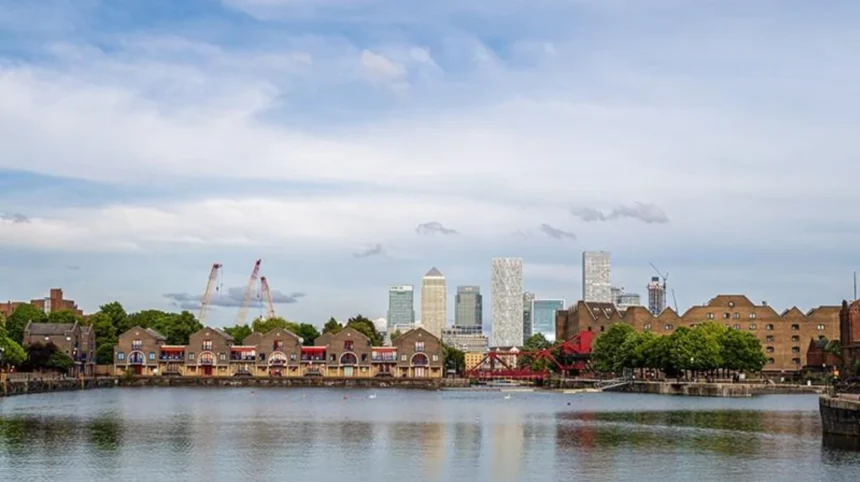
Tower Hamlets has one of the most varied waterfront landscapes in East London. The borough’s southern boundary follows the River Thames, while canals, docks, basins, marinas and riverside parks create additional waterside environments. These areas connect historic Docklands with modern Canary Wharf, Limehouse, Wapping, Shadwell and the Isle of Dogs.
- What makes Tower Hamlets’ waterfront areas important for visitors?
- Which Tower Hamlets waterfront areas should visitors explore?
- How did Tower Hamlets’ waterfront develop historically?
- What can visitors see around Limehouse Basin?
- Where can visitors enjoy Thames views in Wapping and Shadwell?
- What makes Canary Wharf different from other Tower Hamlets waterfront areas?
- What can visitors experience around the Isle of Dogs?
- Why is Island Gardens one of the best places for a Thames view?
- Which waterfront walking routes work well for a London visit?
- What parks and green spaces are connected to Tower Hamlets’ waterways?
- How can visitors combine waterfront sightseeing with food and culture?
- How should visitors plan a Tower Hamlets waterfront day?
- What should visitors know before exploring Tower Hamlets’ waterfront?
- Why does Tower Hamlets’ waterfront remain important to London?
The waterfront is therefore not one single destination. It is a network of places with different characters, landscapes and visitor experiences. Limehouse Basin connects the Regent’s Canal with the Thames. Wapping provides historic riverside streets and access towards Tower Bridge. Canary Wharf combines high-rise architecture, public spaces, restaurants and dockside views. The Isle of Dogs adds Island Gardens and one of the most recognisable views across the Thames towards Greenwich.
For visitors, these locations provide walking routes, photography opportunities, green spaces, architectural landmarks, cafés, restaurants and connections to London’s wider transport network. The waterways also explain much of Tower Hamlets’ industrial and commercial development.
What makes Tower Hamlets’ waterfront areas important for visitors?
Tower Hamlets’ waterfront is important because it combines the River Thames, historic docks, canals, marinas, parks, modern business districts and heritage sites within a compact part of East London. Visitors can experience riverside scenery while also exploring London’s maritime, industrial and commercial history.
The southern edge of Tower Hamlets follows a major curve of the River Thames. The borough describes this distinctive river boundary as an important part of its identity. The same waterfront contains very different environments, from the historic surroundings of Wapping and Limehouse to the contemporary skyline of Canary Wharf.
Water has shaped the physical development of the area for centuries. Docks supported London’s international trade, while canals connected the Thames with inland waterways. Later redevelopment transformed former industrial land into residential, commercial and leisure districts.
This creates a useful visitor experience because modern attractions often sit directly beside historic infrastructure. A walk beside a contemporary dock can therefore reveal old warehouses, former wharves, locks, bridges or maritime buildings.
The waterfront also provides practical connections. Walking routes link neighbourhoods, parks and transport stations, while DLR and London Underground services provide access from central London and other parts of the capital.
Which Tower Hamlets waterfront areas should visitors explore?
The main waterfront areas include Limehouse and Limehouse Basin, Wapping, Shadwell, Canary Wharf, the Isle of Dogs and Island Gardens. Each offers a different combination of river views, docks, canals, parks, architecture, heritage, food and walking opportunities.
Limehouse and Limehouse Basin
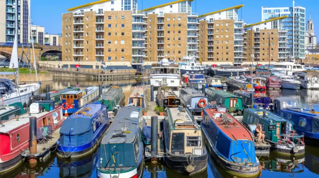
Limehouse Basin is one of the clearest places to understand the relationship between London’s canals and the River Thames. The basin connects the Regent’s Canal and Limehouse Cut with the Thames and now functions as a marina surrounded by residential and leisure development.
The Canal & River Trust identifies Limehouse Basin as a gateway between the Thames and more than 2,000 miles of navigable canals and rivers. Its current environment includes narrowboats, yachts, pleasure craft, cafés and walking routes.
Wapping
Wapping provides a more historic riverside environment. The Thames Path passes through the area and connects towards Tower Bridge and St Katharine Docks. Former industrial buildings and warehouses reflect Wapping’s relationship with London’s historic port.
Shadwell
Shadwell combines residential streets, green spaces, canals and Thames-side routes. Shadwell Basin is particularly relevant for visitors interested in regenerated dockland landscapes.
Canary Wharf
Canary Wharf represents the modern waterfront. Tall commercial buildings rise around docks that were once part of London’s enormous Docklands system. Public spaces, restaurants, shops and transport connections make the area suitable for visitors combining sightseeing with food or business activities.
Island Gardens
Island Gardens occupies the southern part of the Isle of Dogs. The riverside park provides a direct view across the Thames towards Greenwich. Tower Hamlets states that the park covers three acres of waterfront parkland and includes access to the Greenwich Foot Tunnel.
How did Tower Hamlets’ waterfront develop historically?
Tower Hamlets’ waterfront developed through maritime trade, docks, canals, warehouses and industrial transport. The Thames provided access to international shipping, while canals moved goods inland. Later Docklands decline and redevelopment converted many former industrial waterfronts into residential, commercial and public spaces.
The historical importance of the waterfront is particularly visible at Limehouse. The Regent’s Canal was completed in 1820 and connected the Grand Junction Canal system with Limehouse and the Thames. Limehouse became an important interchange between river shipping and inland canal transport.
Limehouse Cut dates from 1766 and is recognised by the Canal & River Trust as the oldest canal in London. It links the Thames at Limehouse Basin with the River Lee at Bromley-by-Bow.
The waterways transported commodities including coal, timber, building materials and food. The Regent’s Canal continued to carry long-distance commercial traffic into the 20th century.
As you explore the modern waterfront, you are crossing land shaped by this maritime past. Read about the full to understand the origins of Tower Hamlets’ waterfront communities, docks and industrial landscapes.
The decline of commercial docks changed the area substantially. Limehouse Basin’s commercial shipping function ended in 1969, while wider Docklands experienced major changes as traditional port operations declined. Former industrial areas subsequently became locations for housing, offices, public spaces and leisure facilities.
This historical sequence explains why contemporary waterfront architecture often appears beside much older structures.
What can visitors see around Limehouse Basin?
Limehouse Basin offers a compact combination of boats, marina views, canal infrastructure, historic buildings, riverside paths and nearby green space. Its position between the Regent’s Canal and Thames makes it an effective starting point for a longer East London waterfront walk.
The basin is accessible from Limehouse Station, which is served by the DLR. The Canal & River Trust provides a one-mile circular walking route beginning and ending at Limehouse Station.
The route provides views of boats and the basin while passing historic infrastructure. The surrounding landscape demonstrates how a former commercial dock has been incorporated into a contemporary urban neighbourhood.
One particularly notable structure is the Grade II-listed Accumulator Tower. Built in 1869, it regulated hydraulic pressure used for cranes, locks, capstans and swing bridges around the dock.
The basin also supports urban wildlife. Birds recorded around the water include swans, geese, coot, moorhen, ducks, cormorants, gulls and grey herons. Fish include species such as carp and bream.
The area therefore works for several types of visitor. Walkers can follow the waterside paths. Photographers can capture boats and the Canary Wharf skyline. Visitors interested in industrial history can examine the surviving infrastructure.
Where can visitors enjoy Thames views in Wapping and Shadwell?
Wapping and Shadwell provide quieter Thames-side environments with historic buildings, riverside paths, former dock infrastructure and green spaces. They are useful for visitors who want to experience the eastern side of central London away from the busiest tourist streets.
Wapping sits between the City of London and Limehouse. Its Thames-side position historically connected the neighbourhood with London’s port activities.
The Thames Path provides a continuous walking framework through this part of East London. Visitors can use the route to move between riverside districts rather than treating each waterfront attraction as an isolated destination.
Shadwell adds another layer to the experience. Shadwell Basin contains regenerated dockland scenery and sits close to the Thames. Routes connect the area with Wapping, Limehouse and Canary Wharf.
The wider riverside network includes parks and community spaces. This creates opportunities to combine walking with short breaks, photography and outdoor recreation.
The contrast between old warehouses, modern housing and open water is particularly useful for visitors studying London’s urban transformation. The waterfront demonstrates how industrial land has been adapted for modern residential and leisure purposes.
What makes Canary Wharf different from other Tower Hamlets waterfront areas?
Canary Wharf differs because its waterfront combines major commercial architecture with docks, public spaces, restaurants, shops and transport connections. The district presents a modern interpretation of Docklands while retaining water as a defining feature of its urban landscape.
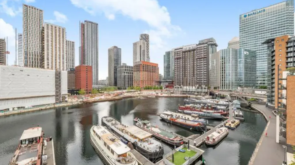
Canary Wharf is one of London’s major financial districts. Its skyline is dominated by high-rise commercial buildings around several docks on the Isle of Dogs.
The district is particularly suitable for visitors interested in architecture and contemporary London. Large office towers create a strong contrast with historic waterfront neighbourhoods such as Limehouse and Wapping.
The dockside environment also creates open public areas within a dense commercial district. Visitors can walk beside the water, observe boats and architectural details, and combine the waterfront with shopping and dining.
Transport makes Canary Wharf practical for short visits. The Elizabeth line, Jubilee line and DLR connect the district with other parts of London.
For digital nomads and business travellers, the area also provides a concentration of cafés, restaurants, public spaces and commercial facilities. Its waterfront is therefore both a sightseeing environment and part of an active working district.
What can visitors experience around the Isle of Dogs?
The Isle of Dogs provides a mixture of docks, residential areas, modern buildings, riverside parks and views towards Greenwich. Its waterfront environment is especially useful for visitors seeking open space, skyline photography and a different perspective on the River Thames.
The Isle of Dogs is a peninsula surrounded on three sides by the Thames. Its geography gives the area an unusually strong relationship with the river.
Canary Wharf occupies the northern part of the peninsula, while residential areas and parks extend towards the southern end.
The landscape changes noticeably between districts. Canary Wharf presents a dense commercial skyline. Further south, Island Gardens provides a more open riverside environment.
This combination allows visitors to experience different aspects of the same peninsula during one walking day.
The area’s dock infrastructure also reveals the legacy of the former Port of London. Modern residential developments now occupy many sites that once supported warehouses, wharves and industrial operations.
Why is Island Gardens one of the best places for a Thames view?
Island Gardens is notable for its open riverside setting and direct view across the Thames towards Greenwich. The three-acre waterfront park includes seating, picnic space and pedestrian access to the Greenwich Foot Tunnel beneath the river.
Tower Hamlets describes Island Gardens as a riverside park with three acres of waterfront parkland. It holds a Green Flag Award and provides a pedestrian route through the Greenwich Foot Tunnel.
The view towards Greenwich has historical significance. The park contains the viewpoint represented in Canaletto’s famous 18th-century painting A View of Greenwich from the River.
This makes Island Gardens useful for visitors interested in both landscape and history.
The Greenwich Foot Tunnel adds another practical attraction. It connects the Isle of Dogs with Greenwich beneath the Thames and provides a pedestrian crossing between two major London destinations.
Visitors can therefore combine Island Gardens with Greenwich rather than treating the park as a standalone stop.
Which waterfront walking routes work well for a London visit?
The most useful waterfront walks connect Limehouse Basin, the Thames Path, Wapping, Shadwell, Canary Wharf and Island Gardens. Short loops suit casual visitors, while longer routes combine several neighbourhoods and provide changing views of docks, river, architecture and parks.
A practical starting point is the one-mile Limehouse Basin circular walk. The Canal & River Trust gives the route as approximately 1.6 kilometres and starts and finishes at Limehouse Station.
Visitors seeking a longer experience can extend their journey towards Wapping and Shadwell using Thames-side paths.
Another option is to connect Limehouse Basin with the Isle of Dogs. This produces a stronger contrast between historic canal infrastructure and the modern Canary Wharf skyline.
The Canal & River Trust also identifies a route along Limehouse Cut towards Queen Elizabeth Olympic Park. Its waterways guide describes this connection as approximately two miles or 3.5 kilometres.
Walking conditions vary according to weather, river conditions and local access arrangements. Comfortable footwear remains appropriate because a waterfront itinerary often involves several kilometres of walking.
Visitors should also check current access information before setting out, particularly when using paths around construction areas, bridges or transport infrastructure.
What parks and green spaces are connected to Tower Hamlets’ waterways?
Tower Hamlets’ waterways connect with a wider network of parks and green spaces, including Island Gardens and Victoria Park. These spaces provide seating, walking, recreation, wildlife and views while creating green connections between neighbourhoods and waterways.
Victoria Park is particularly important within the borough’s wider green infrastructure. Tower Hamlets states that the park receives more than nine million visitors each year and hosts community activities, events, live music and sport.
The council describes Victoria Park as part of a green corridor extending towards Limehouse, along the Regent’s Canal and through Mile End Park, with Queen Elizabeth Olympic Park nearby.
This connection demonstrates that Tower Hamlets’ waterfront experience extends beyond the immediate Thames edge.
Visitors can combine a canal walk with parkland rather than spending the entire day beside dense urban development.
The green spaces also support everyday local activity. Residents use them for exercise, recreation, social activities and relaxation. Visitors therefore encounter working neighbourhoods rather than attractions designed exclusively for tourism.
How can visitors combine waterfront sightseeing with food and culture?
Waterfront sightseeing in Tower Hamlets combines naturally with restaurants, cafés, pubs, cultural venues and historic destinations. Limehouse, Wapping and Canary Wharf provide different dining environments, while nearby museums and heritage sites add cultural context to a riverside itinerary.
Limehouse Basin has cafés and shops around the marina. Narrow Street, close to Limehouse Basin, adds historic architecture and hospitality venues to the waterfront experience.
Canary Wharf provides a much larger concentration of restaurants and cafés. Its commercial environment makes it practical for lunch, coffee breaks and evening dining.
Wapping offers a different setting, with historic streets and buildings close to the Thames.
For cultural context, the Museum of London Docklands provides information about London’s port and Docklands history. Tower Hamlets Council identifies the museum as an important place for understanding the borough’s development as part of London’s port.
Combining a museum visit with a waterfront walk provides a clearer understanding of why the docks existed and how their role changed.
How should visitors plan a Tower Hamlets waterfront day?
A practical waterfront day starts with a defined walking section and then combines heritage, public space, food and transport. Limehouse Basin, Wapping, Canary Wharf and Island Gardens can form separate stops rather than one continuous itinerary.
A visitor beginning at Limehouse can explore the basin and its canal connections before continuing towards the Thames.
The next section can follow the riverside towards Wapping and Shadwell. These areas provide more historic waterfront scenery.
Canary Wharf can then provide a modern architectural contrast. Visitors can stop for food, shopping or coffee before continuing south towards Island Gardens.
Island Gardens works particularly well as a final destination because of its open parkland and Greenwich views.
Another strategy is to select one waterfront district rather than attempting to cover the whole borough. Limehouse suits canal and maritime history. Wapping suits historic Thames-side walking. Canary Wharf suits architecture, dining and modern Docklands. Island Gardens suits parks and river views.
This approach reduces unnecessary travel and gives each area enough time for exploration.
Explore More Area Guide
Tower Hamlets Neighbourhood Guide: Best Areas to Visit
Tower Hamlets Area Guide: Attractions, Markets and Transport
What should visitors know before exploring Tower Hamlets’ waterfront?
Visitors should check transport, opening information, walking conditions and current local access arrangements before travelling. Waterfront routes include public streets, parks, towpaths, bridges and pedestrian crossings, so conditions and access can differ between locations.
Limehouse Basin is free to visit, and the Canal & River Trust lists Limehouse Station as the nearest public transport connection. The Trust also notes that parking is not available at the basin itself.
Victoria Park opens from 7am until dusk, 365 days a year, according to Tower Hamlets Council. Specific conditions and facilities vary by season.
Island Gardens is accessible from Island Gardens DLR station and provides pedestrian access towards Greenwich through the foot tunnel.
The waterfront is best treated as a walking environment. Comfortable footwear, weather-appropriate clothing and a charged phone are practical considerations.
Visitors should also respect residential areas and waterways. Canals, docks and the Thames are active environments with boats, locks, bridges and changing water conditions.
Why does Tower Hamlets’ waterfront remain important to London?
Tower Hamlets’ waterfront remains important because it combines London’s historic port landscape with modern finance, housing, transport, recreation and public space. Its waterways continue to connect communities and destinations while providing evidence of the capital’s industrial and commercial transformation.
The waterfront demonstrates several stages of London’s development within a relatively concentrated area.
The Thames supported international maritime trade. Canals provided inland transport. Docks handled cargo. Industrial sites supported employment and commerce. Later redevelopment introduced offices, housing, parks and leisure facilities.
Limehouse Basin provides a clear example of this transition. The former commercial dock is now a marina and visitor environment while retaining historic structures and connections to the canal system.
Canary Wharf demonstrates the scale of modern Docklands redevelopment. Its high-rise commercial skyline has become one of the defining visual features of East London.
Island Gardens demonstrates another dimension: historic riverside landscape combined with public recreation and pedestrian connectivity.
Together, these places make Tower Hamlets’ waterfront a useful area for understanding contemporary London. The visitor experience is not limited to scenic views. It includes transport history, industrial heritage, architecture, green infrastructure, commerce and community life.
For tourists, the waterfront provides a route through several distinctive parts of East London. For residents, it offers everyday walking and recreation. For business travellers, it provides accessible leisure spaces close to major commercial districts. For digital nomads, cafés, public spaces and transport connections add practical value.
The result is a waterfront landscape where historic infrastructure and modern urban life remain closely connected.
What are the main waterfront areas in Tower Hamlets?
The main waterfront areas in Tower Hamlets include Limehouse Basin, Wapping, Shadwell, Canary Wharf, the Isle of Dogs and Island Gardens. Each offers different combinations of Thames views, docks, canals, parks, heritage sites, restaurants and walking routes.